
Hattfjelldal Municipality
Fluent speakers of Southern Sami number somewhere around five hundred. Hattfjelldal Municipality has 1,284 residents. Everyone alive who speaks the language easily would not fill this one thinly settled corner of Nordland — and this is one of the places where it is still spoken, taught, argued over and used for ordinary things. Since 2017 Southern Sami has been an official administrative language here alongside Norwegian. Since 2019 the municipality has carried a second official name of its own: Aarborte.
Aarborte
The Southern Sami name became co-equal with the Norwegian one by national resolution on 14 June 2019 — Aarborte on its own, Aarborten tjïelte when the word for municipality is attached. That resolution came at the end of a long argument. Until well into the 1700s these valleys were used chiefly by migratory Sami herders; permanent settlement began around Røssvatnet about 1700, reached Susendalen roughly a century later, and drew Norwegian farmers from the eastern valleys in the late 1800s. What followed for Sami children was decades of state schooling designed to make them Norwegian. In 1951 a boarding school for Southern Sami children, Gaske-Nøørjen Saemienskovle, opened here — which meant children living away from their families through the school year, but also meant their language had a classroom. In 1987 the cultural centre Sijti Jarnge followed, driven largely by Anna Jacobsen, born Anna Kappfjell in 1924, who translated the Gospel of Mark into Southern Sami in 1993, ran Sami-language programming at NRK, and received the King's Medal of Merit in silver before her death in 2004.
The Hat-Shaped Mountain
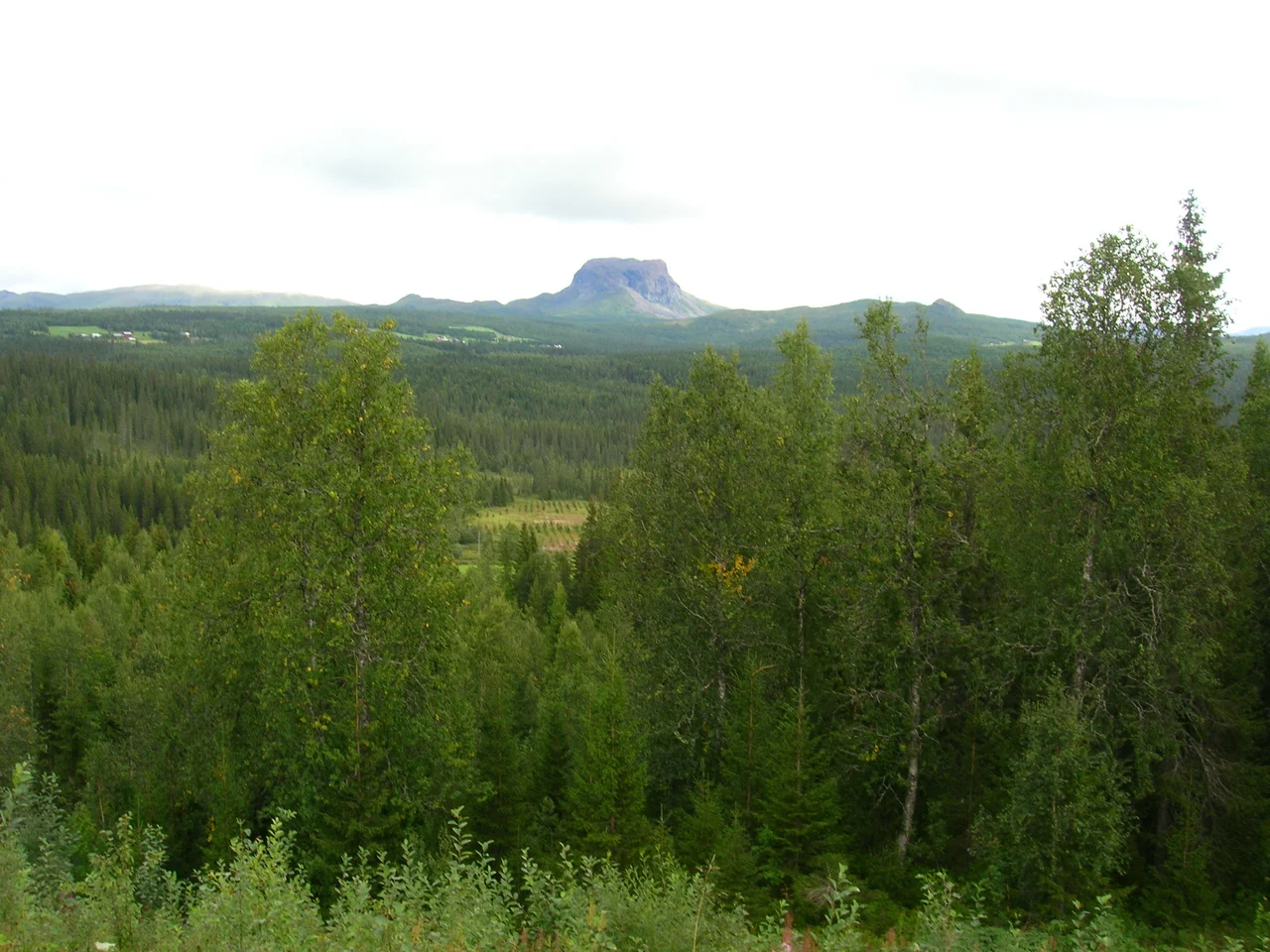
The Norwegian name is literal to the point of bluntness. A mountain nearby, Hattfjellet, has a flat top and steep sides and looks like a hat; the valley beneath it took the mountain's name; a farm in that valley, recorded as Hatfieldalen in 1723, gave its name to the parish and then to the municipality. Spelling it proved harder than describing it. A royal resolution in 1908 dropped a d. Another in 1917 dropped the definite ending. A third, in 1926, added a t, and Hattfjelldal has stayed put since. When the coat of arms was granted on 24 October 1986, the designer Arvid Sveen simply drew the mountain: a white field above a green one, divided by a line with a single raised block in it, the profile of a flat-topped summit visible for a very long way.
Nine Metres of Water
Røssvatnet is the second-largest lake in Norway by surface area, and it is that size because engineers made it so. Before regulation it covered about 190 square kilometres at 374 metres above the sea. The dam first flooded it in 1957, raising the surface nine metres to 383 and the area to roughly 219 square kilometres — enough to move it up a place in the national rankings. Its shores have been occupied since the Stone Age, and in one season of 1957 they were redrawn. The reshaping had administrative consequences too. On 1 January 1964, during Norway's great wave of municipal mergers, the 168 people living on the north side of the lake were transferred out of Hattfjelldal to neighbouring Hemnes Municipality.
Concrete Poured in 1943
Hattfjelldal Airfield, ENHT, sits beside the administrative centre with a 715-metre concrete runway at 210 metres elevation. It began in 1933 as a simple landing field. After taking the area in 1940 the Germans expanded it into a proper airfield with a wooden runway, then replaced that with concrete by 1943, using the field as a staging point for raids on Narvik. That concrete is still there and still unmodified, which makes this the only wartime airfield in Norway surviving in its original form. Today it belongs to a flying club, and part of the hangar is used as storage by Arbor, the particleboard plant that is the municipality's largest industrial employer — a runway built for bombers now sharing space with pallets of chipboard.
A Ledger of Small Numbers
At 2,684 square kilometres Hattfjelldal is the twentieth largest of Norway's 357 municipalities and the 315th most populous, which works out at roughly half a person per square kilometre. The population has fallen by more than fourteen per cent in a decade. Nearly a fifth of those who remain work in agriculture or forestry, and this is Nordland's leading sheep-farming district. The highest ground is Kvigtinden, measured at 1,699.92 metres on the Grane boundary; Børgefjell National Park occupies the southern end; the Vefsna, Nordland's largest river system, runs through on its 163-kilometre journey to the sea at Mosjøen. Not every entry in the ledger is picturesque. In November 2007 Hattfjelldal was one of eight Norwegian municipalities caught in the Terra Securities scandal, having pledged expected future hydropower revenues against leveraged American structured products that nobody involved appears to have fully understood.
From the Air
Hattfjelldal Municipality centres on 65.5475°N, 14.1344°E in southeastern Nordland along the Swedish border, covering 2,684 km². Hattfjelldal Airfield (ENHT) lies at the administrative centre: a 715 m concrete runway at 210 m (690 ft) elevation, general aviation only, no scheduled service, no instrument approach — plan a visual arrival and confirm with the local flying club. The dominant visual references are Røssvatnet, a very large irregular reservoir to the northwest, the flat-topped Hattfjellet above the village, and the Vefsna river system running northwest toward Mosjøen. Kvigtinden (1,699.92 m) marks the southwestern boundary with Grane; Børgefjell National Park fills the south. Recommended viewing altitude 5,000–8,000 ft AGL over the settled valleys, higher near the park. Other airports: Mosjøen Kjærstad (ENMS) roughly 70 km northwest, Mo i Rana Røssvoll (ENRA) to the north, Namsos (ENNM) to the southwest, and Vilhelmina South Lapland (ESNV) across the border in Sweden. High-latitude conditions apply: short winter daylight, icing, and terrain above 1,600 m within the municipality.
Nearby Stories
- Ranseren 7.4 km away
- Røsvatnet 12 km away
- Grane Municipality 13 km away
- Majavatn 17 km away
- Hemavan 17 km away
- Vefsn Municipality 22 km away
- Kittelfjäll 43 km away
- Lapplandsleden 132 km away