
Grane Municipality
The weapons came ashore on the Helgeland coast, landed from boats that had crossed from Britain, and then they moved inland on men's backs — up out of the fjords, over the fells, down into the forested valleys of Grane and Vefsn. Through 1942 the Gestapo worked its way along that line. In the autumn it reached Tangen farm at Majavatn, where Germans and Norwegian resistance men exchanged fire, and the arrests that followed rolled up the whole district. On 8 and 9 October 1942, after summary trials, twenty-four men from Grane, Vefsn, Vevelstad and the Trondheim area were shot at Falstad camp. Grane counts fewer than 1,500 people today, scattered across 2,004 square kilometres. A loss on that scale does not stay abstract in a place this small.
The Line Over the Mountains
The operation had a British strategic purpose and an entirely local cost. Captain Birger E. Sjøberg — the cover name of Nils Berdahl, born 1905 — was ordered by his superior, Captain Martin Linge, to organise and equip an expedition to Helgeland: make contact with the resistance groups already working there, and supply whatever they lacked. It belonged to Operation Jupiter, Winston Churchill's plan for an Allied landing in Norway. Boats crossing from Britain, among them those of the Shetland Bus skipper Leif Larsen, put weapons and equipment ashore on the coast, and men carried the loads over the watershed into the inland valleys.
Once the Gestapo had a thread to pull, the unravelling was fast. The twenty-four executed at Falstad came from communities where families knew one another in every direction, and the proceedings that condemned them were summary. Berdahl did not survive the war either; he died in 1944. Since 11 August 1984 a memorial march has carried Sjøberg's name, roughly 25 kilometres of mountain between the head of Vistenfjorden and Eiterådalen outside Mosjøen — the kind of ground those crates crossed.
A Name That Refuses to Explain Itself
Grane looks like the plainest name in Norway. It is not. Spelled the same way in 1661, it takes a long a and a crisp, short n, and it is uninflected — no definite form, no dative, no genitive, which is peculiar among genuine old farm names in this district. That grammatical shape belongs to farms cleared in the Middle Ages, probably around the twelfth century. Yet the Grane farm was not cleared until the mid-1600s, by people who came from Åneset in what is now Vefsn, and nothing suggests an earlier settlement on the site.
The obvious reading — a place where spruce grows — collapses under pollen analysis, which shows spruce forest reaching this stretch of country only in the 13th or 14th century and taking hundreds of years more to spread. Name scholars trace the stem instead to an Old Norse word for something sharp, something that juts up out of the landscape. A third possibility comes from Southern Sámi: kråane, meaning corner or crook, for the elbow the Vefsna makes here as it stops running west out of Hattfjelldal and turns north for the fjord. The municipality is named for the farm, the farm is named for something, and nobody can say what.
Maajehjaevrie
The lake and settlement the maps label Majavatn is Maajehjaevrie in Southern Sámi, and reindeer herding has continued in the country around it without a break. In 1915 the Finnemisjonen established a chapel and a gathering ground there as a meeting place for Sámi people — a mission's initiative, on Sámi land, in an era when the Norwegian state was working hard to make the language disappear.
Gustav Kappfjell was born at Majavatn in 1913 and sent, at eight, to the Sámi school at Havika, where pupils were forbidden to speak their own language. He herded reindeer, hunted, and took over the family farm in 1951, his father having been killed in a bus accident in 1948 and his mother having died three years after that. He also wrote. His collection Gaaltije, published in 1987, was the first literary work ever to appear in Southern Sámi — poems about mountain life, ancestry, and the fights over land and water that his community was losing. Grane gave him its culture prize the same year. He died in 1999, having put into print the language a school had tried to take out of him.
Two Thousand Square Kilometres, Fourteen Hundred People
The arithmetic is stark: 0.7 people per square kilometre, thirty-seventh largest municipality in Norway by area, three hundred and fourth by population. Most of that space is forest, water and high ground. Kvigtinden tops out just short of 1,700 metres. Parts of two national parks lie inside the boundary — Børgefjell, protected in 1963 and known for its Arctic foxes, and Lomsdal–Visten — and the municipality holds more than two thousand fishing lakes.
Everything human runs on one narrow line. The E6 and the Nordland Line thread north through the valley together, past a portal on the Trøndelag border that announces the Gate to North Norway. Grane sold the structure in 2013 for 200,000 kroner to two brothers who now welcome around 50,000 visitors a year, and an argument flares up periodically over whether a country ought to have a gate through the middle of it. The coat of arms granted on 18 July 1980 makes a quieter claim: one blue salmon, leaping, on white.
From the Air
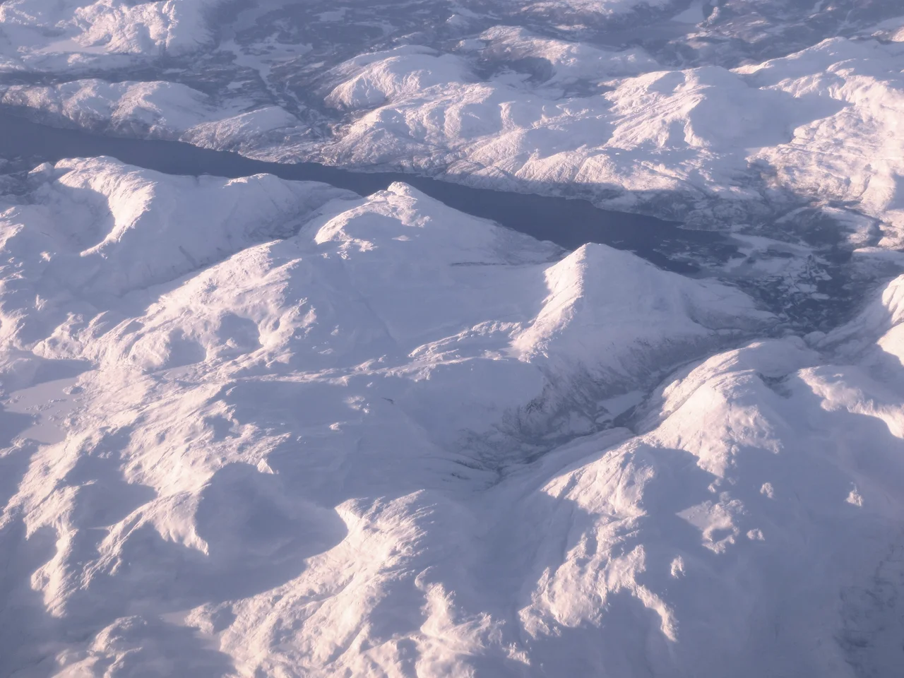
Grane's administrative heart lies at 65.4006°N, 13.5106°E, with the municipality running north to Trofors at 65.53°N and east toward the Swedish border. Valley floors are low, but terrain rises fast — Kvigtinden reaches 1,696 m (5,566 ft) on the Børgefjell side of the municipality, so 8,000 ft clears the high ground comfortably while 3,000–4,000 ft AGL gives the best read of the valley itself. Navigate by the paired E6 highway and Nordlandsbanen railway running south to north through Svenningdalen, and by the Vefsna, the largest river in Nordland. Store Majavatn sits near the Trøndelag border at the southern end of the municipality; Røssvatnet, Norway's second-largest lake, lies east in Hattfjelldal. Nearest airports: Mosjøen Airport, Kjærstad (ENMS) to the north, Mo i Rana (ENRA) beyond it, and Namsos (ENNM) to the south. Inland Helgeland draws heavy precipitation and low cloud off the Atlantic year-round, and December daylight here lasts only a few hours around midday.
Nearby Stories
- Unkervatnet 6.1 km away
- Majavatn 9.5 km away
- Jetnamsklumpen 11 km away
- Vefsn Municipality 15 km away
- Lomsdal–Visten National Park 15 km away
- Okstindbreen 28 km away
- Tjotta International War Cemetery 30 km away
- Namsskogan Municipality 38 km away