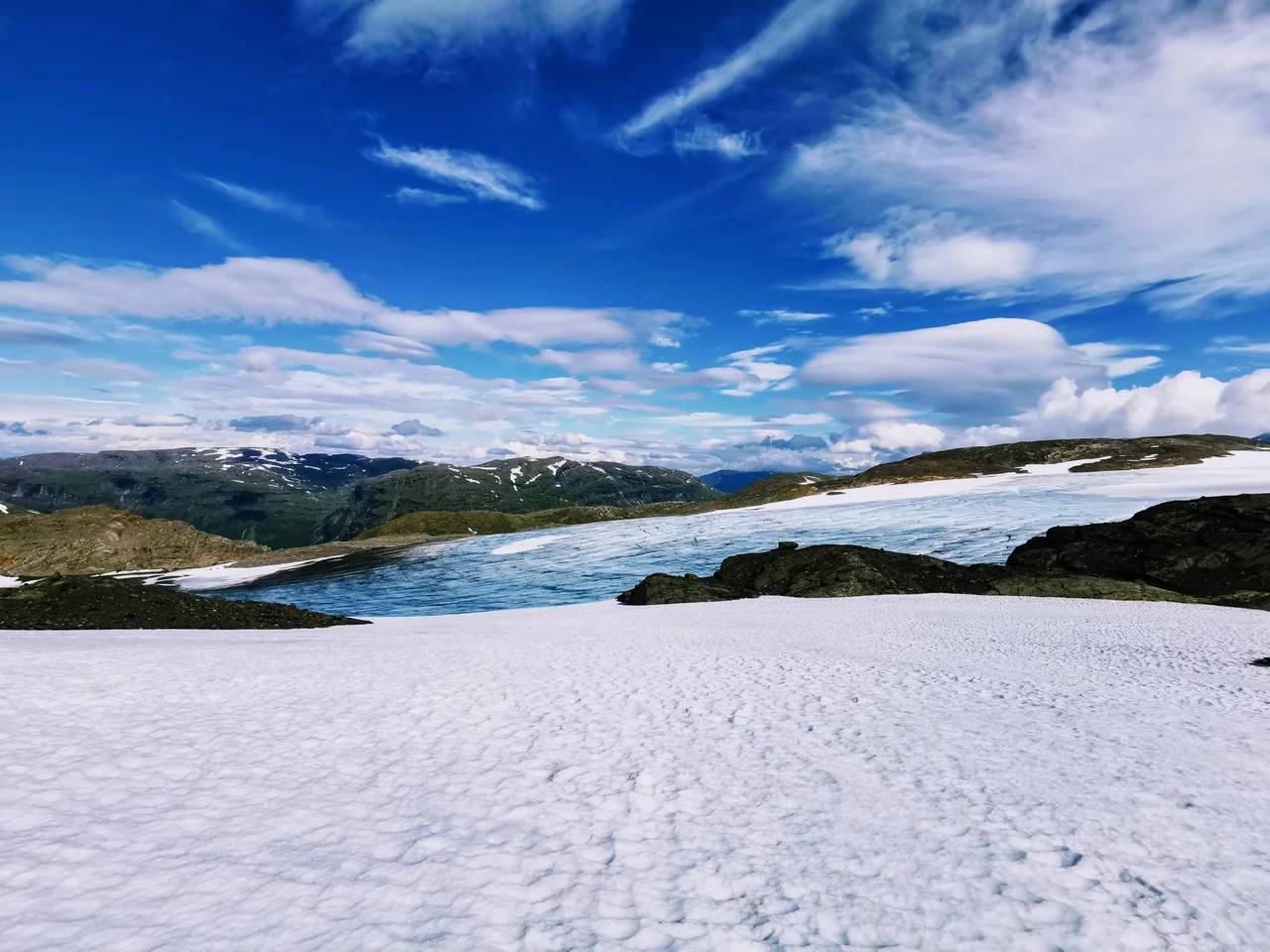

Okstindbreen
Two surveys, ten years apart, contain the whole story. In 2012 Okstindbreen covered 53.6 square kilometres. In 2022 it covered 36.9. Nearly a third of the ice — 16.7 square kilometres of it, an area larger than most cities' downtowns — simply was not there any more. This is the eighth-largest glacier on mainland Norway, the frozen heart of the Okstindan range in Nordland, and it is not a remnant clinging to a shaded gully. It is a full ice field, spilling between 1,900-metre summits and reaching down to 750 metres, and it is going fast enough that the change registers between one decade's map and the next.
One Ice Field, Seven Names
Okstindbreen is a collective noun as much as a place. The ice field carries seven named parts — Vestisen, Vestre Okstindbreen, Austre Okstindbreen, Bessedørbreen, Steikvassbreen, Vestre Svartfjellbreen and Oksfjellbreen — because it does not behave as one body. It fills the high basins between the peaks and then finds ways out, each outlet moving at its own speed down its own valley, each responding differently to the same snowfall and the same summer.
The largest of these outlets is Austre Okstindbreen, measured at 14 square kilometres in 1996. It drains northeast toward the valley of Oksfjelldalen, below and beyond Oksskolten, the highest mountain in North Norway. Water leaving a glacier of this size does not run clear. It carries rock flour — bedrock ground to powder under the weight of moving ice — and the streams below the snout run an opaque grey-blue that no other kind of river produces.
A Glacier With a Long Memory
Austre Okstindbreen is among the better-studied glaciers in northern Scandinavia, and researchers have reconstructed a complete record of its behaviour across the Holocene — the roughly 11,700 years since the last ice age ended. That record matters because it establishes what normal looks like over a very long baseline. Glaciers have always advanced and retreated. Cold centuries push them forward; warm ones pull them back.
Against that baseline the recent numbers stop being ambiguous. A 31 percent loss over a single decade is not the ordinary breathing of an ice mass responding to a run of mild winters. Modelling of Norwegian glaciers through the twenty-first century points the same direction: as the equilibrium line — the altitude above which winter snow survives the summer — climbs higher up the mountain, less and less of an ice field lies in the zone where it can replace what it loses. Okstindbreen tops out near 1,740 metres. There is only so much room above.
The Largest of Many
Okstindbreen is the biggest of numerous glaciers scattered through the Okstindan area, and the others are the more vulnerable for being small. A large ice field has depth and thermal inertia on its side; a two-square-kilometre patch of ice under a north-facing wall has neither. When the climate shifts, the small ones go first and go quietly, without anyone photographing the process.
What makes this particular concentration of ice possible is position. The Okstindan massif stands inland but not far inland, close enough to the Atlantic to catch the moisture that Norwegian weather delivers relentlessly from the west, and high enough to hold it as snow. That combination — heavy precipitation meeting sufficient altitude at 66 degrees north — is what builds a glacier. Warm the system by a degree or two and the same storms arrive as rain.
Seeing It
From the Swedish fells east of the border, Okstindan reads as a pale interruption in an otherwise brown-and-grey horizon, and the pallor is this ice. From the air the shape is clearer: a white lobed mass draped over high ground, with arms running down into the valleys and dark ridges of exposed rock rising through it where the ice has thinned enough to let the mountain show.
Those dark patches are the measurement made visible. Every ridge that emerges from an ice field is ground that was covered within living memory, and on Okstindbreen there are more of them each year. The glacier that a hiker photographs from Rabothytta today is a noticeably smaller object than the one photographed from the same spot when the hut opened in 2014.
From the Air
Okstindbreen lies at 65.99°N, 14.15°E in Hemnes Municipality, Nordland, filling the interior of the Okstindan range. The ice spans roughly 750 m to 1,740 m in elevation, with surrounding summits to 1,916 m; plan a minimum safe altitude of 8,500 ft and 10,000–12,000 ft for photography of the full ice field. Best light is mid-morning in summer, when low sun angle picks out crevasse fields and the medial dark bands of exposed rock. Visual references: Oksskolten immediately southwest of the Austre Okstindbreen outlet, Oksfjelldalen running northeast, Røssvatnet's large water body to the south. Nearest airports are Mo i Rana Røssvoll (ENRA) about 40 km northwest and Hemavan Tärnaby (ESUT) about 55 km southeast. Glacier surfaces produce strong reflected glare and, in flat overcast, complete loss of surface definition — carry sunglasses and do not rely on visual altitude judgement over the ice.
Nearby Stories
- Lukttinden 7.7 km away
- Ume River 13 km away
- Joesjö 18 km away
- Dunderland Valley Bus Crash 19 km away
- Grane Church 23 km away
- Nasa Silver Mine 57 km away
- Kittelfjäll 65 km away
- Træna Lighthouse 80 km away