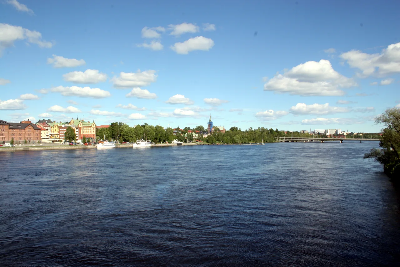

Ume River
Forty elk. Ten boats. One human being. That is the inventory of the rock carvings at Norrforsen, cut into stone beside the rapids of the Ume River around 3,000 BCE by people who had already been living in this valley for two thousand years. The proportions tell you what mattered: the animals that fed them, the craft that carried them, and — almost as an afterthought — themselves. Five millennia later the river still runs the same 460 kilometres southeast from the Norwegian border to the Gulf of Bothnia, but nearly every metre of its fall now passes through turbines, and the salmon that drew the first settlements have to climb seventy-six concrete steps to get home.
From a Border Lake to the Baltic
The river begins in Överuman, a lake of about 52 square kilometres lying at 525 metres in the Scandinavian mountains, straddling the frontier — a three-square-kilometre sliver of it is Norwegian, where it goes by the name Umbukta. In South Sámi the lake is Byjjesmehkie. The river that leaves it is Ubmejeiednuo in Ume Sámi, in which *jeiednuo* simply means large river, a name that predates every other on the map by an unknown margin.
From there the Ume runs southeast through the Vindelfjällen Nature Reserve, widens into Lake Storuman, and eventually reaches the Gulf of Bothnia at the small town of Holmsund beside the city of Umeå. At the mouth sits Obbolaön, an island that splits the outflow into two streams at the last moment. For much of its length the river has a road for company: the E12, Blå Vägen, the Blue Route, which follows the water almost the whole way from the border. Its catchment drains something close to 29,300 square kilometres of northern Sweden.
The Word the River Gave Swedish
The first sawmill at the Baggböle rapids was built in 1813-14 by three partners — Johan Unander, Eric Nyberg and Johan Vikner — who obtained permission to use the falling water. In the 1830s the Scottish-Swedish brothers James and Robert Dickson arrived, drawn by a timber market opening in Britain, and built the operation into the largest water-powered sawmill in Sweden.
Their methods became notorious enough to enter the language. *Baggböleri*, derived directly from the name of this place, is still the Swedish word for reckless, extractive deforestation — a business practice memorialised as an insult. The mills ran from May to October, employing 170 workers. The figure is recorded that way in the sources: 170, excluding women and children. The women and children were there, working the same season on the same river; they simply were not counted as workers. Steam changed everything after 1849, when the first steam-powered mill opened at Tunadal to the south and twenty more followed within a decade, all of them free to sit at ports instead of waterfalls. Baggböle held on until 1884.
6 December 1899
Umeå got its first hydroelectric power on 6 December 1899, from Klabböle Kraftverk on the south bank. The plant worked, but it fought its own location: this stretch of river supercools in winter and produces frazil ice, a slush of loose crystals that clogs intakes and does not respond to any of the obvious remedies. Klabböle nevertheless supplied the city for nearly sixty years, until 1958. It is a museum now.
Its replacement was Stornorrfors, commissioned that same year and built underground — five Francis turbines, 599 megawatts of installed capacity, and a discharge tunnel 26.5 metres high and 16 metres wide. Sweden has one hydroelectric station with greater installed capacity, Harsprånget on the Lule River, but none that generates more electricity in a year: Stornorrfors produces roughly 2,256 gigawatt-hours annually. Meanwhile the old Baggböle sawmill site, expanded in 1914 and sold to the city in 1947, became a park. It is now Arboretum Norr — trees again, on the ground where trees were once destroyed for profit.
Seventy-Six Steps
Salmon built the human geography of this valley. Settlements went up along the river in the 1200s and 1300s specifically to be near the run, and the fish remain the reason the Ume and its tributary the Vindel are considered critical habitat for the entire Baltic salmon population.
Stornorrfors should have ended that. A power station across the river is an absolute barrier to a migrating fish, and the Vindel — 445 kilometres long, Sweden's largest tributary, and permanently protected from hydroelectric development — would have been cut off from the sea entirely. What saved it was a ladder: roughly 300 metres of channel climbing 76 steps, the longest fish passage in Sweden, rebuilt in 2010. In 2013 nearly 15,000 salmon made the climb. The upper Vindel, where they are going, produces close to half of all the wild smolts that reach the Baltic Sea. A compensatory hatchery at Norrfors has released more than 100,000 fry a year since 1959. The elk carved at Norrforsen are gone from the story; the salmon, by a margin of seventy-six steps, are not.
From the Air
The Ume River runs roughly 460 km from Överuman (65.9°N, 14.6°E, 525 m elevation, on the Norwegian border) southeast to the Gulf of Bothnia at Holmsund near Umeå. The upper valley reference point is 65.96°N, 15.02°E. Follow the E12 highway, which shadows the water for most of its length — the easiest linear navigation feature in inland Norrland. Recommended altitude 3,000–6,000 ft for the valley, higher over the mountain headwaters where terrain reaches 1,768 m. Key visual markers: the long thin Överuman reservoir at the border, Lake Storuman, the confluence with the Vindel River near Vännäs, the Stornorrfors dam and Norrfors rapids west of Umeå, and Obbolaön splitting the river mouth. Airports along the course: Hemavan Tärnaby (ESUT) at the headwaters, Vilhelmina (ESNV) mid-valley, and Umeå (ESNU) at the mouth. Winter brings frazil ice and river fog to the lower reaches; the upper valley is subject to fell-generated cloud and rapid visibility loss.
Nearby Stories
- Oksskolten 3.5 km away
- Joesjö 15 km away
- Dunderland Valley Bus Crash 19 km away
- Vindelfjällen Nature Reserve 22 km away
- Hattfjelldal Municipality 25 km away
- Matsdal 48 km away
- Sädvvájávrre 49 km away
- Operation Musketoon 61 km away