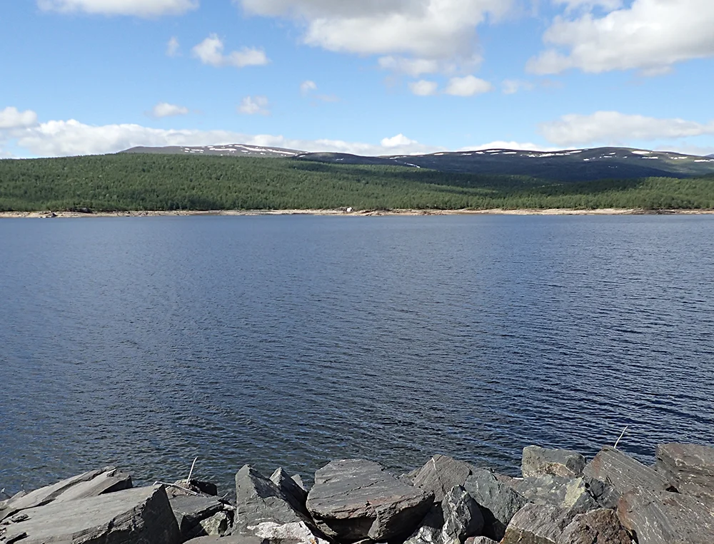

Sädvvájávrre
In 2002, two local people walking the drawn-down shore of Sädvvájávrre found a human skull in the mud. The reservoir had been doing this for years - filling, emptying, scouring - and each cycle stripped a little more soil from a low headland on the southern side. What the water had finally uncovered was a churchyard nobody had managed to locate precisely: the burial ground of Silbojokk, a parish that existed for 137 years and then simply stopped. The lake is 40.1 square kilometres, 120 metres deep in places, and today it is an engineering component of the Skellefte River. It is also an accidental excavation, running one slow cut a year.
A Smelter at the Rapids
Between 1635 and 1659 the southern shore of this lake, near the outlet of the Silbbajåhkå stream, held the smelting works of the Nasafjäll silver mine. The stream mattered: its rapids had enough fall to drive the bellows. The forest mattered more. Extensive pine stands ringed the lake, and the works took them for timber and charcoal until at least 4,000 to 5,000 hectares had been cleared. That forest has never come back. Pine stumps from the seventeenth century still stand around the shoreline and charcoal beds turn up in several places. At the western end, near where the smelter stood, there are only a handful of pines even now. Move east and the trees thicken a little, but almost every one of them grew after the Nasafjäll era ended. Three and a half centuries later, you can still read the works in the treeline.
A Parish of Eighty
Where a smelter went, a parish followed. Silbojokk was formally constituted in 1640 and received its first vicar, Johannes Byrelius, the same year. Little is recorded of the first church building. After the works were destroyed it was not rebuilt, yet the congregation carried on serving the mountain Sami, who were in the district each summer with their reindeer. Services were held in a room in one of the surviving houses - a room far too small for a congregation of roughly eighty people. A proper church went up beside the cemetery in 1691 and burned down in 1747, after which the summer services resumed in a temporary place of worship. By the 1760s there was talk of building again, but by then there was no usable timber left standing anywhere near the lake. The replacement chapel was built in 1777 at Lövmokk, north of Jäkkvik, and Silbojokk ceased to be a parish.
August 1659
The end of the first mining period came from the west. In August 1659 a Norwegian force under Preben von Ahnen - a Danish-Norwegian bailiff who spent twenty years as a district officer in Nordland - crossed the mountains, plundered the mine and burned it, along with the smelter and the church at Silbojokk. Twenty-four years of work had extracted roughly 860 kilograms of silver and 250 tonnes of lead, hauled sixty kilometres by Sami drivers conscripted with their sleds and reindeer, many of whom had already fled west into Norway to escape the levy. The raid closed the operation for over a century. On the Norwegian side of the border the expedition left a different trace: the valley von Ahnen is said to have travelled through is still called Junkerdalen, after the nickname his contemporaries gave him.
The Reservoir
Sädvvájávrre sits at the head of the Skellefte River, which is now almost fully developed for hydroelectricity, and the lake's job is long-term storage - holding water through the year so that the stations downstream can release it when demand requires. It has been regulated three times, in 1942, 1953 and 1985, and the surface now moves between 460.7 and 477 metres above sea level, a working range of more than sixteen metres. The reservoir holds 605 million cubic metres. Test fishing has brought up lake trout, arctic char, brown trout and splejk, a hybrid. All of that is unremarkable for northern Sweden. What is unusual is what the regulation has been doing to the shoreline since the last raising.
What the Water Uncovered
Archaeologists dug ahead of the 1985 raising, in 1983 and 1984, excavating the smelter and its outbuildings and examining a smithy north of the stream. On the headland called Kyrkudden they found a structure they tentatively read as a church - but no burials nearby, which left the graveyard unaccounted for. Then came the annual scouring, the 2002 skull, and a rescue survey in 2004 which established that the cemetery had been there all along. Eleven graves were recorded that season, holding fifteen people. Twelve more graves and at least thirteen further individuals came to light in 2005, together with what appeared to be the second church. A 2015 survey finally traced the cemetery's extent and recovered almost 250 loose finds from the eroding ground: mostly nails, but also window glass, lead, and human bone. These were the people of a mining parish above the Arctic Circle - smelter workers, their families, the Sami who came in summer. Their graves are being read one flood cycle at a time.
From the Air
Sädvvájávrre lies at 66.475N, 16.451E in Arjeplog Municipality, Swedish Lapland, straddling the upper Skellefte River about 25 km east of the Norwegian border. At 40 square kilometres it is a substantial, elongated lake running roughly east-west and is easy to identify from altitude; the reservoir's exposed drawdown zone often shows as a pale bathtub ring around the shoreline, particularly in late winter and early spring. The Silver Road (Swedish national road 95) follows the northern shore and gives a clear linear reference; Pieljekaise National Park lies immediately south and extends to the water. Best viewed from 3,000-6,000 feet AGL. Nearest airports are Arvidsjaur (ESNX) roughly 160 km southeast and Gällivare (ESNG) to the northeast, with Bodø (ENBO) about 120 km northwest in Norway. Terrain to the west rises to the border fells; expect orographic cloud on the Norwegian side and rapid deterioration in visibility with frontal passage.
Nearby Stories
- Junkerdal National Park 9.7 km away
- Skellefte River 10 km away
- Nasa Silver Mine 20 km away
- Ammarnäs 35 km away
- Kungsleden 41 km away
- Norra Storfjället 46 km away
- Sarek National Park 91 km away
- Boden Fortress 222 km away