
Oksskolten
Austisen, the eastern body of ice in the Okstindbreen field, has done something no other Norwegian glacier is known to have managed. Research into the last nine thousand years suggests it has survived every single warm period in that span without vanishing. It sits on the flank of Oksskolten, and it is the reason that climbing the highest mountain in Northern Norway is a rope-and-crampons proposition rather than a long walk uphill. Getting to the top means crossing blue ice riddled with crevasses, on a glacier that has been there since before the pyramids and is now, for the first time in its long career, shrinking fast.
One Thousand Nine Hundred Sixteen
The summit stands 1,916 metres above the sea in Hemnes Municipality, Nordland County. That makes it the high point of Nordland, the highest mountain in Northern Norway, and the holder of the eighth-largest topographic prominence of any Norwegian peak - a figure that matters more than raw height, because it measures how far the mountain rises above everything around it. Oksskolten does not stand alone. The Okstindan range carries nine summits above 1,500 metres with prominence exceeding 130 metres, running down from Oksskolten's 1,916 to Hekkelfjellet's 1,560. The peak sits just south of the lake Gresvatnet, east of the village of Korgen, and north of Røssvatnet, which at 219 square kilometres is the second-largest lake in Norway. Røssvatnet owes some of that rank to the dam that has regulated it since 1957; unregulated it would cover 190 square kilometres and rank third.
The Ice on the Way Up
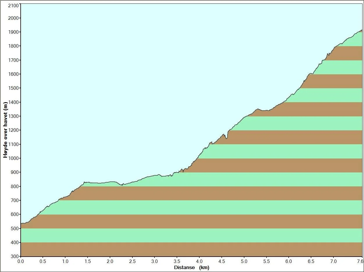
Okstindbreen is the eighth-largest glacier on mainland Norway, an ice field whose highest surfaces reach 1,740 metres and whose lowest tongue comes down to 750. Austre Okstindbreen, the biggest outlet, was measured at 14 square kilometres in 1996 and drains northeast into the Oksfjelldalen valley. The numbers since then tell a harder story: the field covered 53.6 square kilometres in 2012 and 36.9 in 2022, a loss of 31 per cent in ten years. Climbers meet what remains. The marked route from the Norwegian Trekking Association leaves the trail a few kilometres past Kjensvasshytta and climbs to the glacier's edge, where crossing the blue ice means crampons and a roped party because of the size of the crevasses. Eight to ten hours covers the round trip. There is an alternative for those who would rather not step on ice, following a marked detour across the meltwater river Oksfjellelva.
1883, Twice Over
The first recorded ascent came in 1883, and the credit divides depending on which country's sources you read. Norwegian accounts point to the French explorer Charles Rabot, who spent that year working through the mountains and glaciers of northern Norway; a plaque on the summit honours two of the 1883 climbers, Rabot among them. English-language records name Peder Stordal. Both may be right, since more than one party appears to have reached the top that season. Rabot's name has certainly stuck to the landscape. It sits on a glacier, and on a cabin routinely billed as the finest unstaffed hut in the Norwegian mountains: Rabothytta, completed in August 2014 to a design by the Oslo architects Jarmund/Vigsnæs, perched at around 1,200 metres on the very lip of Okstindbreen with the ice filling its windows and Oksskolten above.
An Older Claim on the Summit
People were reading this range long before anyone thought to record an ascent. Ancient Sami structures in the Bessedørdalen valley have led to the suggestion that Okstindan was once a holy mountain - a reading that remains proposed rather than settled, but one worth holding in mind when the peak is described as though it were discovered in 1883. The Sami name for a mountain is rarely just a label; sacred sites in the Nordic north were places of offering and orientation, and this is the most conspicuous summit for a great distance. In the years since, the range has become one of the better-studied corners of Arctic Norway, with a research station in the valley and a Holocene glacier record from Austre Okstindbreen more complete than most. The Okstindan Nature and Culture Park now works to keep both threads visible - the ice and the people who watched it first.
From the Air
Located at 66.012N, 14.339E in Hemnes Municipality, Nordland County, Norway, with a summit elevation of 1,916 m (6,286 ft) - the highest point in Northern Norway. Oksskolten anchors the Okstindan range, nine summits above 1,500 m, and the Okstindbreen ice field lies immediately west and north; the lake Gresvatnet sits just north of the summit and the very large Røssvatnet reservoir spreads to the south. The white mass of the glacier against dark gneiss is unmistakable from the air, as is the Oksfjelldalen valley draining northeast. Recommended viewing altitude at or above 9,000 ft MSL to clear the range with margin; the summit generates its own cloud and lee turbulence. Nearest airports: Mo i Rana Røssvoll (ENRA) about 25 nm northwest, Mosjøen Kjærstad (ENMS) about 35 nm southwest, Hemavan Tärnaby (ESUT) about 55 nm east-southeast across the Swedish border, Bodø (ENBO) about 100 nm north. Expect rapid mountain weather, icing above the freezing level in most seasons, and frequent low cloud on the western slopes fed by moisture off the Norwegian Sea.
Nearby Stories
- Lukttinden 7.7 km away
- Ume River 13 km away
- Joesjö 18 km away
- Dunderland Valley Bus Crash 19 km away
- Grane Church 23 km away
- Nasa Silver Mine 57 km away
- Kittelfjäll 65 km away
- Træna Lighthouse 80 km away
Sources
- Oksskolten - Wikipedia
- Okstindbreen - Wikipedia
- Okstindan has 11 summits and Norway's oldest glacier - Visit Northern Norway
- Oksskolten - the highest mountain in Northern Norway - Okstindan Nature and Culture Park
- Rabothytta is the coolest cabin in Norway - Visit Northern Norway
- The effects of footpath development on vegetation at the Okstindan Research Station in Arctic Norway - Biological Conservation
- A complete record of Holocene glacier variability at Austre Okstindbreen, northern Norway - Quaternary Science Reviews
- Røssvatnet - Wikipedia
- Okstindan - Norwegian Wikipedia (Norsk bokmål)
- Hemnes Municipality - Wikipedia