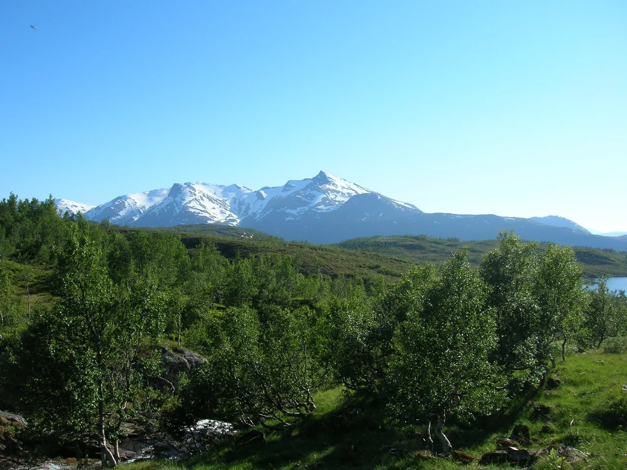

Lukttinden
In modern Norwegian, lukt means smell. That makes Lukttinden read, to anyone who learned the language in school, as something close to Stink Peak - a name no mountain deserves and this one never earned. The word is a fossil. It came into Norwegian from Sami by way of the lake at the mountain's foot: Luktvatnet, in Southern Sami Loektejaevrie, built from loekti, an inlet, and jaevrie, a lake. The lake with many inlets. Only the ending is Norwegian, from tind, a peak. Properly unpacked, the 1,343-metre summit standing between Mo i Rana and Mosjoen is the peak above the many-inletted water.
The Map Underneath the Map
Names like this are scattered across inner Helgeland, and they are easy to drive past. Vefsn Municipality, which owns this summit, carries the Southern Sami name Vaapste. Rossvatnet, some thirty-odd kilometres to the southeast, is Reevhtse. The Norwegian on the road signs is the top layer of a map that has been written over more than once, and the older writing keeps surfacing exactly where you would expect it - on lakes, on peaks, on the shapes of land that mattered most to whoever was moving through this country first.
Luktvatnet itself looks modest on paper. It covers 3.74 square kilometres and sits at 137 metres above sea level, with the E6 running along its western shore. Its many inlets are the entire reason for its name, and the reason for the mountain's. Traffic heading north toward Mo i Rana passes them at ninety kilometres an hour without a second look.
The Mountain Without a Glacier
East of Lukttinden the ground turns serious. The Okstindan range carries Oksskolten, which at 1,916 metres is the highest mountain in North Norway, and it carries Okstindbreen, a glacier substantial enough to require rope, crampons and someone who knows how to use both. Lukttinden has none of that. No ice, no crevasses, no glacier travel - and that absence is precisely what gives the peak its local reputation.
It is a walk-up. Norwegian tour guides list it as an easy trip, which in a district where the neighbouring summits demand technical skill amounts to a genuine selling point. The mountain is not even the tallest in its own municipality; Geittinden, at 1,556.55 metres, holds that title. Lukttinden's advantage is a different sort of arithmetic. It offers most of the altitude of a serious peak while asking for almost none of the equipment.
Thirteen Hundred Metres of Air
West of the summit the land falls away toward Ommervatnet, a lake of 5.47 square kilometres lying at just 42 metres above sea level. The vertical gap between that water and the top of Lukttinden runs to roughly 1,300 metres. Standing at the edge of it, the number stops being abstract and becomes something you feel in the back of your knees.
Turn east and the Okstindan wall fills the horizon instead, white where the glacier holds its ground. Between the two views lies the whole logic of the place: soft, farmed, forested valley on one side, hard ice on the other, and this bare accessible summit sitting between them like a viewing platform. Lukttinden stands at 65 degrees 59 minutes north, about half a degree short of the Arctic Circle - close enough that midsummer nights here never go properly dark, far enough that the sun still technically sets.
The Road at Its Feet
The best-known photograph of Lukttinden was taken from the old Korgfjell road, near the point where the E6 leaves Luktvatnet. Which is to say: from beside a parked car, by someone who stopped. That is how most people meet this mountain, and there is nothing wrong with it. Helgeland is full of summits that reward a stop rather than an expedition.
The geography arranges itself neatly from the roadside. The E6 threads between Luktvatnet and the Korgfjellet massif; Lukttinden stands over the arrangement, east of Ommervatnet, south of the lake that named it, and west of the glaciers it declines to imitate. Between Mo i Rana and Mosjoen there is a great deal of mountain and not much else. This one is the mountain that lets you up.
From the Air
Lukttinden lies at 65.9903 N, 13.5444 E, with a summit elevation of 1,343 m (about 4,406 ft). It is the most prominent bare peak between Luktvatnet to the north and Ommervatnet to the west, both of which are reliable visual references - Ommervatnet sits at only 42 m above sea level, making the escarpment above it unmistakable. The E6 highway runs along the western shore of Luktvatnet and gives a clear linear feature for orientation. The glaciated Okstindan range, including Oksskolten at 1,916 m, lies to the east and is the highest terrain in North Norway; give it wide clearance. Nearest airports are Mosjoen Airport, Kjaerstad (ENMS), roughly 27 km to the southwest, and Mo i Rana Airport, Rossvoll (ENRA), roughly 55 km to the northeast. Recommended viewing altitude is 7,000-9,000 ft. Inner Helgeland generates rapid orographic cloud and local turbulence in westerly flow; summits here are frequently obscured even when the valleys are clear.
Nearby Stories
- Sundøy Bridge 3.8 km away
- Okstindbreen 4.4 km away
- Grane Church 19 km away
- Lomsdal–Visten National Park 21 km away
- Hattfjelldal Municipality 22 km away
- Dunderland Valley Bus Crash 38 km away
- Træna Lighthouse 50 km away
- Operation Musketoon 62 km away