
Hemavan
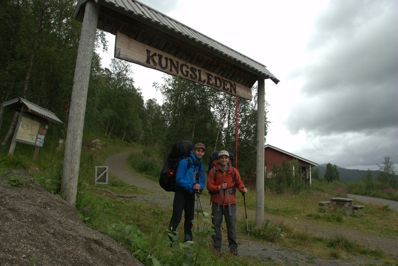
After 467 kilometres you come down out of the fells and there is a chairlift. That is the peculiar ending Kungsleden gives its walkers: a month of birch forest, boulder field and river crossing, hut to hut from Abisko in the far north, and then Hemavan — a village of a couple of hundred residents with a ski area on the slope above it and an airport runway a kilometre from the last waymarker. Sweden's most famous long-distance trail does not end at a monument or a coastline. It ends in a working alpine resort in the Ume river valley, which is either an anticlimax or exactly the right reward, depending on how many days you have gone without a shower.
The End of the King's Trail
Kungsleden was named in 1928, the project of the Swedish Tourist Association, an organisation founded in 1885 with the conviction that ordinary people should be able to walk through the mountains of their own country. The trail runs roughly 467 kilometres between Abisko and Hemavan and is served by 21 huts, spaced at the distances a walker actually covers in a day — nine kilometres in bad terrain, twenty-two in good.
The hut network is not continuous. Between Kvikkjokk and Ammarnäs lies a 130-kilometre stretch with no huts at all, which is the section that separates hikers who carry a tent from hikers who did not read carefully. The highest point on the whole route is the pass at Tjäktjapasset, 1,150 metres. The southern end took the longest to finish: the trail only reached Hemavan in 1975, nearly half a century after it acquired its name.
A Lift in 1954
Tourism came here by road. Through the 1930s the route along the Ume river toward Norway was improved, and the first visitors followed it into a valley that had previously received almost nobody. The infrastructure arrived in a tight cluster two decades later — the Högfjällshotellet in 1953, the Hemavan inn in 1954, and in the same year the first ski lift.
What grew from that single lift is now, together with Tärnaby 18 kilometres down the valley, the largest centre for downhill skiing in Sweden. The pistes here have among the biggest vertical drops in the country, which is not obvious from the map — these are fells, rounded and treeless, not the sharp alpine profiles of the Alps, and the drop is hidden in their bulk. Most of the tourist infrastructure belongs to a single company, Hemavan Alpint, which gives the resort a coherence that larger places, carved up between competing operators, tend to lack.
One Kilometre to the Runway
Hemavan Tärnaby Airport sits a kilometre from the village at 458 metres above sea level, with a single asphalt runway and scheduled flights to Stockholm-Arlanda. It opened in 1994 and produced a statistical oddity: for sixteen years afterwards, Storuman Municipality was the only municipality in Sweden operating two airports with scheduled service. The other one, at Storuman itself, closed in 2010.
The road matters more. Hemavan sits on the E12, the Blue Highway, which runs from Mo i Rana on the Norwegian coast — 100 kilometres northwest of here — clear across Scandinavia and Finland to Petrozavodsk in Russian Karelia. Buses connect the village to Umeå on the Baltic coast, where the fast trains are, and there is an overnight service from Stockholm. What there is not, despite the Norwegian border lying only about 40 kilometres away, is any public bus across it. The mountains are open. The timetables are not.
Two Hundred People, Five Thousand Square Kilometres
Hemavan itself is small — 222 inhabitants at the 2010 count — and low, sitting in the valley floor beside the lake Ahasjön with the fells rising on every side. The surrounding landscape carries formal designation as a nationally important cultural landscape, recognition of a valley shaped by centuries of reindeer herding, settlement and movement rather than by anything dramatic in its geology.
North and east of the village lies Vindelfjällen, at 5,628 square kilometres the largest nature reserve in Sweden and one of the largest protected areas in Europe. Above the resort stands Norra Storfjället, whose summit Norra Sytertoppen reaches 1,768 metres — the highest ground in Västerbotten County. The arithmetic is worth pausing on. A village that would be a rounding error in most countries functions as the front door to a protected wilderness roughly the size of Trinidad, and the route in is a marked footpath that starts behind the ski lifts.
From the Air
Hemavan lies at 65.81°N, 15.10°E in the Ume river valley, Storuman Municipality. Hemavan Tärnaby Airport (ESUT / HMV) is 1 km from the village at 458 m (1,503 ft) elevation with a single 1,601 m asphalt runway, 15/33. Surrounding terrain rises steeply: Norra Storfjället to the northeast tops out at 1,768 m (5,800 ft), so circuit and approach planning must respect a valley-floor field surrounded by fells. Recommended sightseeing altitude 6,000–9,000 ft. Visual references: the E12 highway and Ume river running southeast–northwest through the valley, lake Ahasjön beside the village, the Överuman reservoir 25 km northwest at the Norwegian border, and the U-shaped notch of Syterskalet cutting through the fells to the northeast. Alternates: Mo i Rana Røssvoll (ENRA) 98 km northwest, Vilhelmina (ESNV) to the southeast. Expect valley fog on calm autumn mornings, strong channelled winds along the valley axis, and very short daylight from late November to mid-January.
Nearby Stories
- Unkervatnet 13 km away
- Røsvatnet 19 km away
- Vindelfjällen Nature Reserve 21 km away
- 2024 Finneidfjord Train Derailment 28 km away
- Matsdal 31 km away
- Hattfjelldal Municipality 37 km away
- Dunderland Valley Bus Crash 39 km away
- Iraft 55 km away