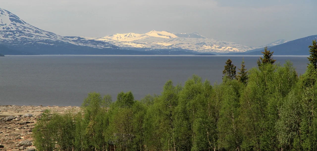

Røsvatnet
The water came a year early. Families around Røssvatnet had been told they had until 1958 to strip their houses, move what could be moved, and decide which of the old buildings were worth saving. Then in the summer of 1957 the lake began to rise, more than five metres in a matter of weeks, and the arithmetic of the whole thing changed. There was no time to take down a barn. There was no time to clear the birch and pine from ground that was about to become lakebed, which is why, for decades afterward, drowned timber kept surfacing in the shallows to tear the bottoms out of boats and shred fishing nets. When the reservoir settled, the surface stood roughly ten metres above the old lake, and Norway had a new second-largest lake.
Nine Hundred and Five Dekar
The historian Jostein Lorås put numbers to it in a 1994 study, and the numbers are the least of it. Some 905 dekar of cultivated ground — about ninety hectares, the hayfields and potato plots of a mountain valley where growing anything is already an argument with the climate — went under. Twenty-three farms were abandoned outright. Another seventy-two lost enough of their working land that what remained no longer added up to a living. Several hundred people were affected, across families who in many cases had been on that ground since the 1800s. These were not marginal holdings on a map in an engineer's office. They were the flat, sheltered, south-facing acres at the bottom of the valley — which is precisely why they were farmed, and precisely why a reservoir wanted them.
What Nobody Wrote Down
No archaeological survey was carried out before the flooding. Burial places went under the water along with everything else, unrecorded. People who wanted to preserve old buildings and old tools — the accumulated equipment of a working life, the things that make a farmstead legible to whoever comes next — simply ran out of days. Residents around the lake have long argued that the Røssvatnet regulation was the largest damming of an inhabited area anywhere in Northern Europe. Whether or not that claim survives every comparison, it says something true about how the loss registered locally: not as an inconvenience, but as the end of a settled place. The arguments with Statkraft and the national water and energy directorate over compensation and cleanup have never entirely stopped.
The Rank It Bought
Røssvatnet sits in Hattfjelldal and Hemnes municipalities in Nordland, a long, branching sheet of water below the Børgefjell massif. Unregulated, it covered 190 square kilometres and ranked third among Norway's lakes. Regulated, at its highest permitted level, it covers 219 square kilometres and ranks second. The dam also swallowed the gap between Røssvatnet and Tustervatnet upstream, merging the two into a single body. It is 240 metres deep and holds something like 15 cubic kilometres of water, its surface rising and falling between roughly 371 and 383 metres above sea level as demand dictates. Røssvassholmen, the big island in the southern basin, covers 17.39 square kilometres and stands 206 metres above the water at full pool — Norway's second-largest lake island, after Helgøya in Mjøsa.
Two Point Zero Terawatt-Hours
Røssvatnet is the head reservoir for the Øvre Røssåga and Nedre Røssåga power stations, holding about 2.0 TWh — the third-largest hydropower store in Norway. That energy was not abstract. It went to the industrial plants of Helgeland in the postwar decades, when Norway was building itself an economy out of falling water. The dam was rebuilt in 2000 to meet modern safety standards. What the ledger does not show is the drawdown zone: the wide, grey, stump-strewn band of dead shoreline exposed whenever the reservoir is drained toward its lower limit, unstable underfoot, difficult to land a boat on, and freezing unpredictably in winter. Some clearing was finally done on state land in the 1970s. The felled timber outlasted the effort.
An Older Shoreline
There is a strange coda. In the 1970s, in the raw erosion zone between the old waterline and the new one, archaeologists found Stone Age settlements — evidence that people have been living beside this lake for thousands of years, far longer than any of the farms the reservoir took. The reservoir scoured the ground bare and handed over the proof. It is the sort of irony that offers no comfort to anyone who watched their own house go under, but it does place them in a line: Røssvatnet has been a good place to live for a very long time, and the twenty-three families who left in 1957 were not the first to make that discovery, only the ones asked to give it up.
From the Air
Røssvatnet lies at 65.784°N, 14.008°E in interior Nordland, its surface swinging between roughly 371 and 383 m above sea level. From the air it is one of the largest and most recognisable water features in northern Norway — a branching 219 km² sheet with the substantial island of Røssvassholmen in its southern basin, hard against the Swedish border to the east and the Børgefjell highlands to the south. Look for the pale drawdown band around the shore, a reliable visual signature of a regulated reservoir and clearest in late winter and early spring. Recommended viewing altitude 5,000–8,000 ft AGL. Nearest airfields are Mosjøen Airport, Kjærstad (ENMS) to the west and Mo i Rana Airport, Røssvoll (ENRA) to the northwest; Namsos Airport, Høknesøra (ENNM) lies well to the south. Interior mountain weather changes fast here, with frequent low cloud on the surrounding fells and short daylight windows from November to February.
Nearby Stories
- Vefsn Municipality 6 km away
- 2024 Finneidfjord Train Derailment 9.3 km away
- Hattfjelldal Municipality 12 km away
- Joesjö 15 km away
- Dunderland Valley Bus Crash 42 km away
- Stekenjokk 53 km away
- Wideroe Flight 710 62 km away
- Træna Lighthouse 73 km away