
Bostadh (Iron Age settlement)
The wind did the excavation. In January 1993, storm-force gales and high tides scoured nearly a metre of sand from the dune face above Bosta Beach on the island of Great Bernera. When the storm passed, locals could see stones - shoulder-high, set in lines, plainly built. A series of stone buildings emerged in a thirty-metre stretch beneath what had been an unremarkable dune. They had been buried for more than a thousand years. People had lived here in the Late Iron Age, between roughly 400 and 800 CE, and then the sea had taken the place back.
Hints in the Sand
Archaeologists had suspected something at Bosta for decades. As early as 1966, midden deposits - the rubbish heaps of ancient households - were observed eroding at the base of the dunes, along with stone structures. In 1968 further erosion exposed Iron Age pottery sherds, stone implements, and corroded iron. Inside one structure marked out by large set stones, excavators found a flint flake, a thick pottery sherd, an antler tine of red deer used as a tool, and a fragment of whale bone shaped into another. These objects are now in the Glasgow Art Gallery and Museum. A year later, an arc of set stones and short sections of walling appeared, almost certainly the remains of houses. Midden material to the west yielded shells, bones, fragments of broch-type pottery, and a piece of decorated bone perforated for use as a comb. Even a single twisted ring of corroded iron, 114 millimetres across, turned up in 1983. The signs were unmistakable. The dune was a lid.
The Storm of 1993
The January storm did what decades of slow erosion had only hinted at. A metre of dune face vanished, the beach itself dropped roughly a metre, and a wall of stone buildings emerged over thirty metres of newly exposed coastline. The walls were heavy - over a metre thick in most places - built of drystone inner and outer faces with sand cores between them, set on dark brown sand deposits. The buildings were bordered by exposed rock to the north, a stream estuary to the south, and Bosta Cemetery to the east. Once revealed, the site could not simply be reburied. In 1996 a rescue excavation began. It uncovered five structures from the first millennium CE, the associated midden deposits, and one later building - probably Norse - that had been built into the ruins of the older village.
Lives Around the Hearth
Three of the five houses excavated date to the 1st millennium CE and share clear architectural features. They are stone roundhouses, each with a south-facing entrance and at least one annex room. The walls have drystone faces inside and out, packed with sand and midden material in their cores. The central hearths are rectangular, three-sided and open at one end, constructed of fitted stones. The same stratigraphic sequence runs through Houses 1 to 3, meaning these three were lived in at the same time. House 3 sits in a substantial midden spread that the excavators left unexcavated for time. The artefacts paint a domestic picture: bone and pottery, carved bone implements, the remains of composite bone combs, hammerstones, querns for grinding grain, scraps of metalwork. One decorated pottery piece from House 5 dates tentatively to the third to fifth centuries CE. Conditions in the sand preserved palaeoenvironmental evidence beautifully - the kind of detail that turns ruins back into kitchens and yards.
The Norse Layer
Above House 1, three sides of a later rectangular building emerged, surviving only to two courses of stone. Its associated midden flowed downhill from the structure and overlapped the sand infill of House 3. A fragment of a steatite bowl with rivet holes in this later midden gave the building its likely date - the Norse period, when soapstone bowls were the common cookware. The Vikings who had named so much of Lewis had passed this way too, building over what they found and leaving their own kitchen waste on top. Bostadh became a small archaeological palimpsest: Iron Age village, then Norse outpost, then nothing, then sand, then storm.
The House You Can Walk Into
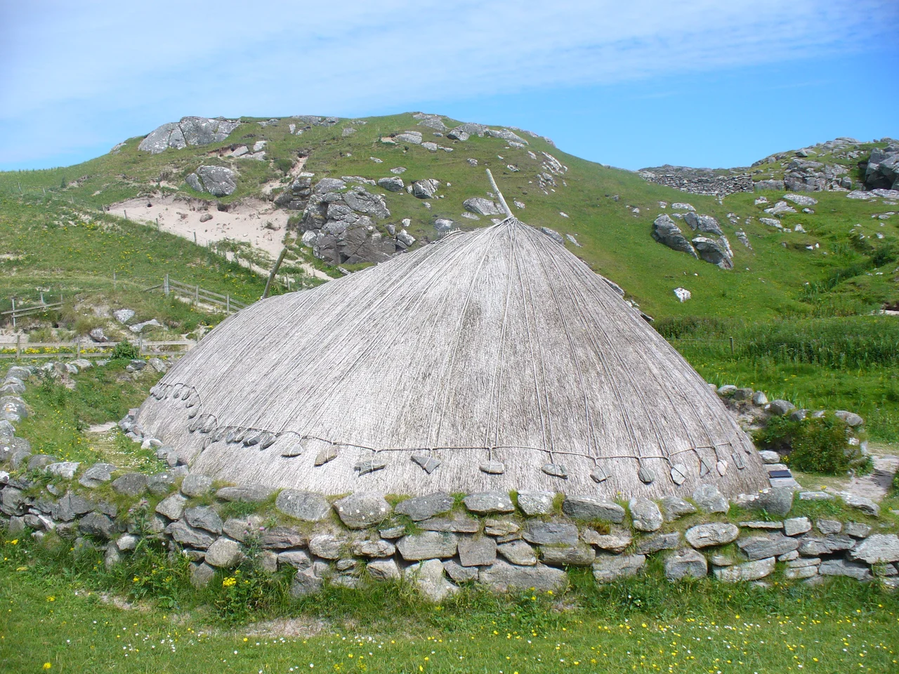
Beside the original site stands a reconstruction. Built using techniques that would have been familiar to the original inhabitants, the new Iron Age house first wore a thatched roof secured with ropes and stone weights. Wind and weather forced a switch to turf - more durable in Hebridean conditions. The wooden 'horns' at either end of the roof ridge are still in place. In the summer months visitors can tour the house, learn about the settlement, and watch the experimental archaeology that the Bernera Historical Society conducts there. The settlement is a scheduled monument, monitored by Historic Environment Scotland and managed by the Comunn Eachdraidh sgire Bhearbaraidh. The original five buried houses are once again under sand for protection. The reconstruction stands above them, smoke sometimes rising from the central hearth, looking exactly the way a small Hebridean settlement looked sixteen centuries ago.
From the Air
Coordinates 58.26 N, 6.88 W. Bosta Beach lies at the northern tip of Great Bernera, fronting a small sheltered bay. The reconstructed Iron Age house is visible as a low turf-roofed structure just above the beach. Nearest airport is Stornoway (EGPO), about 23 nm east-northeast. Recommended viewing altitude 1,500-3,000 ft. The site's relationship to the dunes and the exposed Lewisian gneiss to the north is best seen at low altitude in side light. Expect strong Atlantic winds that build and erode the dunes here continuously.
Nearby Stories
- Hebrides 8.6 km away
- Tiumpan Head Lighthouse 11 km away
- The Flannan Isles Mystery: The Lighthouse Keepers Who Vanished 12 km away
- German submarine U-905 33 km away
- Rua Reidh Lighthouse 35 km away
- Spaceport 1 40 km away
- Sandwood Bay 104 km away
- The Laki Eruption: The Volcano That Changed World History 843 km away