
Bountiful Islands
Matthew Flinders did not waste praise on barren ground. When the young English navigator nosed HMS Investigator into the southern Gulf of Carpentaria in 1802 and stepped ashore on a low sandy island, he found it so thick with sea turtles, so generous with what a hungry crew needed, that he gave it a name no map could improve upon: Bountiful. More than two centuries later the name still fits, though the bounty has shifted. The turtles still come, but it is the birds that now define the place. On these few hundred hectares of sand and scrub off the Queensland coast, terns gather in numbers that matter to the whole planet.
Flinders and the Generous Shore
The year 1802 found Matthew Flinders midway through the first circumnavigation of Australia, charting a coastline Europeans had barely glimpsed. The Gulf of Carpentaria tested him; it was hot, shoal-ridden and poorly mapped, and his ship was beginning to rot beneath him. So an island that offered easy provisions was a gift, and he named it accordingly. Flinders had a habit of letting the land speak through his charts, honouring the abundance he found, and Bountiful Island joined a string of such names across the region. Decades later, in 1841, Captain John Lort Stokes brought HMS Beagle through the same waters, calling at the Bountiful Islands as he surveyed this remote corner of the Gulf in finer detail.
A Nursery for Terns
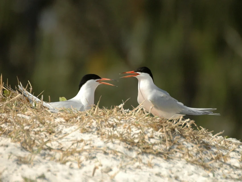
Today the islands' importance is measured in wings. Tiny as they are, at roughly 450 hectares of land, the Bountiful Islands qualify as an Important Bird Area because they shelter more than one percent of the global population of two species. Up to 2,000 pairs of roseate terns nest here, slender and pale, their plumage flushed faintly pink in the breeding season. Alongside them crowd a far larger throng: somewhere between 26,000 and 30,000 pairs of crested terns, one of the great seabird gatherings of the Gulf. For these birds the islands' very emptiness is the attraction. With no people and few predators, the open sand becomes a safe place to lay eggs and raise the next generation above the reach of the tide.
Small Land, Vast Sea
It is easy to underestimate a place this size. The whole island group amounts to only about 4.5 square kilometres of dry land, low enough that a big tide seems to threaten to swallow it and flat enough to vanish behind the curve of the sea from a few miles off. Yet that smallness is precisely the point. Surrounded by the warm, shallow, turtle-rich waters of the southern Gulf of Carpentaria, the Bountiful Islands offer exactly what a nesting seabird or an egg-laying turtle most needs: bare ground, safe from the mainland's predators and far from human disturbance. The islands draw their significance not from grandeur but from isolation, a few hundred hectares of sand doing ecological work out of all proportion to their footprint.
Islands in Wellesley Country
The Bountiful Islands belong to the wider Wellesley group, the scatter of islands across the southeastern Gulf that Flinders named for a colonial governor. These are the home waters of Aboriginal peoples whose connection to this sea country runs deep, among them the Kaiadilt, whose heartland lay on Bentinck Island in the South Wellesley group not far to the south. The Kaiadilt were among the last coastal Aboriginal people in Australia to maintain their traditional life largely undisturbed, navigating these islands by canoe and reading the reefs and tides with extraordinary precision, until the upheavals of the twentieth century forced most of them from their country. The low islands of the Gulf, Bountiful among them, were never empty in the way a passing chart-maker might assume; they sat within a living map of sea country known and named long before any European sail appeared.
From the Air
The Bountiful Islands lie at approximately 16.67°S, 139.86°E in the southern Gulf of Carpentaria, within the Shire of Mornington in Queensland, north of Mornington Island. From the air they read as small, very low sandy islands ringed by reef and pale shallows, easy to overfly and easy to miss; their flatness offers little vertical landmark, so they serve best as a charted waypoint rather than a visual one. The nearest airstrip of significance is on Mornington Island (Gununa, ICAO YMTI) to the south; Burketown (YBKT) lies on the mainland to the southeast and Karumba (YKMB) further around the Gulf. This coast sits squarely in the tropical cyclone belt during the November-to-April wet season, with monsoonal cloud and storms; the dry season brings the clearest conditions. Note these are uninhabited conservation islands with no facilities.
Nearby Stories
- Sweers Island 29 km away
- Little Eva 56 km away
- Norman River 88 km away
- Karumba 113 km away
- Old Westmoreland Homestead 131 km away
- Aboriginal Shire of Kowanyama 184 km away
- Vanderlin Island 243 km away
- Aboriginal Shire of Pormpuraaw 257 km away