
Sweers Island
Carve your name into a tree and you announce that you were here. In 1802, the explorer Matthew Flinders did exactly that on a small island in the southern Gulf of Carpentaria, cutting the word "Investigator" into the bark for his ship. Four decades later another captain found the marks, added his own vessel's name, and so did the men who came after him, until a single tree on this remote shore had become a logbook of European voyages into the top of Australia. The tree is gone now, its damaged trunk hauled away to a museum in Brisbane. But Sweers Island remembers more than the explorers. Long before any of them, this was Kaiadilt country, and it still is.
Flinders Comes Ashore
In November 1802, Flinders was nearing the end of an extraordinary task: sailing the entire coastline of Australia in the leaky sloop HMS Investigator to settle a question that had haunted European maps for two centuries. Was this one continent or several islands? The Gulf of Carpentaria, a vast bite out of the north coast, was suspected of being the entrance to a strait that cut the landmass in two. Flinders dropped anchor among the South Wellesley Islands to careen his rotting ship and take on water. He named this one for Salomon Sweers, a Dutch official in Batavia who, a century and a half earlier, had helped send Abel Tasman to chart these same waters. The carved tree was almost an afterthought. It would outlast the man.
The Investigator Tree
In 1841 John Lort Stokes, commanding the survey ship Beagle, landed and found Flinders's inscription still legible on a native hackberry, Celtis paniculata. Stokes carved "Beagle" beside it. Then came the others: Gregory's northern expedition in 1856, and in 1861 the searchers hunting for the lost explorers Burke and Wills. Each crew left its mark, until the trunk read like a roll call of nineteenth-century exploration. A cyclone in March 1887 split the tree apart. Rather than let the relic rot in the salt air, surveyors cut away the carved section and shipped it to the Queensland Museum in 1889, where it survives today, a slab of timber inscribed with the ambitions of men who sailed past the edge of the known.
A Town Called Carnarvon
For a brief, feverish stretch in the 1860s, this empty island held a town. As the mainland port of Burketown sickened, settlers looked offshore for cleaner ground, and a settlement called Carnarvon rose on Sweers with a customs house, a hotel, and police. When a deadly fever swept Burketown in 1868, the explorer William Landsborough evacuated survivors here, and for eighteen months the island sheltered the sick. Ships trading into the Gulf called at Carnarvon instead of the mainland. The paddle steamer Pioneer, hauling wool and hides, wrecked on the island's south-western tip during a cyclone in 1870. The town faded by the 1870s, the customs house lingering until 1884, and the Gulf swallowed the memory of its short-lived capital.
Kaiadilt Country
All of this is recent history. The Kaiadilt people have known these islands for thousands of years, their ancestral home centred on nearby Bentinck Island, with Sweers and Allen reached on hunting and fishing forays across the shallow tidal flats. Their language, Kayardild, is one of the most distinctive in Australia. In 1948, after a cyclone and tidal surge poisoned Bentinck's fresh water, missionaries and the government removed the Kaiadilt to a mission on Mornington Island. The dislocation was devastating; for years afterward, few Kaiadilt children survived infancy, leaving a wound in the generations. Today most of Sweers Island is Aboriginal freehold, held in trust on behalf of the traditional owners who never stopped belonging to it.
Island Time
Now the island runs on the slow rhythm of the tides and the fishing seasons. A low-key lodge, established in 1987, offers the only beds, reachable by a gravel airstrip cut into the scrub. Anglers come for the sweetlip and coral trout, the golden snapper, and in the cooler months the Spanish mackerel and queenfish that run through the Gulf. The wet season simmers from November to March; the long dry stretches cooler and clear from April to October, when daytime temperatures still climb toward the low thirties. There is nothing to do here but fish, watch the seabirds wheel, and feel the great empty Gulf press in on every side. After two centuries of carved names and abandoned towns, the island has gone quiet again.
From the Air
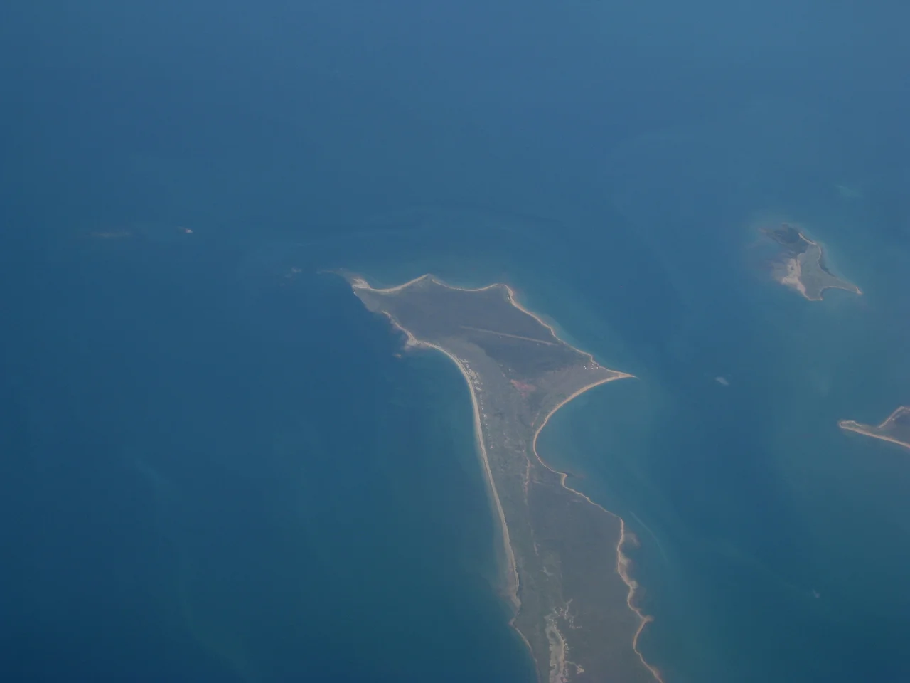
Sweers Island sits at 17.10°S, 139.62°E in the southern Gulf of Carpentaria, roughly 70 km north of Burketown on the Queensland mainland and 3 km east of the larger Bentinck Island. Approaching from the south, the South Wellesley group reads as a scatter of low, vegetated islands ringed by pale sand and turquoise shallows against the deeper Gulf. The island has a 1,100 m all-weather gravel airstrip operated by the resort; there is no instrument approach, so use it only in clear daylight VFR conditions. The nearest serviced strip is Burketown Airport (YBKT) on the mainland; Mornington Island Airport (YMTI) lies to the northeast and Normanton (YNTN) further east. Best viewing altitude is 2,000–4,000 ft, where the reef edges and tidal flats stand out vividly. Watch for sea breezes and afternoon wet-season buildups from November to March.
Nearby Stories
- Nicholson River 19 km away
- Bountiful Islands 26 km away
- Little Eva 32 km away
- Flinders River 41 km away
- Norman River 68 km away
- Lawn Hill crater 154 km away
- Aboriginal Shire of Kowanyama 221 km away
- Vanderlin Island 266 km away