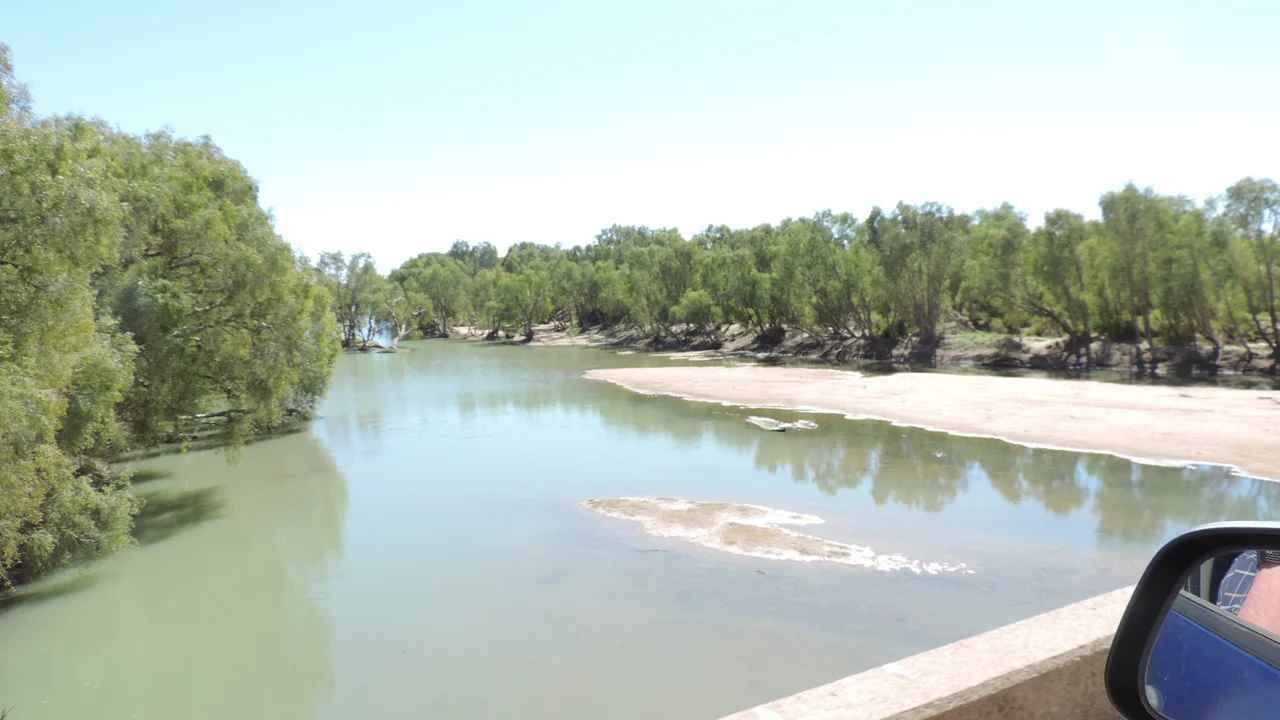

Flinders River
Queensland's longest river spends most of the year looking like anything but. For long dry months the Flinders is a sequence of waterholes and bone-pale sand, its bed a patchwork of silt, gravel, and cobble winding west across the downs. Then the monsoon arrives. In February 2019 the river burst its banks and swelled to nearly sixty kilometres wide, a sheet of brown water so vast it generated its own local weather. From a thread you could step across to an inland sea that warps the climate above it, the Flinders contains the whole drama of the Gulf Country in a single watercourse.
A Thousand Kilometres to the Gulf
At roughly 1,004 kilometres, the Flinders is the longest river in Queensland and the eighth-longest in all of Australia. It rises in the ranges northeast of Hughenden and runs west past Richmond and Julia Creek before swinging northwest toward the Gulf of Carpentaria. Its catchment is enormous, covering about 109,000 square kilometres, roughly one and a half percent of the entire continent, fed by thirty-six tributaries with names like Morepork Creek and Eurimpy Creek. There are no dams on the Flinders itself. The water that reaches the Gulf has crossed the open downs largely unimpeded, gathering into a single permanent waterhole, Flagstone, before the wet season transforms everything.
The First Nations of the River
Long before any of this country appeared on a European chart, it belonged to its people. The traditional owners of the Flinders catchment include the Kalkadoon, Mitakoodi, Kukatj, Guthaarn, Mayi-Yapi, Mayi-Kulan, Mayi-Thakurti, Ngawun, Wanamara, Mbara, Yirandali, and Gugu-Badhun nations, who have lived along these waters for thousands of years. Their languages map the land in detail: Wanamarra, also called Maykulan, was spoken across the river country around Kynuna and Richmond, while Dalleburra belonged to the downs near Hughenden. These were not empty plains awaiting discovery. They were a thoroughly known and named homeland, and they remain so.
Named for a Man Who Mapped a Continent
In 1841 the survey ship HMS Beagle nosed into the Gulf, and Captain John Wickham and Lieutenant John Lort Stokes charted the muddy estuaries where the Flinders and Albert rivers meet the sea. They named the river for Matthew Flinders, the navigator who had circumnavigated Australia and given the continent its name, though he had died decades earlier without ever seeing this corner of it. Stokes had an ear for the country's moods, christening the surrounding features Disaster Inlet and Morning Inlet. The names stuck, a layer of English laid over country that already carried a dozen older names in a dozen older tongues.
Where Burke and Wills Reached the End
Twenty years later the river witnessed one of the most famous and tragic episodes in Australian exploration. In 1861, Robert O'Hara Burke, William John Wills, Charles Gray, and John King reached the Flinders delta, fulfilling their expedition's goal of crossing the continent from south to north. The triumph was hollow. Gray died on the return journey, and Burke and Wills both perished at Cooper Creek after staggering back to find their supply depot abandoned. Only King survived, kept alive by the Yandruwandha people whose generosity the expedition had done little to earn. The river they had struggled so far to reach flowed on, indifferent, toward the Gulf.
From the Air
The Flinders River meets the Gulf of Carpentaria at about 17.6 degrees south, 140.6 degrees east, but its course stretches more than a thousand kilometres southeast to the ranges near Hughenden. In the dry season, look for a wide, pale, braided channel threading the downs rather than a flowing river; in the wet, the floodplain can spread tens of kilometres across, an unmistakable feature from altitude. Burketown (YBKT) is the nearest aerodrome to the mouth, with Mornington Island (YMTI) offshore to the north; Richmond and Hughenden lie along the upper river inland to the southeast. Clearest flying is May through September, well away from the monsoon and its cyclones.
Nearby Stories
- Leichhardt River 16 km away
- Leichhardt Falls 33 km away
- Sweers Island 46 km away
- 2000 Australia Beechcraft King Air Crash 48 km away
- Delta Downs Station 58 km away
- Normanton to Croydon Railway Line 72 km away
- Bountiful Islands 103 km away