
Leichhardt Falls
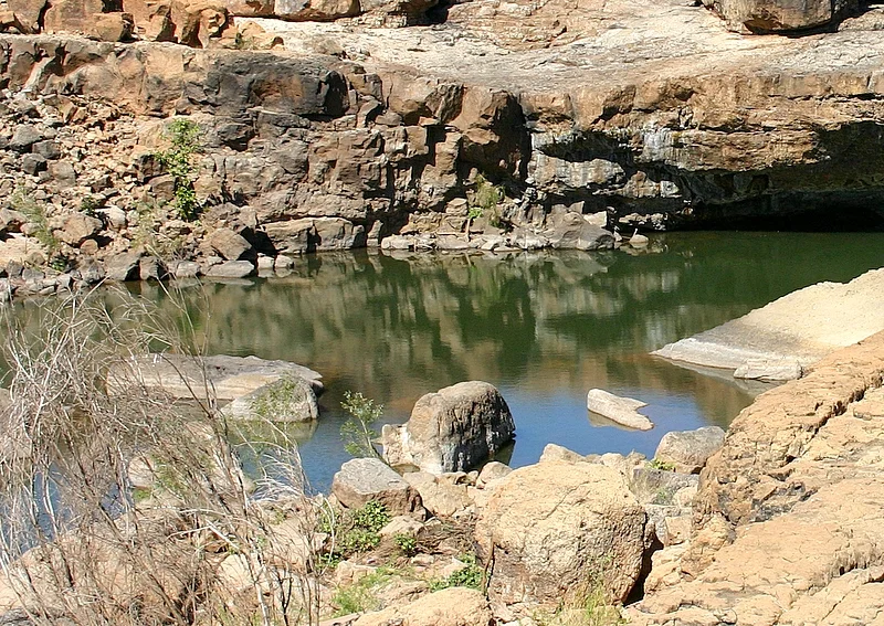
Forget height. Leichhardt Falls earns its reputation by spreading out. Where the Leichhardt River reaches a broad shelf of rock in the Gulf Country of North West Queensland, the water does not drop so much as fan across the stone in steps and braids, hundreds of metres wide. In the wet season it becomes a single roaring sheet the colour of strong tea. By late in the dry, the same shelf is a quiet mosaic of still pools and bare rock, and you can walk out across a riverbed that was a torrent a few months before.
A Waterfall That Breathes With the Seasons
The falls sit about fifty kilometres upstream from where the Leichhardt River empties into the Gulf of Carpentaria, and roughly seventy-seven kilometres from Burketown along the Nardoo-Burketown Road, part of the Savannah Way. They are not a fixed spectacle. The Gulf has two seasons, wet and dry, and the river obeys them completely. From December through March, monsoon rain swells the Leichhardt into a brown flood that pours over the full breadth of the shelf. As the dry season deepens through the middle of the year, the flow shrinks to channels, then to a trickle, then to disconnected pools strung along the rock. To see Leichhardt Falls is to see whichever river the calendar has handed you.
Rock, Pool and Pandanus
Up close, the appeal is the geometry of it: flat sandstone ledges, shallow cascades that step down in tiers, and clear pools caught between them. The setting is classic Gulf savanna — pandanus and paperbarks along the banks, open woodland beyond, an enormous sky. It has become a favourite free camping spot for travellers driving the Savannah Way across the top of the continent, who pull up on the rocky riverbank and walk a couple of hundred metres to the main drop, with more rapids and falls strung along the eastern side. There is a real sweetness to arriving here after hours of flat red road: the sound of water in a country that spends half the year bone dry.
The Man Who Walked to the Setting Sun
Both the river and the falls carry the name of Ludwig Leichhardt, the Prussian-born naturalist and explorer who became one of colonial Australia's great mysteries. In 1844 and 1845 he led an overland expedition of roughly 4,800 kilometres from the Darling Downs to the remote outpost of Port Essington near present-day Darwin, skirting the Gulf of Carpentaria and cataloguing its plants, animals and geology as he went. That journey made his name and pioneered the southern Gulf route that others would follow for decades. His luck did not hold. In 1848 he set out from the Queensland frontier to cross the entire continent from east to west. Asked where he was bound, he is said to have answered simply, "To the setting sun." He and his whole party vanished. No trace was ever confirmed, and the search for what became of him continued, in fits and starts, for more than a century.
A Waypoint on the Savannah Way
Reaching the falls is part of their character. They sit on the Savannah Way, the long unsealed road network that strings across the top of the continent, and for travellers crossing the Gulf they have become a natural place to break the journey. There is no entry gate and no ranger station — just the river, the rock and the bush — and visitors camp on the bank, swim the pools in the cooler months, and listen to the water in a landscape where running water is a seasonal gift. It is worth remembering that this is country shaped by extremes: the same shelf that holds a few quiet pools in October can run brown and full from bank to bank in February, and the roads that bring you here can vanish under floodwater for weeks. Leichhardt Falls rewards those who time their visit to the rhythm of the Gulf rather than the calendar of a holiday.
From the Air
Located at roughly 18.22°S, 139.88°E on the Leichhardt River in flat Gulf savanna. The nearest sealed runway is Burketown Airport (YBKT) about 77 km north-west by road, with 24-hour AVGAS and JET A1; Normanton (YNTN) lies to the north-east. From the air the falls read as a pale braided scar across darker woodland, dramatic and full in the December-March wet, faint and pool-flecked by the August-October dry. Watch for the dry-season clarity that lets you trace the whole stepped shelf at once. Recommended viewing 2,000-3,500 ft. In the wet, sudden storms and flooding can isolate the surrounding roads for weeks.
Nearby Stories
- Augustus Downs Station 16 km away
- Boiling Down Works, Burketown 29 km away
- Flinders River 50 km away
- Lawn Hill crater 66 km away
- Burke and Wills Camp B/CXIX 68 km away
- Little Eva 70 km away
- Century Mine 88 km away
- Millungera Station 206 km away