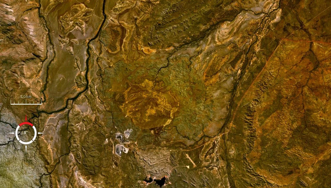

Lawn Hill crater
For a long time, nobody could explain the ring. Eighteen kilometres across, a near-perfect circle of low dolomite hills sits in the outback of north-western Queensland, north of Mount Isa, and for decades geologists argued about how it got there. The answer came in 1987, written in the rocks themselves: shatter cones and shocked quartz, the unmistakable fingerprints of a meteorite impact. Something fell out of the sky here and hit the ground with such violence that it bent and shattered solid stone. Then time buried the wound and slowly carved it back open.
Reading the Fingerprints
Impact structures hide in plain sight. From the ground, the Lawn Hill ring looks like ordinary hill country, and that ambiguity fuelled a long debate about its origin. What settled it was evidence that can only form under the instantaneous, world-bending pressures of a hypervelocity strike. At the centre of the structure, geologists found shatter cones - distinctive fractured rock that radiates outward like the splash from a stone dropped in water - and grains of shocked quartz threaded with microscopic planar deformation lines. No volcano, no earthquake, no slow geological process makes these. Only an impact does. The discovery, reported in 1987, transformed a puzzling circle into one of Australia's confirmed astroblemes, the scarred record of a cosmic collision.
When Australia Lay Underwater
Pinning down the date took longer than confirming the cause. The structure cuts through dolomite of Cambrian age, and early on it was unclear whether the rock was deposited after the crater formed or deformed by the blast itself. More recent argon-isotope dating of impact-melted particles points to the Ordovician period, roughly 472 million years ago. At that time this country was not desert but seabed - the Georgina Basin, a shallow marine basin still actively collecting sediment. The meteorite struck water-saturated dolomite, and the ground it hit was soft, wet and still being laid down.
Preserved by Being Buried
There is an irony at the heart of Lawn Hill: it survives precisely because it was covered up. After the impact, the Georgina Basin kept depositing sediment, sealing the crater under younger layers of rock. Protected from the weather, the shattered structure waited out hundreds of millions of years that would otherwise have erased it. Most impact craters on Earth are ground away by erosion or swallowed by plate tectonics; this one was tucked away and preserved. Erosion has since stripped back the cover and exposed the resistant dolomite ring, which is why the circle stands out today. The original crater may have been slightly wider, around twenty kilometres, before time trimmed its edges.
A Window for Life
A crater is more than a hole. Researchers have studied the Lawn Hill structure as a natural laboratory for how impacts reshape the environments around them - fracturing rock, opening pathways for water, and creating sheltered microenvironments where life can take hold. The inner zone of the structure, roughly eight kilometres across and stripped of its dolomite cap, exposes the deeper rocks that were uplifted from below in the instant of impact. The same broken country that records a moment of destruction also offers a place to ask how violence and biology intersect on a young planet - and on other worlds where craters are the rule rather than the exception.
From the Air
The Lawn Hill crater lies at 18.67 degrees south, 138.63 degrees east, in north-western Queensland about 220 km north-north-west of Mount Isa and just north of the Century Mine. From the air the impact structure reads as a subtle circular ring of low dolomite hills roughly 18 km in diameter, best seen with low-angle morning or evening light that throws the rim into relief; the dramatic gorges of Boodjamulla (Lawn Hill) National Park lie nearby to the west. The region has a tropical semi-arid climate, so the dry season from April to November gives the clearest viewing. The nearest major airport is Mount Isa (ICAO YBMA) to the south-east; Burketown (YBKT) lies to the north toward the Gulf coast.
Nearby Stories
- Riversleigh World Heritage Area 8.5 km away
- Barkly Tableland 17 km away
- Augustus Downs Station 71 km away
- Leichhardt Falls 74 km away
- Burketown Post Office 120 km away
- Tree of Knowledge, Camooweal 133 km away
- Mount Cuthbert Township and Smelter 133 km away
- Wollogorang Station 140 km away