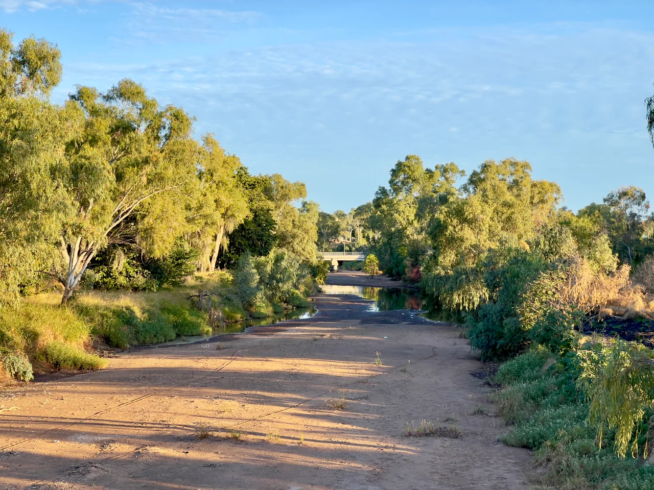

Leichhardt River
The man whose name this river carries got it wrong. In 1845, pushing across the parched Gulf Country toward Port Essington, Ludwig Leichhardt crossed a wide watercourse and decided it was the Albert. He was mistaken. More than a decade later, Augustus Charles Gregory came through the same country on the 1855–56 North Australian Expedition and crossed this same river. Knowing that Leichhardt had once mistaken it for the Albert, Gregory named it in the lost explorer's honour. Leichhardt had already vanished — swallowed by the interior in 1848 — and would never know a river bore his name. So the Leichhardt commemorates a man twice over: once for his error, and once for his absence.
From Rifle Range to the Gulf
The river begins humbly, in the Selwyn Range beneath Rifle Creek Hill, about 25 kilometres south of the mining town of Mount Isa. From there it runs north, crossing the Barkly Highway and threading the Gulf Country in a long, looping arc. It widens through Lake Moondarra and Lake Julius, both held back by dams, then bends east and north again past Augustus Downs Station before spilling into the Gulf of Carpentaria. Its catchment sprawls across nearly 33,000 square kilometres of mining leases and cattle runs. For all that human use, the lower river and its estuary remain in near-pristine condition, the wide brown delta meeting the shallow tropical sea much as it always has.
A River That Disappears
This is an ephemeral river, and that single word explains its character. In the wet season it can run hard and broad, fed by monsoon rains and cyclones spinning off the Gulf. In the dry, the upper reaches retreat into a string of disconnected waterholes, glassy pools strung along a bed of sand and stone where a river used to be. To stand on its banks in October is to stand in a riverbed; to return in February is to find that riverbed under metres of moving water. The land here keeps two faces, and the Leichhardt wears both.
Bones and Burdens
The riverbed holds older stories than any explorer's. Paleontologists working its course have turned up fossil remains, including, in 2011, the skull of an unidentified ancient marsupial that one researcher likened to something left over from Planet of the Apes. The modern river carries heavier burdens too. In 2009 the mining giant Xstrata spent roughly three million dollars on remediation, hauling some 40,000 tonnes of contaminated material out of the riverbed near Mount Isa, where more than a century of hard-rock mining has left its mark on the water that drains the range.
The Explorer Who Walked Into Nothing
Leichhardt's name marks rivers and ranges across northern Australia, yet the man himself remains a mystery. The Prussian naturalist made his reputation on that 1844 to 1845 trek from the Darling Downs to Port Essington, surviving where others perished. But in 1848 he set out to cross the continent from east to west and simply vanished, swallowed by the inland with his entire party. No reliable trace was ever found. Gregory's 1858 search was one of many that failed. When Gregory named the river during his earlier 1855–56 expedition, he honoured a man already passing into legend, a ghost given a permanent address on the map of the Gulf.
From the Air
The Leichhardt River sits at roughly 17.58 degrees south, 139.8 degrees east, where it meets the Gulf of Carpentaria in north-west Queensland. Trace it inland and it leads you southeast toward Mount Isa and the Selwyn Range. From a few thousand feet in the dry season, look for the braided, sandy channel and the chain of waterholes rather than a continuous ribbon of water; after the wet, the delta broadens dramatically. Nearest aerodromes are Burketown (YBKT) to the east and Mount Isa (YBMA) far to the south near the river's source. Skies are clearest May through September; the wet season brings towering cumulus and cyclonic activity off the Gulf.
Nearby Stories
- Little Eva 24 km away
- Leichhardt Falls 35 km away
- Flinders River 35 km away
- Sweers Island 36 km away
- Lawn Hill crater 103 km away
- Old Westmoreland Homestead 109 km away
- Delta Downs Station 120 km away
- Normanton to Croydon Railway Line 146 km away