.jpg)
Old Westmoreland Homestead
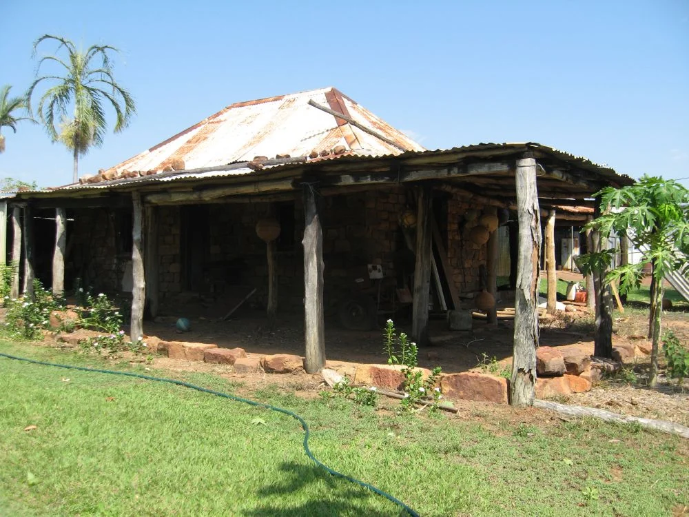
Look at the little stone house and you can read the fear in its walls. They are thick. The doors open inward. The windows are few and small. This is not the design of a home built only for shade and shelter - it is the design of a home built for defence. Constructed around 1882 near the Northern Territory border and close to the Gulf of Carpentaria, Old Westmoreland Homestead survives as one of the oldest buildings in this remote corner of Queensland, and its modest architecture is a frank record of the violence that came with the cattle.
Built Like a Refuge
Westmoreland Station was taken up in 1881 by Thomas and Robert McIntosh, Robert Philp and William Kirk, sprawling across some 640 square miles of Gulf country. Thomas Brassey McIntosh managed the run and built the two-roomed stone house that still stands. He used what the land gave him: hewn sandstone blocks set in mortar made from crushed termite-mound earth, a hipped roof of early corrugated iron lashed to bush-timber rafters with wire twitches, floors of dirt and antbed. It is humble construction - but deliberate. The thick walls, inward-opening doors and scarcity of windows were chosen with conflict in mind, hardening the house against attack while also keeping out the savage Gulf heat.
A Frontier at War
When Westmoreland was settled in the early 1880s, the Gulf was a war zone. This is Gangalidda and Garawa country, and the Aboriginal people who had lived here for many thousands of years did not cede it quietly. Across the district, conflict between the traditional owners and the incoming pastoralists was open and bloody - a guerrilla resistance met with deadly force. The place names still carry it: Massacre Inlet, Battle Creek, and Hells Gate to the south-east, named for the point where police escorts turned back and left travellers to cross into contested country alone. The defensive walls of Westmoreland were not built against an imagined threat. They were built against people fighting to hold their homeland, and the violence ran in both directions, though rarely on equal terms.
A Premier Among the Partners
The men who founded Westmoreland were no minor figures. Robert Philp, one of the original 1881 partners, went on to become Premier of Queensland and was a founder of the great trading house Burns, Philp & Company. Later directors included Sir William Charles Angliss, the Melbourne meat baron, and Walter Sidney Palethorpe Kidman, son of the legendary "Cattle King" Sidney Kidman. Westmoreland was run in concert with other properties - Cliffdale and Patterdale in Queensland, and Wollogorang just across the line in the Northern Territory. The little stone house sat at the centre of a web that reached all the way to the halls of colonial power.
What Drought and Termites Left
The station's fortunes rose and fell hard. Severe drought struck the Gulf in the late 1890s, and in 1897 the Westmoreland lease was forfeited; the run sat empty for about fifteen years. When a new leaseholder took it up in 1912, he found the roof of the stone homestead eaten through by white ants and the kitchen collapsed. The house endured anyway. Today its verandah posts have been replaced where termites took them, its doors swapped, its floor concreted, a newer dwelling built alongside - yet the original two rooms still stand. Listed on the Queensland Heritage Register in 2008, Old Westmoreland is prized as a rare surviving example of vernacular nineteenth-century stone homesteads, and for the antbed mortar, once common across the outback, that almost nowhere else survives.
From the Air
Old Westmoreland Homestead lies at 17.34 degrees south, 138.25 degrees east, in far north-western Queensland near Nicholson, close to the Northern Territory border and the southern shore of the Gulf of Carpentaria. From the air the head station appears as a small cluster of roofs, sheds and yards amid open box, bloodwood and tea-tree forest cut by creek flats and stony ridges; the Nicholson River system threads the surrounding country. The climate is tropical with a pronounced wet season, so the dry months of April to November give the clearest viewing. The nearest airfields are Burketown (ICAO YBKT) to the east and Doomadgee (YDMG) to the north-east; across the border, Borroloola (YBRL) lies to the west.
Nearby Stories
- Little Eva 14 km away
- Burketown Post Office 74 km away
- Bountiful Islands 114 km away
- Lawn Hill crater 125 km away
- Merlin diamond mine 158 km away
- Vanderlin Island 194 km away
- McArthur River 220 km away
- Brunette Downs Station 230 km away