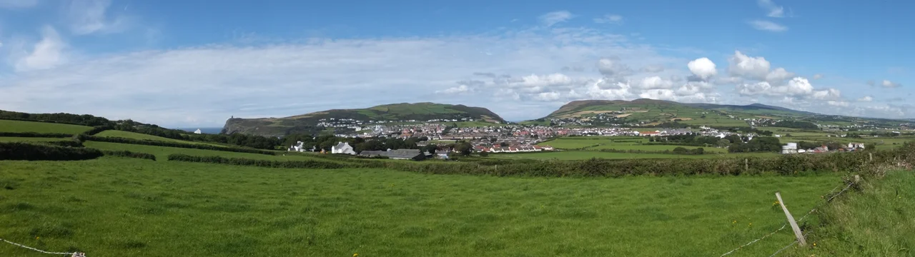

Bradda Head
From above, the tower looks like a key inside a lock. That is deliberate. William Milner made safes for a living - the famous fire-resistant Milner safes of Liverpool, the kind banks bought to hold their reserves - and when he moved to the small Manx fishing village of Port Erin to recover from illness, he became its most generous benefactor. He paid for boats. He fed families through hard winters. When he died, the villagers built him a tower on the cliffs above the bay, in the shape of a key and lock, paid for by private donation. He didn't know they were doing it until it was nearly finished. That tower has stood on Bradda Head since 1871.
The Headland and the View
Bradda Head rises 382 feet above Port Erin Bay at the southwest corner of the Isle of Man. On a clear day, the view from the top of Milner's Tower reaches further than you would expect: south to the Calf of Man and the white-painted bulk of Chicken Rock lighthouse, southwest across the Irish Sea to the Mourne Mountains of Northern Ireland, west toward the east coast of the Republic of Ireland. The headland is reached by Bradda Glen, on the Port Erin to Peel section of Raad ny Foillan - the Way of the Gull, the coastal footpath that loops around the entire island. Walkers come up out of the glen, climb the last steep grass, and find themselves on a clifftop with one of the great views of the British Isles.
William Milner and His Tower
William Milner built fire-resistant safes in Liverpool and grew rich doing it. In the middle of the nineteenth century he came to Port Erin to recuperate from an undisclosed illness, and never quite left. He invested in the village - personally, financially, attentively. He cared particularly for the fishermen, whose livelihoods were precarious, and for the impoverished families who depended on the inshore catch. He was, by all accounts, the kind of philanthropist who did not advertise. When he died, the people he had helped commissioned a memorial - secretly, by private donation - on Bradda Head where he had loved to walk. The result, completed in 1871, was a stone tower in the shape of a key and a lock, with a spiral staircase inside, built from local slate. Milner's Tower. It has stood on the cliffs ever since.
Mining Beneath the Cliffs
Most of Bradda Head's earlier history is industrial. The headland holds rich veins of copper and lead, some of them reaching several hundred fathoms below sea level. Bronze Age miners chipped at the surface deposits. Medieval miners drove shafts in the thirteenth century. By the early 1700s, deep shafts were being excavated horizontally below the waterline, and access to the workings was often by steep slopes or steps carved into the cliff faces. The Captain's house and the pump house clung to the southern rock face, low down where you can still see them from a passing boat. Mining continued until 1904. The Bradda Head Mines are now silent, but their tunnels and shafts persist within the headland, occasionally visited by cavers and dive teams who explore the flooded lower levels.
Caves, Coves and the World's Best Photograph
In 1931, an amateur photographer named C.W. Powell pointed his Kodak camera at Bradda Head and the bay below and took an image that won the Kodak World's Best Photograph prize - and £4,000, an enormous sum at the time. The site has been irresistible to photographers ever since. Erosion and rockfall have created a complex maze of caves and tunnels in the rock beneath the headland, navigable by kayakers, paddleboarders and freedivers when the swell allows. Scallop fishing was a thriving trade off Bradda before the Second World War. An ancient coin hoard was found here in 1848. A small Bronze Age cairn sits on nearby Bradda Hill. The headland is, in short, a layered place - geological, economic, archaeological and aesthetic - all visible from the same single viewpoint on top of Milner's Tower.
Today, on the Cliffs
Walkers, photographers, artists and bird-watchers share the headland now. The cliffs are popular with seabirds: choughs, fulmars, kittiwakes wheeling on the updrafts. Below, in Port Erin Bay, the small Victorian seaside village goes about its summer business - boat trips depart from here in season for the Calf of Man, the wildlife reserve a couple of miles to the south. In May 2023 a privately-owned light aircraft crashed into the cliffside; the lone pilot died, a stark reminder that the headland is closer to busy aviation traffic than its quiet appearance suggests. But mostly Bradda is gentle - a stiff walk up out of the glen, a tower built out of unsolicited affection, and a long view over an old sea.
From the Air
Located at 54.092°N, 4.778°W on the southwest tip of the Isle of Man, overlooking Port Erin Bay. Bradda Head rises 382ft (116m) above sea level - Milner's Tower sits on the summit. Ronaldsway Airport (EGNS) is 12km east. The Calf of Man and Chicken Rock lighthouse are visible 5km to the south. On clear days the Mourne Mountains of Northern Ireland are visible 80km west across the Irish Sea. Caution: light aviation has experienced terrain conflicts here - the cliffs rise sharply from the water. Best photographed at low cruising altitude (1,500-3,000 ft AGL) approaching from the west over the sea.
Nearby Stories
- RAF Jurby Head 14 km away
- German submarine U-246 16 km away
- German submarine U-1051 17 km away
- Kilclief Castle 18 km away
- Ardglass 31 km away
- St Bees Lighthouse 44 km away
- Trwyn Du Lighthouse 54 km away
- Seascale Lifeboat Station 61 km away