.JPG)
Ardglass
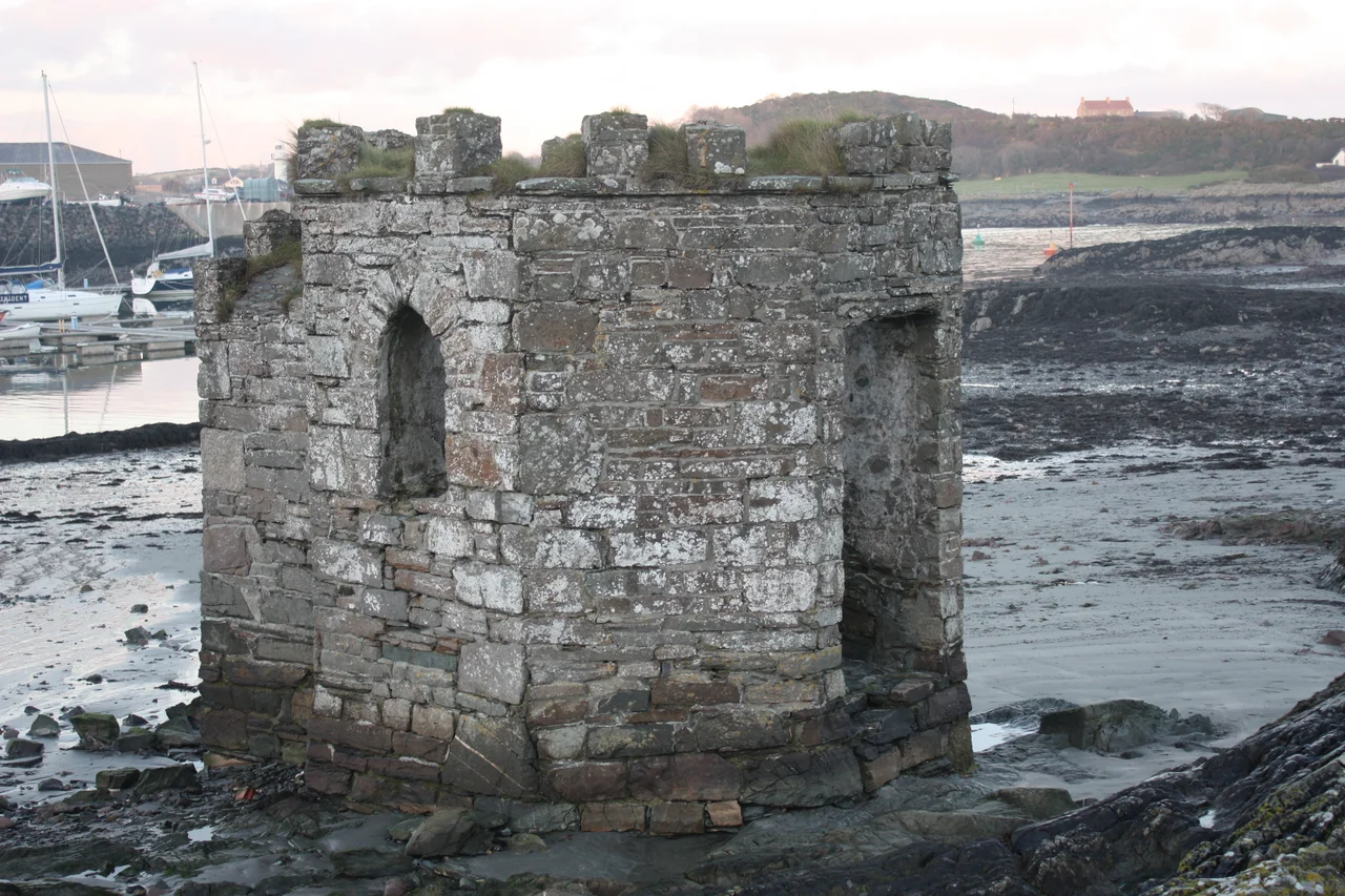
Four stone towers crowd a single small harbour, more medieval tower houses than any other town in Ireland can claim. In the fifteenth century, Ardglass was Ulster's busiest port, and the towers are what the merchants left behind. Jordan's Castle still glowers above Quay Street. King's Castle keeps its watch from the rise. Cowd Castle sits closer to the water. The fourth, now a golf clubhouse, hides its origins behind whitewashed walls. They stand like a frozen council of merchants who once feared what the sea might bring.
The Port That Outlasted Its Heyday
Ardglass has been a fishing port for more than two thousand years. The natural inlet here, accessible at every state of the tide, gave the Anglo-Norman traders of the late Middle Ages a working harbour while better-placed rivals dried out twice a day. By the 1400s the grain trade had made Ardglass rich enough that its merchants ringed their warehouses with stone towers, the most extensive network of medieval warehouses to survive in Ireland. Then the focus of Ulster trade shifted, and Ardglass slept for three hundred years. No real harbour works went up until after 1812, when William Ogilvie bought the estate and rebuilt the pier. Today the port is quieter than its medieval peak, but the boats still come in. Up to five million pounds passes through the herring, prawn and whitefish trade each year.
Captain Hughes and the Storm
On 27 November 1838, a great storm tore the new lighthouse off the end of the Ardglass pier and dropped it into the sea. The harbour master who inherited that broken pier in 1845 was Captain Bernard Hughes, a man who would spend the next thirteen years trying to make Ardglass into something it would never quite become. When Brunel's SS Great Britain ran aground in Dundrum Bay in 1846, Hughes helped with the salvage. The experience convinced him that the northeast Irish coast needed a Harbour of Refuge, and Ardglass should be it. He wrote to the Admiralty. He wrote to the press. He invented and patented a new method of building sea walls without mortar, so that the stones could shift under wave action without breaking. The Admiralty never gave him his harbour. But the Hughes family went on to produce two generals, a vice-commodore of Elder Dempster, the staff captain of the RMS Mauretania, and an Air Marshal who commanded RAF Transport Command. Not bad, for a harbour master who never quite won his argument.
Castles, Follies and Fishbones
Francis Joseph Bigger, the Belfast solicitor and Irish nationalist, bought Jordan's Castle in 1911 and rechristened it Castle Sean. He restored its battered tower as a meeting place for the Celtic Revival, hosting figures like the historian Alice Stopford Green among its medieval stones, and eventually bequeathed it to the state. A short walk away, on a hill above the village, sits Isabella's Tower, a folly built around 1830 by Aubrey de Vere Beauclerc as a gazebo where his invalid daughter could sit and watch the sea. Up the coast at Ardtole, the roofless fifteenth-century church still stands on its hilltop, the Isle of Man on a clear day visible across the Irish Sea. None of these were grand aristocratic projects. Tower houses, in the Irish countryside, were the architecture of lesser lords and gentry, of merchants who could afford stone but not splendour. Ardglass is the shape that money took here, before the trade moved on.
Phennick Cove
The marina at Ardglass goes by an older name too, Phennick Cove, and on a quiet summer evening with the prawn boats tied up at the South Pier it is easy to forget the harbour was ever anything else. Eight archaeological sites lie within the village, two more nearby. The 1996 conservation area was drawn around the early-nineteenth-century street pattern that William Ogilvie laid out, but the medieval bones show through everywhere, in the angle of a wall, in the squared stones of a doorway. The disused railway station, where the Belfast and County Down line ended its run from 1892 until the closures of 1950, is one more layer over the older ones. Ardglass keeps adding pages without throwing the old ones away.
From the Air
Ardglass sits at 54.253°N, 5.601°W on the eastern tip of the Lecale peninsula, six miles southeast of Downpatrick on the Irish Sea coast. From cruising altitude the small harbour and four medieval tower houses are visible as dark stone against the village; Strangford Lough lies six miles to the north. Recommended viewing altitude 2,000–4,000 feet for the tower-house silhouettes against the water. Nearest airports: Newtownards (EGAD) 22 nm north, Belfast City (EGAC) 25 nm north-northwest, Belfast International (EGAA) 35 nm northwest. Watch for sea breeze across the Irish Sea and frequent low cloud off the Mournes to the south-southwest.
Nearby Stories
- Lisburn 4.8 km away
- Ballywalter 5.9 km away
- Pasages (steam trawler) 10 km away
- Silent Valley Reservoir 11 km away
- St Patrick's Isle 14 km away
- Castlebellingham 28 km away
- German submarine U-246 33 km away
- German submarine U-1051 35 km away