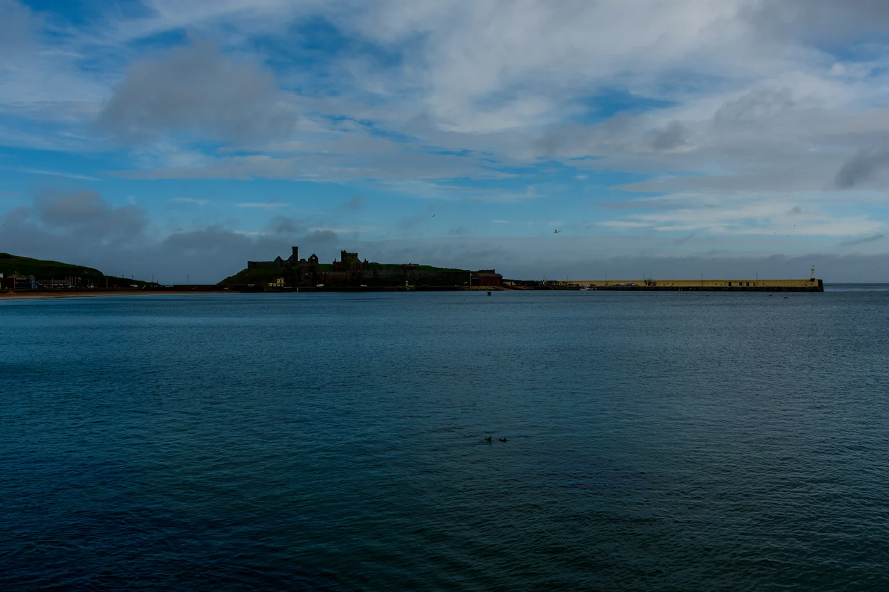

St Patrick's Isle
From the air it looks like punctuation - a small comma of red sandstone set just off the coast at Peel, joined to the mainland by a causeway barely wider than the road. The whole islet is enclosed in fortress walls that run right to the cliff edge, and inside those walls sit ruins that step back through time at almost geological speed. A ruined cathedral whose roof finally gave up in the eighteenth century. An Irish-style round tower of the sort more often found on the other side of the sea. Earlier still, the footings of a small Celtic church. And beneath all of it, the postholes and middens of permanent habitation reaching back into the Late Bronze Age. St Patrick's Isle has been continuously meaningful to whoever lived on this coast for nearly three thousand years.
Where Patrick Set Foot
The tradition is that this is the spot where St Patrick first stepped onto the Isle of Man, in 444, while returning from Liverpool to Ireland. Whether or not the story can be verified, the dedication is old enough that the Manx language preserved it: the island was originally called Inis or Ynnys Patraic - Patrick's island. Having established Christianity here, tradition says, Patrick appointed St Germanus of Man as the first bishop, charged with building the church across the island. The Celtic round tower on the site is the kind of structure found at major monastic centres across Ireland - tall, narrow, with a high doorway that could be pulled up against attackers. Its presence on a small Manx islet says something about how seriously this place was taken in the first millennium. Whether or not Patrick actually came ashore here, generations of pilgrims believed he had, and the believing shaped a thousand years of building.
Cathedral of a Sea Bishopric
The most striking ruin on the islet is the roofless shell of St Germanus's Cathedral, which served as the headquarters of the Diocese of the Isles before the Protestant Reformation. The map of that diocese looks improbable on a modern atlas. From a tiny Manx tidal island, the bishop's authority stretched across the Outer Hebrides and most of the Inner Hebrides - Iona, Skye, Raasay, Canna, Eigg, Coll, Tiree, Mull, Colonsay, Islay, Jura, Gigha - and reached the Isle of Bute and the Isle of Arran. Galloway may once have fallen within it too, which is one explanation for the strange story of Wimund, the twelfth-century bishop-turned-pirate who claimed lands in that direction and was eventually blinded and mutilated by Cumbrian locals who had grown tired of his raids. The cathedral here at Peel was the administrative centre for a maritime church organised by Viking sea routes rather than by modern coastlines. When it was left to decay in the eighteenth century, no one rebuilt it. The Diocese of the Isles had long since splintered, and the cathedral was already a memorial to a vanished political geography.
Fortress, Sanctuary, Sealife Reserve
The Lords of Mann eventually built a residence within the walls, and Peel Castle in its final form is more a fortification than a cathedral compound - the steep, rocky edges of the islet always favoured defence. Walk the perimeter today on the public path that runs around the outside of the castle walls and you stand a few metres above the Irish Sea, with gulls below you and the ruined cathedral roofless above. The causeway that connects the islet to the town of Peel runs across Fenella Beach, named after the character in Sir Walter Scott's 1823 novel Peveril of the Peak, in which a young woman of the Isle of Man features as a central figure. The fictional connection is now physically inscribed on the landscape. Beyond the historic ruins, part of the island and the surrounding waters are managed as a sealife sanctuary - so the same place that once organised a North Atlantic bishopric now offers refuge to seabirds and to the marine life of the Manx coast. Bronze Age, Celtic, Norse, medieval, modern conservation. The strata are still here. They are just no longer roofed.
From the Air
Coordinates 54.2258 N, 4.7017 W on the west coast of the Isle of Man. St Patrick's Isle is a small tidal island connected to Peel by a short causeway over Fenella Beach. Peel Castle's red sandstone walls follow the islet's shoreline almost continuously and are the most distinctive landmark on this stretch of coast - visible from substantial altitude. Ronaldsway Airport (EGNS) lies about 13 nautical miles southeast. Recommended viewing altitude 1,500-3,000 ft AGL. Sea fog can roll in from the Irish Sea quickly; the islet is most photogenic in late afternoon when low sun warms the sandstone.
Nearby Stories
- Ballywalter 14 km away
- Pasages (steam trawler) 15 km away
- SS Georgetown Victory 19 km away
- Celtic Array 31 km away
- Raeberry Castle 34 km away
- German submarine U-1051 36 km away
- St Bees Lifeboat Station 49 km away
- PS Rothsay Castle 73 km away