The River That Spirals Through Empires
Most rivers run in lines, more or less. The Brantas spirals. From its source on the slopes of volcanic Mount Arjuno in East Java, the river begins heading southeast, then gradually curves south, then southwest, then west, then north, and finally swings eastward before splitting into two channels and emptying into the Madura Strait. Traced on a map, its 320-kilometer course draws something close to a full circle around the volcanic highlands of East Java. Within that circle lies the heartland of Javanese civilization: the sites of ancient kingdoms, the ruins of temple complexes, and a dozen modern cities that still depend on the river that connects them.
Born from Fire
The Brantas drains more than 11,000 square kilometers of some of the most volcanically active terrain on Earth. Its watershed collects water from the southern slopes of Mount Kawi, Mount Kelud, and Mount Butak, from Mount Wilis to the west, and from the northern flanks of Mount Welirang, Mount Liman, and Mount Anjasmoro. These volcanoes are not dormant curiosities. Mount Kelud erupted catastrophically in 1919, killing more than 5,000 people, and erupted again in 2014, sending ash plumes across Java. The relationship between the Brantas and its volcanoes is paradoxical: the same eruptions that periodically bury riverside communities in mud and debris also replenish the soil with mineral-rich volcanic ash, making the river's floodplain some of the most fertile agricultural land in Indonesia.
A Kingdom's Refuge
Around 929 AD, King Mpu Sindok made a decision that would reshape Javanese history. He abandoned the Mataram kingdom in Central Java and moved his court to a new location along the Brantas River, near what is now the Jombang Regency. The reasons remain debated by historians, but one compelling theory points to the eruptions of Mount Merapi, which may have made the Central Javanese heartland uninhabitable. Whatever drove the migration, the Brantas valley proved hospitable. The river provided water for rice cultivation, transportation corridors for trade, and a natural defensive perimeter sheltered by volcanic peaks. Over the following centuries, the kingdoms of Kediri, Singhasari, and eventually the Majapahit Empire all established their capitals along the Brantas or its tributaries, making this one river system the geographic spine of medieval Javanese power.
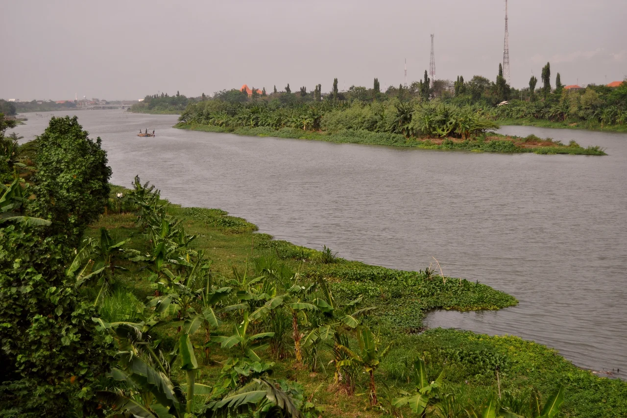
Cities on the Current
Today the Brantas threads through more than a dozen cities and regencies in a chain that reads like a gazetteer of East Java: Batu, Malang, Blitar, Tulungagung, Kediri, Nganjuk, Jombang, Mojokerto. Each city has its own relationship with the river. In Kediri, the Brantas runs shallow and wide, its exposed banks a familiar backdrop to daily life. In Malang, the river passes through highland terrain where cooler temperatures once attracted Dutch colonial planters. Near Mojokerto, the Brantas flows past the archaeological ruins of Trowulan, the Majapahit capital, where its periodic floods have buried centuries of artifacts under meters of mud. At its terminus, the river splits into two: the Kalimas, which runs through Surabaya, and the Porong River to the south, each carrying a share of the volcanic sediment downstream to the sea.
Monsoon Rhythms
Life along the Brantas is governed by the tropical monsoon. The wet season, which peaks in March with an average of 496 millimeters of rainfall, fills the river to capacity and charges the rice paddies that line its banks. By August, the driest month, rainfall drops to just 28 millimeters, and the river shrinks to expose its stony bed. Annual temperatures hover around 26 degrees Celsius, climbing to 30 in October and dipping to 24 in June. These rhythms have dictated planting and harvest cycles for centuries. The river's water management is now supplemented by modern infrastructure, but the fundamental pattern persists: abundance and scarcity alternating with the seasons, just as they did when Mpu Sindok first established his court along these banks more than a thousand years ago.
Painted by a Stranger's Eye
In the 1860s, the Dutch painter Abraham Salm produced a lithograph of the Brantas that captured the river as European colonists experienced it: a broad tropical waterway framed by dense vegetation and volcanic peaks, romantic and slightly wild. Early 20th-century photographs show a different Brantas, its banks more settled, the surrounding forest giving way to plantations and paddies. Today satellite imagery reveals the river's extraordinary spiral course in a way no ground-level observer could fully appreciate. From the air, the Brantas is unmistakable, its winding silver path cutting through the green patchwork of East Java's rice country, tracing the same improbable loop it has followed since long before any kingdom claimed its shores.
From the Air
The Brantas River is located at approximately 7.46S, 112.43E where it approaches its delta near the coast. The river's 320 km spiral course through East Java is a striking feature visible from altitude, threading through the cities of Malang, Blitar, Kediri, Jombang, and Mojokerto. The river splits into the Kalimas (running through Surabaya) and Porong River near the coast. Nearest major airport is Juanda International Airport (WARR) in Surabaya. The volcanic peaks of Mount Kelud, Mount Kawi, and Mount Welirang that define the watershed are visible to the south and west. Best appreciated from higher altitudes (10,000+ feet) where the spiral course becomes apparent against the green floodplain.
Nearby Stories
- Surawana: The Temple That Reads Like a Compass 12 km away
- Cepu Forest Railway 24 km away
- The High Language of the Tengger Mountains 24 km away
- Battle of Gegodog 34 km away
- The Train Builders of Madiun 34 km away
- The School That Gave Itself Away 39 km away
- The Dam That Drew Blood 47 km away
- Cemoro Lawang 52 km away