Cemoro Lawang
The alarm goes off at 3 a.m. Nobody complains. In Cemoro Lawang, waking in the dark is the entire point. This hamlet of guesthouses and warung stalls sits at 2,217 meters on the northeastern rim of the Tengger Caldera, and its sole purpose -- its economic engine, its reason for appearing on any map at all -- is to deliver visitors to the edge of an active volcano before the sun comes up. By 4 a.m., headlamps bob along the trail that drops from the crater rim into the sand sea below. By 5:30, hundreds of people stand on the flanks of Mount Bromo or the viewpoint at Mount Pananjakan, waiting for the moment when first light hits the volcanic complex and the caldera fills with color. Then they go back to bed. Cemoro Lawang is a village built around a single hour of the day.
On the Edge
Cemoro Lawang belongs administratively to Ngadisari Village in the Sukapura district of Probolinggo Regency, but those bureaucratic layers feel abstract when you are standing at the caldera rim. The hamlet clings to a narrow strip of land where the road from Probolinggo simply runs out of mountain. Below, the Tengger Sand Sea spreads like a grey lunar plain, and the volcanic cones of Bromo, Batok, and their neighbors rise from its surface. The viewpoint at the edge of the village offers an unobstructed panorama of the entire Tengger volcanic complex -- Mount Bromo smoking to the southwest, the tree-covered flanks of Mount Batok beside it, and on clear mornings, the massive silhouette of Mount Semeru, Java's highest peak at 3,676 meters, looming behind them all. Most visitors arrive from Surabaya, a three-hour drive to the northwest, though some come overland from Bali. Either way, the last stretch of road climbs steeply through sub-alpine forest before emerging at the crater's lip.
Cold Mornings, Thin Air
The climate at Cemoro Lawang defies equatorial expectations. Sitting just eight degrees south of the equator but more than two kilometers above sea level, the hamlet experiences a subtropical highland climate classified as Cwb under the Koppen system. The wet season runs from December through March, bringing lukewarm temperatures and substantial rainfall -- the area averages 1,924 millimeters annually. But it is the dry season, from June through September, that defines the character of the place. Mornings routinely bring single-digit Celsius temperatures. Frost forms on exposed surfaces before dawn. The average annual temperature is 13.2 degrees Celsius, cooler than many European cities. Visitors arriving from the tropical lowlands of Java discover that they need the jacket they almost left behind. The thin air at this altitude adds to the sensation of having traveled much farther than three hours from Surabaya's sweltering streets.
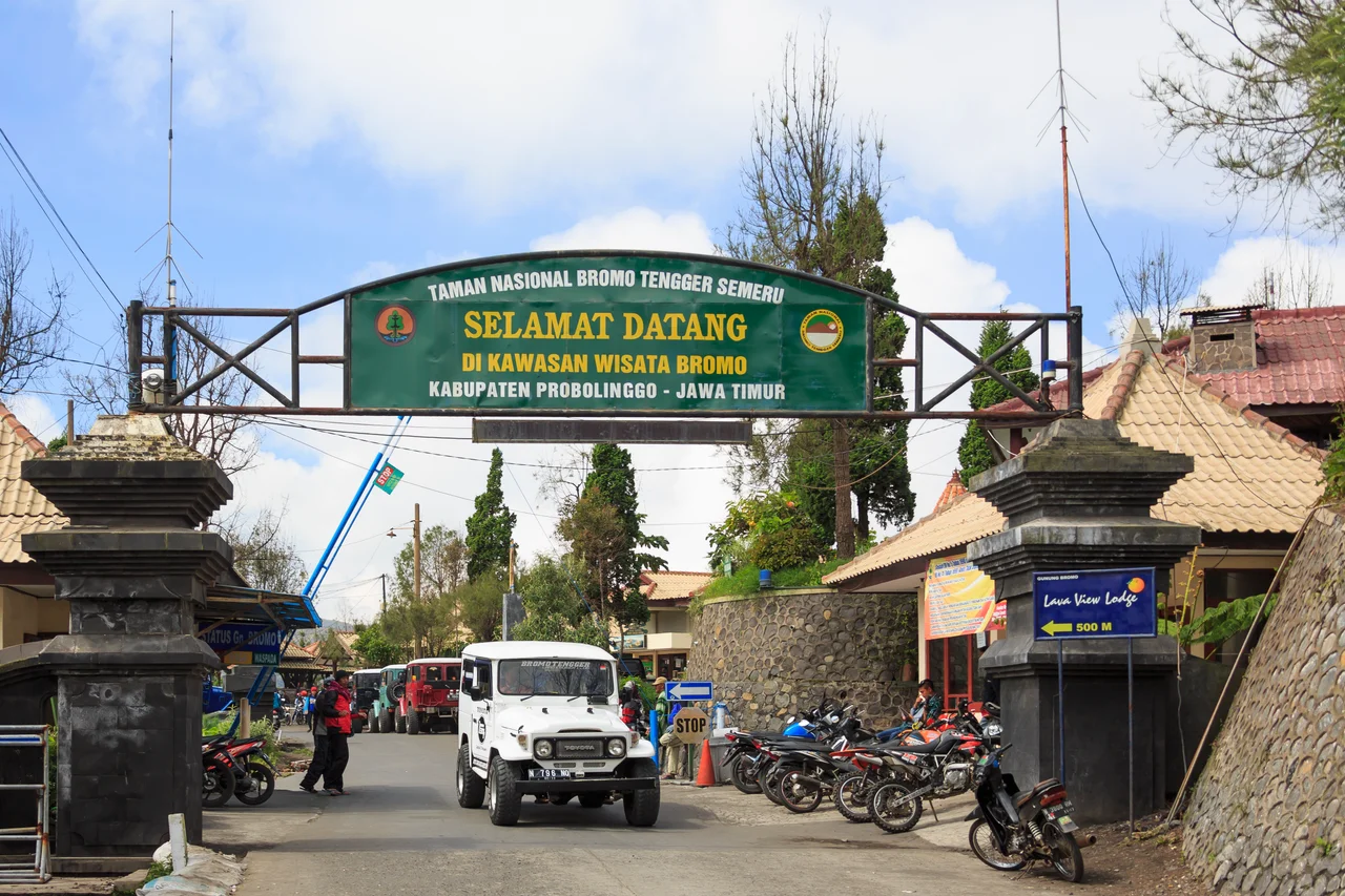
The Tengger Gateway
Cemoro Lawang is one of several access points to the Tengger Caldera, but it has become the most popular for a simple reason: proximity. From the hamlet, the trail descends directly into the sand sea, and from there it is a relatively straightforward walk or horseback ride to the base of Mount Bromo. The volcano's crater is reached by climbing a concrete staircase up the ash-covered slope -- a surreal experience, ascending into sulfurous fog while the sand sea stretches behind you in every direction. The hamlet itself consists of a few dozen structures: guesthouses ranging from basic to moderately comfortable, small restaurants serving nasi goreng and hot drinks against the chill, and the national park gatehouse that marks the official entrance to Bromo Tengger Semeru National Park. There is no town center in any conventional sense. The buildings line the road and face the caldera, as though the entire settlement is oriented toward the view rather than toward itself.
Between Two Worlds
What makes Cemoro Lawang more than a trailhead is its position between worlds -- between lowland Java and the volcanic highlands, between the modern tourism economy and the ancient Tengger culture that predates it. The Tengger people, descendants of the Majapahit empire, have lived in these mountains for centuries, maintaining Hindu traditions on an island that long ago became predominantly Muslim. Their villages dot the slopes around the caldera, and Cemoro Lawang sits at the intersection of their homeland and the stream of visitors who pass through it. During the annual Yadnya Kasada ceremony, Tengger villagers climb Bromo to throw offerings into the active crater. Tourists watch. The Tengger pray. The volcano smokes on, indifferent to both. After the dawn spectacle, Cemoro Lawang goes quiet. The guesthouses empty. Motorbikes descend toward Probolinggo. The hamlet returns to its default state: a small cluster of buildings on a high rim, waiting for the next sunrise.
From the Air
Located at 7.92S, 112.96E on the northeastern rim of the Tengger Caldera in East Java. From the air, look for the small cluster of buildings perched on the caldera wall, where the road from Probolinggo terminates at the crater edge. The Tengger Sand Sea and volcanic cones are immediately to the southwest. The hamlet sits at 2,217 meters elevation. Mount Semeru (3,676 m) dominates the skyline to the south. Abdul Rachman Saleh Airport (WARA) near Malang is approximately 55 km to the southwest. Juanda International Airport (WARR) in Surabaya is about 100 km northwest. Best viewed during morning hours when the caldera is often clear before afternoon clouds build.
Nearby Stories
- Kelud: The Mountain That Swallows Its Own Lake 23 km away
- Where an Empire's Memory Lives in Clay and Stone 23 km away
- Bangil Railway Station 31 km away
- Meru Betiri: The Last Forest on Java's Southern Edge 35 km away
- Shaken Foundations: The 2021 East Java Earthquake 65 km away
- Blue Fire and Bitter Water: Ijen Volcano 76 km away
- Where Three Worlds Meet: The Great Mosque of Sumenep 88 km away
- The Ghost Boat That Built an Empire 400 km away