
Breadalbane Hydro-Electric Scheme
Sixty miles of tunnels run beneath these hills. Nothing on the surface tells you they are there. Walk the lanes around Loch Tay or Loch Earn and you see what visitors always see: water, heather, stone-built villages, the soft outline of Ben Lawers in the distance. The drama is underground. In the late 1940s and 1950s, an engineer named Edward MacColl and his crews carved a hidden hydraulic city out of the Perthshire bedrock, linking three of the great Highland lochs through pipelines, surge towers, and shafts. Seven power stations were the visible result. The invisible result was a postwar promise made flesh: cheap electricity for crofters, profits to lift the Highlands out of decades of neglect, and an engineering scheme so ambitious it briefly held a world tunnelling record. The Breadalbane Scheme generates 120 megawatts. The story of how it got built is one of the most quietly remarkable construction projects in Scottish history.
Tom Johnston's Vision
The scheme exists because of a politician who refused to accept that the Highlands had to stay poor. Tom Johnston was Secretary of State for Scotland during the war, and in 1943 he pushed through the Hydro-electric Development (Scotland) Act, creating the North of Scotland Hydro-Electric Board. The deal was unusual. Profits from selling bulk electricity to the Scottish lowlands would fund the economic development and social improvement of the north. Private consumers in remote glens would be hooked up to the grid at the same price as city dwellers, regardless of the actual cost of stringing a line across a moor to a single farmhouse. The first chairman was Lord Airlie, who thought the 1943 Act did not go far enough. The deputy chairman and chief executive, Edward MacColl, was an engineer who clearly intended to move fast. Within three months of taking the job, he produced a list of 102 potential sites. The Breadalbane scheme was numbered 25 in the construction queue.
Lawers Dam and the Longest Drop
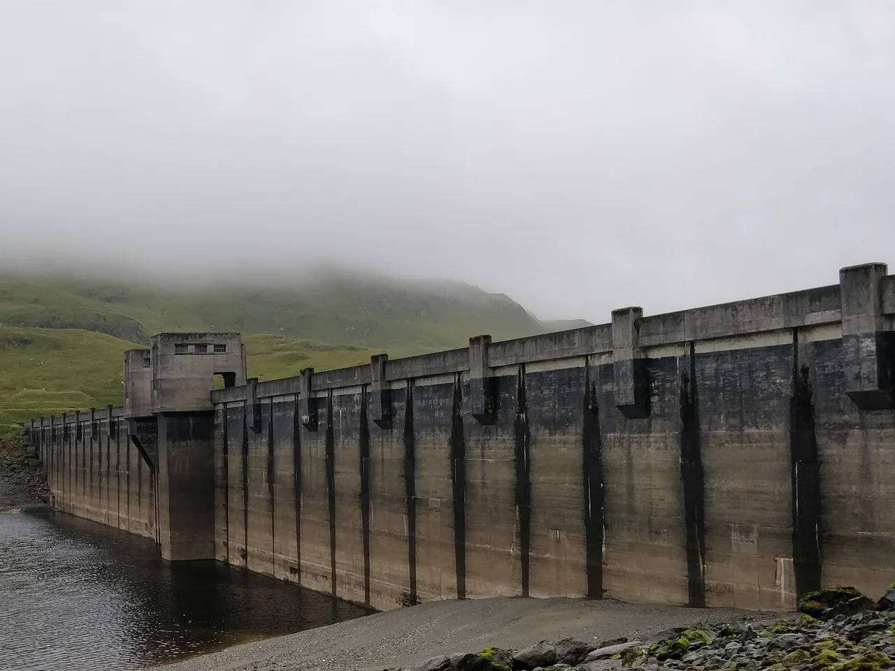
Construction began in autumn 1951. The first piece was Lawers Dam at the south-eastern end of Lochan na Lairige, a small loch whose water level was raised by 90 feet to create a reservoir holding 460 million cubic feet of water. The dam itself is 1,129 feet long and 138 feet tall at its highest point, built in the massive buttress style pioneered at Loch Sloy. What makes Lawers extraordinary is not its size but its drop. Water released from the dam descends a vertical distance of 1,362 feet down through tunnel and pipeline before it reaches Finlarig power station on the shore of Loch Tay. For more than fifty years that was the highest hydraulic head of any hydro scheme in Scotland, unmatched until the Glendoe Hydro Scheme exceeded it in 2009. Finlarig contains a single 30-megawatt Pelton turbine, still the largest Pelton in Britain. The station was commissioned in 1955, four years after the first concrete was poured.
The St Fillans Section
South of Loch Tay, in the catchment that feeds Loch Earn, a separate cluster of stations was built. Lednock and St Fillans took water from new reservoirs at Lochan Breaclaich and Loch Lednock. The Lednock dam is one of only two diamond-headed buttress dams in Scotland, the other being at Errochty. Because it sits close to the Highland Boundary Fault, it was specifically designed to cope with earthquakes. St Fillans power station is unusual too: it is the only one of the seven built underground, hidden in the rock with a gross head of 830 feet and a 21-megawatt output. Its water discharges into Loch Earn itself, which then feeds the River Earn eastward toward the Forth. A small weir just below the loch outlet diverts some of that flow into Dalchonzie power station, a modest 4-megawatt installation commissioned in 1958. Three power stations on a single river system, each making use of every available foot of fall.
Sixty Miles of Tunnel
The tunnels are the part nobody sees. In total, the scheme involved roughly sixty miles of bored passage, carrying water from one catchment to another. The North of Scotland Hydro-Electric Board ran something close to a tunnelling school, training crews and refining drilling techniques. In October 1955, a collecting tunnel in the St Fillans section advanced 557 feet in seven days, a claimed world record. Other days were less kind. The Lochay tunnellers hit a water-bearing fault, and 50,000 gallons an hour flooded into the workings, drowning 5,000 feet of tunnel. The fix was almost workmanlike: pump out the water, line a diversion with cast-iron segments, carry on. The tunnel from Stronuich to Lochay alone is 4.73 miles long and 13 feet in diameter. The board kept finding ways to economize. Fly ash replaced cement in the dams at Lednock, Lubreoch, and Giorra, making the concrete slower to harden but less permeable in the long run. Massive buttress dams turned out to be about thirty percent cheaper than solid gravity dams. Most of the scheme was complete by late 1959. Lednock, held up by problems on the Breaclaich section, finally came online in March 1961.
From the Air
The Breadalbane Scheme spreads across roughly 56.48°N, 4.30°W in highland Perthshire, with major dams at Lawers, Breaclaich, Lednock, and Lubreoch, and power stations at Finlarig, Lochay, Lednock, St Fillans, and Dalchonzie. From the air, look for the long thin reflection of Loch Tay running northeast-southwest, with Killin at its western head and Loch Earn parallel to the south. The reservoirs sit at higher elevations in the surrounding hills. Nearest airports: Glasgow (EGPF) approximately 55 nm south-southwest, Edinburgh (EGPH) approximately 55 nm southeast. Recommended viewing altitude 5,000-7,000 ft AGL for a clear view of the entire catchment. The Highland Boundary Fault crosses south of Lednock, marking the geological transition between Highlands and Lowlands. Strong terrain-induced turbulence is common over the surrounding Munros in unsettled weather.
Nearby Stories
- Loch Achray 2.6 km away
- Ben Nevis 5.4 km away
- Ben Alder 5.9 km away
- Inveraray Castle 9.5 km away
- Kilchurn Castle 14 km away
- Massacre of Monzievaird 14 km away
- Battle of Dollar 16 km away