
Breaks Interstate Park
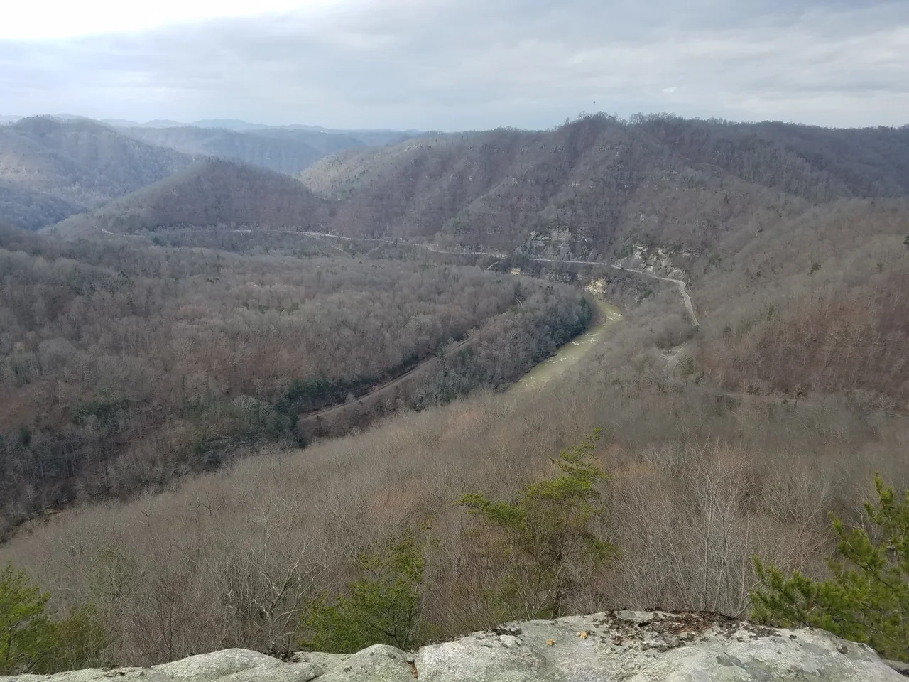
Daniel Boone passed through this notch in Pine Mountain in 1767, hunting for a way west, and the name he gave it stuck. The Breaks. A frontiersman's shorthand for a gap in a wall - and Pine Mountain, stretching unbroken for more than a hundred miles along the Kentucky-Virginia border, is very much a wall. Here, where the Russell Fork has spent something like a hundred and eighty million years cutting through sandstone, the ridge finally yields. The river falls into a five-mile gorge that drops more than eight hundred feet to the water, and the locals, with some justification, call it the Grand Canyon of the South.
The Notch Boone Named
The gorge sits at the northeastern terminus of Pine Mountain, straddling Dickenson County, Virginia and Pike County, Kentucky. Long before Boone arrived, Shawnee and Cherokee hunting parties knew these ridges - the gorge was a landmark, a hunting ground, and a barrier all at once. Boone, working westward through a country that did not want to be crossed, noticed where the mountain broke and remembered. He moved on toward the Cumberland Gap and history, but the name he scribbled into his account stayed. Two centuries later, Virginia and Kentucky agreed to manage the canyon together - one of only two bi-state parks in the country operated under a single interstate compact rather than as parallel state units. Daniel Boone would have approved of the cooperation. He spent a lifetime crossing borders that other people insisted were real.
What the River Carved
The Russell Fork is not, by any reasonable measure, a large river. But time is a tool with infinite patience. The sandstone here was laid down when an inland sea covered Appalachia, sediment compacting into rock under its own weight. When the sea retreated and the Appalachians rose, the Russell Fork found a line and began to work. Drop by drop, flood by flood, it cut. The canyon runs five miles long and ranges from 830 feet deep at its shallowest to well over a thousand at the rim. White-water rafters who run the gorge in autumn, when water is released from the upstream reservoir, encounter Class V rapids - the river's old work meeting the river's current work. Climbers who scale the sandstone walls find the same texture that draws them to the New River Gorge in West Virginia.
The Elk Returned
In 2023, an elk wandered onto park land for the first time since the 1800s. Eastern elk - the subspecies that once roamed Appalachia in herds large enough to alter the landscape - went extinct in the nineteenth century, hunted and crowded out as settlement filled the valleys. Kentucky began reintroducing Rocky Mountain elk in the late 1990s, releasing animals onto reclaimed mine land further west. The herd grew, then it moved. By 2023, scouts had reached the Breaks. The park now runs seasonal bus tours into elk viewing areas, and on the right autumn morning, a visitor can hear something the gorge has not heard in a hundred and fifty years: a bull elk bugling across the sandstone walls.
Above the Rim
The park covers 4,500 acres of rim, ridge, and canyon. A lodge perches on the Virginia side with overlooks that drop straight into the gorge. Hiking trails wind along the edge, threading through hemlock and rhododendron and pulling up short at sudden views of the river half a mile below. Down by Laurel Lake, paddle boats and canoes share quieter water with the park's distinctly Appalachian invention - the hydro bike, half bicycle and half pontoon. CSX freight trains rumble through the gorge along the old Clinchfield Railroad alignment, the same route engineers cut along the river bottom a century ago because the river had already done the hardest work.
Why the Name Stuck
Most places Boone named have been renamed since, by people more comfortable with maps than with the country itself. The Breaks survived. Perhaps because no better word was offered. Perhaps because the gorge, when you stand on the rim, really does feel like the place where the mountain finally gives way - a break in a wall that has held everything else back. The Russell Fork keeps cutting. The elk are returning. The trains still run. And the canyon, two and a half centuries after a frontiersman gave it a name, is still doing what it has always done: getting deeper.
From the Air
Breaks Interstate Park sits at 37.30 degrees north, 82.30 degrees west, straddling the Kentucky-Virginia border at the northeastern terminus of Pine Mountain. Best viewed from 3,500-5,000 feet AGL, the five-mile gorge of the Russell Fork is dramatic, especially in late autumn when foliage exposes the sandstone walls. The nearest airport for general aviation is Pike County Airport (KPBX) to the west; KTRI (Tri-Cities) is the nearest commercial field. Watch for orographic turbulence over Pine Mountain on windy days.
Nearby Stories
- Wise County, Virginia 21 km away
- War, West Virginia 21 km away
- Aracoma Alma Mine accident 23 km away
- Battle of Matewan 24 km away
- Emory and Henry University 36 km away
- Cumberland Gap 83 km away
- The Kentucky Meat Shower: When Flesh Fell From a Clear Sky 89 km away
- Battle of Blue Licks 150 km away