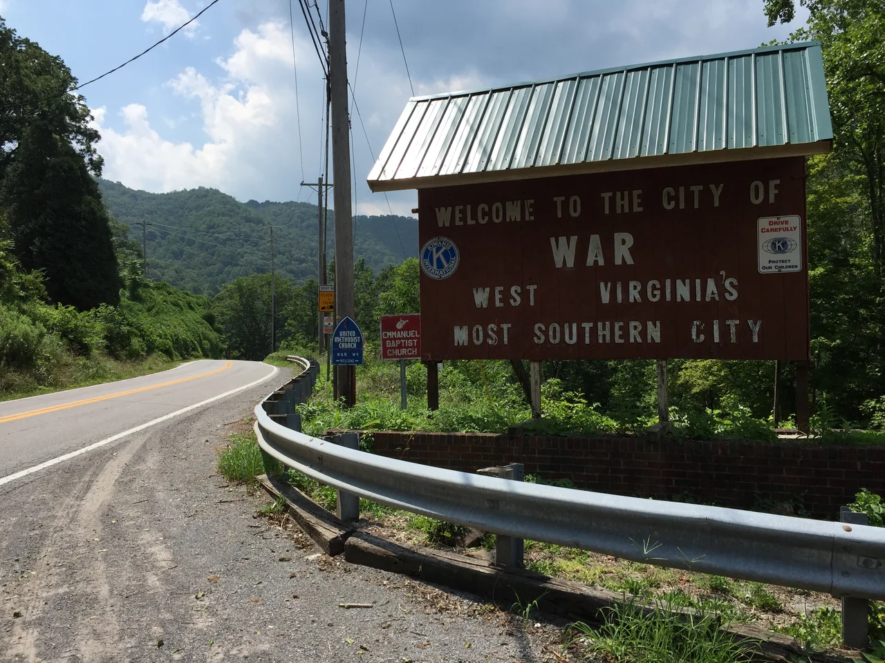
_at_Excelsior_A_Road_(McDowell_County_Route_102-08)_in_War,_McDowell_County,_West_Virginia.jpg)
War, West Virginia
War is the only place in the United States named simply War. The original name was honest enough: Miner's City. Then the post office and the maps settled on the shorter, stranger word, and a small city in the steep hollows of McDowell County became the only American place where you can mail a letter from War. Six hundred and twenty-three people lived here at the 2020 census. A century earlier, when the Norfolk and Western Railway whistled through the confluence of Dry Fork and the Tug Fork tributaries, there were many more. The story of War is the story of how coal built a town that coal could not keep.
The Name and the Hollow
War sits in a narrow Pocahontas Coalfield valley in the far southern toe of West Virginia, where the hills crowd in and the creeks do most of the city planning. The total city limits cover less than a square mile, and almost all of that is land that had to be wrestled away from the floodplain. The original Miner's City name came from the men who arrived in the 1910s to dig the Pocahontas seam, an unusually thick, low-sulfur coal that fed Norfolk and Western locomotives and, eventually, much of the eastern seaboard's power grid. The town was incorporated in 1920, the same year a labor war was breaking out a few mountains north in Matewan.
When the Trains Came
The Norfolk Southern Railway station at War was, for decades, the reason the city existed. The line that became Norfolk Southern began as the Norfolk and Western, and through the first half of the twentieth century it hauled coal out of these hollows in volumes that are hard to picture now. McDowell County, of which War is a part, was once the highest-producing coal county in the United States, and War's tipple and rail siding were links in that chain. The mines fed a Black and white workforce that came from Virginia, Kentucky, Alabama, the Carolinas, and overseas. Carl Rutherford, the blues musician, was born here and learned to play in coal-camp houses where music was how families talked about the long shifts and the lost friends.
The Slow Empty
Mechanization arrived after World War II and did what mechanization always does: it produced more coal with fewer hands. By the 1980s, the closures had cascaded. The 2000 census found 788 people in War, with a median household income near sixteen thousand dollars and roughly 43 percent of residents below the poverty line. By 2020, the number was 623. Houses sit empty on the hillsides; storefronts on the small main street look out at a quieter Dry Fork than the one their owners knew. And yet people remain. Families that have been here for four generations still walk their kids to school past the old company houses, and the city government keeps the lights on in a Pocahontas Coalfield town that refuses to become a ghost.
What Remains in the Name
There is no monument here to the Miner's City. The name change was a small post office decision a century ago, and now it is simply the city's identity, printed on baseball caps and welcome signs. Climb the ridge above the Dry Fork at dusk and you can see what made the place worth building in the first place: a thin ribbon of bottomland, hemmed by mountains so steep the coal seams once seemed to outcrop directly into the railbed. War is small, but the people who stay know exactly why they stay, and exactly what was lost when the trains stopped running on a real schedule. The town does not need to pretend to be bigger than it is. It is the only War in America. That is enough.
From the Air
Coordinates: 37.30N, 81.68W, elevation roughly 1,400 feet (430 m). War sits in the narrow Dry Fork valley of the southern Pocahontas Coalfield. Recommended viewing altitude 4,500-6,500 feet MSL to clear the surrounding ridges. The Norfolk Southern rail line traces the creek through town. Nearest airports: Mercer County (KBLF, Bluefield) approximately 25 nm east, and Logan County (6L4) to the northwest. Mountain VFR conditions are essential; fog often fills these hollows at dawn.
Nearby Stories
- Breaks Interstate Park 6.9 km away
- Appalachian League 8.7 km away
- Princeton, West Virginia 10 km away
- Beckley, West Virginia 18 km away
- Buffalo Creek Flood 21 km away
- Wise County, Virginia 34 km away
- Emory and Henry University 36 km away
- Prestonsburg, Kentucky bus crash 41 km away