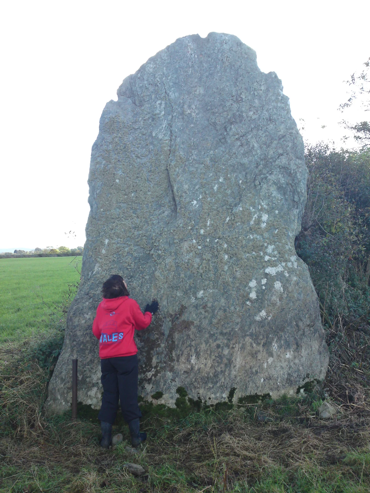

Bryn Gwyn Stones
An account written in 1797 explains it with brisk Welsh contempt: 'ignorant country people supposing money was hid under them tore them up'. The Bryn Gwyn Stones, near Brynsiencyn on Anglesey, were originally a circle of eight massive uprights - the tallest standing stones anywhere in Wales. Today only two remain, one wide slab and one tall pillar, standing in a modern field bank like the last two teeth in an old jaw. The rest were dragged out of the ground by neighbours convinced there must be gold underneath.
What Henry Rowlands Saw
In 1723 the antiquary Henry Rowlands - a parson and amateur archaeologist born on Anglesey - visited Bryn Gwyn and recorded the site in his book Mona Antiqua Restaurata. He described a 'ruinous circle of eight stones', some of them already toppled, but enough surviving for him to read the original shape. By 1797, when the second account appears, six of those stones were gone. The treasure hunt had taken them. Anglesey in the late eighteenth century was a poor place; the idea that the ancient Britons might have buried gold beneath their monuments was widespread, and any large stone with no obvious agricultural use was at risk. The Bryn Gwyn stones were too big to move whole, but the digging beneath them had collapsed the pits, and farmers simply broke up the stumps to clear the field.
The Cottage in the Circle
The two survivors lived on largely because someone built a cottage against the wide slab in the eighteenth century, using it as the building's end wall. Notches cut along its top show where the roof timbers were fitted into the stone. The cottage occupied a patch of ground inside the original circle, sharing its space with whatever ritual geometry the Neolithic builders had laid out four thousand years before. By the time the cottage was demolished, the stone had become both Neolithic monument and recycled domestic architecture - the kind of layered survival you find only in places where nobody got round to clearing the site.
Excavation Confirms Rowlands
Modern archaeology has caught up with the antiquary. In 2008, an excavation found three pits where standing stones had once stood, two of them still containing the broken stumps - consistent with Rowlands's record of a partly ruinous circle. Two years later, further excavations in 2010 identified three more removed stone pits, bringing the total to seven of the eight expected. A further pit inside the circle held what archaeologists call a 'blade-style' stone, a thinner upright with an alignment toward both the summer solstice sunrise and the winter solstice sunset. The same dual alignment shows up at other Neolithic monuments along the Atlantic seaboard - including Bryn Celli Ddu, ten kilometres to the north-east. Whoever was building on Anglesey five thousand years ago was watching the sky carefully.
Castell Bryn Gwyn and the Lost Circle
The Bryn Gwyn stones do not stand alone. About 280 metres to the north-east is Castell Bryn Gwyn, a substantial earthwork that has been variously interpreted as a Neolithic henge, a Bronze Age enclosure, and an Iron Age fort - it was probably all three at different times. Further to the north-east, at a place called Tre'r Dryw Bach, eighteenth-century visitors recorded another large stone circle. That one has been cleared away entirely; there is nothing on the ground today. What remained at Bryn Gwyn, what survived at Bryn Celli Ddu, what got swept off the land at Tre'r Dryw - the difference between visible prehistory and invisible prehistory on Anglesey is often a single landowner's decision in a single century. The two stones now leaning into a modern hedgerow are the lucky ones.
From the Air
The Bryn Gwyn Stones stand at 53.18 degrees north, 4.30 degrees west on south-eastern Anglesey, in farmland about a mile south-west of Brynsiencyn village and roughly three miles west of the Menai Strait. Hard to spot from the air; look for the distinctive field pattern between the Afon Braint and the A4080 road. Best viewed at 1,500-2,500 feet. Caernarfon Airport (EGCK) is five nautical miles south-east; RAF Valley (EGOV) lies 12 miles west - watch for fast-jet training and Valley MATZ.
Nearby Stories
- Wakestock 1.7 km away
- Trefriw 3.8 km away
- Irish Sea 8.7 km away
- Irish Sea Bridge 20 km away
- East–West Interconnector 30 km away
- Machynlleth 36 km away
- HMS Tyler 41 km away
- New Brighton Lifeboat Station 54 km away