Caetetus Ecological Station
For six years, no one saw them. The black lion tamarins - all four hands of fur and amber eyes, one of the rarest primates on Earth - had gone silent among the 2,176 hectares of forest that researchers had been combing on their behalf. Then in August 2016, near the administrative headquarters of the Caetetus Ecological Station, two adults appeared. They had been there all along. In the sandstone plateau country of western Sao Paulo, where 94 percent of the original semi-deciduous forest has been cut and burned and plowed under, the tamarins had simply refused to vanish.
The Six Percent
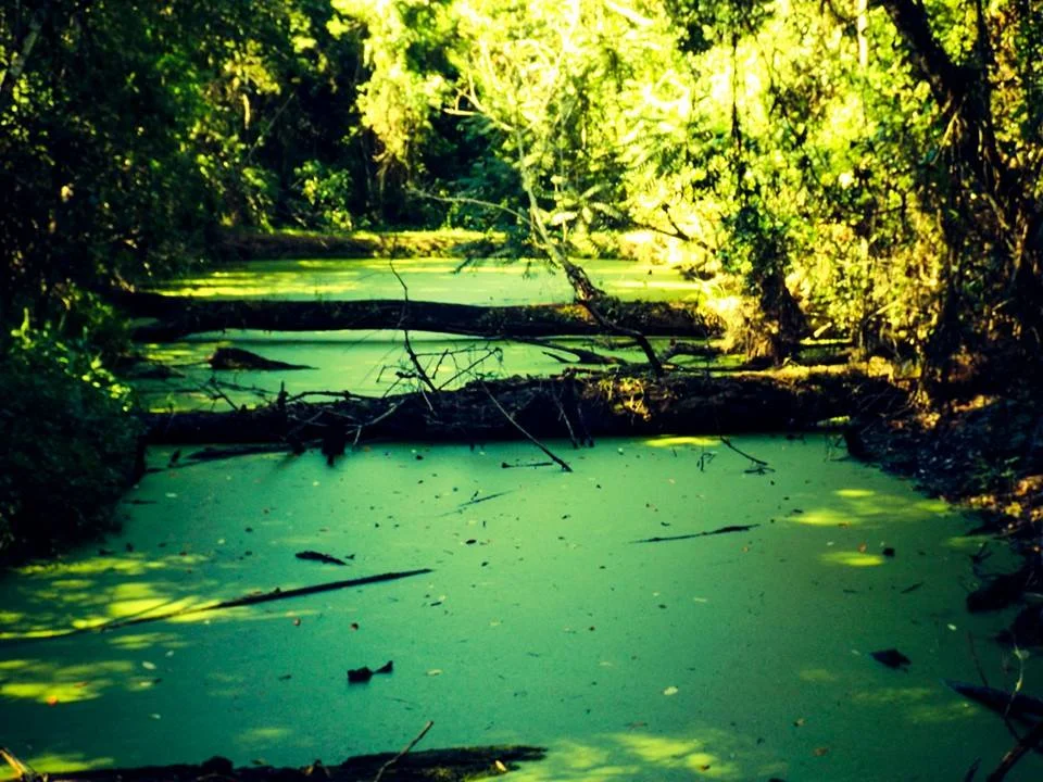
Once, a vast seasonal forest stretched across the western plateau of Sao Paulo, a green corridor where peroba and cedar and jequitibA rose in layered canopies above the red earth. The trees were too valuable to survive the twentieth century. Loggers took the hardwoods first - peroba-rosa for floors, ipe for construction, cabreuva for oil. Then cattle and coffee took what remained. Today, only six percent of that forest still stands, and within a 200-kilometer radius of Caetetus, there is almost nothing else. The station is an island. A 2,176-hectare remnant, divided between the municipalities of Galia and AlvinlAndia, holding within its boundaries something close to the original ecosystem - what Brazilian scientists call a "memory forest," a place to understand what the rest of the landscape once was.
From Paradise Farm
The land began as Fazenda Paraiso - Paradise Farm - private property on the Marilia Plateau. In August 1976, Governor Paulo Egidio Martins signed decree 8.346, declaring the land of public utility and expropriating it for the state. It became the Galia State Reserve. Eleven years later, in February 1987, Governor Andre Franco Montoro elevated its status, transforming the reserve into an ecological station under decree 26.718. By 1995 it carried a new name on its gate: the Olavo Amaral Ferraz Ecological Station, though most Brazilians still call it Caetetus. The progression from private farm to scientific reserve maps a particular shift in Brazilian environmental thinking - from land as commodity to land as archive.
The Tamarin's Return
The black lion tamarin, Leontopithecus chrysopygus, is not black all over. Its body is dark, but the rump and thighs glow a deep rust orange, a flash of warm color when the small primate moves through the understory. Before its rediscovery, the species was thought extinct for most of the twentieth century. Caetetus holds one of the few populations left. When researchers recorded the two adult tamarins near the station headquarters in August 2016, after six years of searches that found nothing, the discovery mattered beyond one forest - it confirmed that the protected core was still functioning as habitat. Cougars still pass through. Ocelots and oncillas hunt here. Collared peccaries and South American tapirs, vulnerable across the state, leave tracks in the red clay. In 1986, twelve brown howler monkeys were released into the forest, but the group was too small to take root. Some restorations succeed. Others become cautionary tales.
Three Hundred Voices
Between October 2005 and December 2006, ornithologists counted birds at Caetetus. They recorded 226 species in a single forest of this modest size. Later surveys added 68 more, bringing the total to 293 - a roster that includes Atlantic Forest endemics, cerrado specialists, and the vulnerable blue-winged macaw, Primolius maracana, whose raucous calls still echo through the waterfall-cut valleys where the Meio and Barreiro streams drop toward the lower plateau. In the dry winter months, from April through September, the forest thins and the streams slow. Then October rains return, and the seasonal semi-deciduous forest does what its name promises: it fills back in with leaves, and the tamarins move higher into the canopy.
Walking the Paraiso Trail
The station admits visitors, but carefully. Students and organized groups follow the Paraiso Trail and the Cipo Trail through interpretive signs explaining the vegetation - the chupa-ferro with its iron-hard wood, the catigua, the guaraiuva. The aim is not recreation but reconnection, an attempt to close the six-year gap between the people of Sao Paulo and the forest their ancestors lived within. The Instituto de Pesquisas Ecologicas and the Fundo Nacional do Meio Ambiente support the work. What the trails lead to, finally, is an idea more than a destination: that an ecosystem can be reduced to six percent of itself and still contain nearly all its original pieces, if you give it enough unbroken ground to hold on to.
From the Air
Located at 22.40 degrees S, 49.70 degrees W in the Marilia Plateau region of western Sao Paulo state. Elevation 520-600 meters with gentle slopes. Nearest major airports are Bauru-Arealva (SBAE) to the east and Marilia-Dr. Gastao Vidigal (SBML) to the south. Best viewing altitude 3,000-5,000 feet to appreciate the forest island against surrounding pasture and cropland. The ESEC appears as a distinct green patch in a matrix of agricultural clearing.
Nearby Stories
- Bauru Station (NOB) 18 km away
- Pompeia, São Paulo 44 km away
- São Paulo (state) 81 km away
- Birigui 96 km away
- Presidente Prudente 119 km away
- Atlantic Forest Biosphere Reserve 207 km away
- Campinas Cathedral Shooting 277 km away
- Guaira Falls 438 km away