
Caherdorgan North
Five drystone huts sit in a ring above Smerwick Harbour, their corbelled roofs long since collapsed into the grass. This is Caherdorgan Cashel — a small stone fort that once held a household, perhaps a family of monks or farmers, perhaps both at once. Nearby, only three hundred metres to the north, stands a ruined medieval rectangular building known as the Chancellor's House, complete with bread oven and fireplace. Between them lies the strange continuity of Irish settlement: an Iron Age form reused in the early Christian period, sitting alongside a medieval ecclesiastical residence, all on the same slope of the same hill, watching the same water.
The Cashel and the Beehive Huts
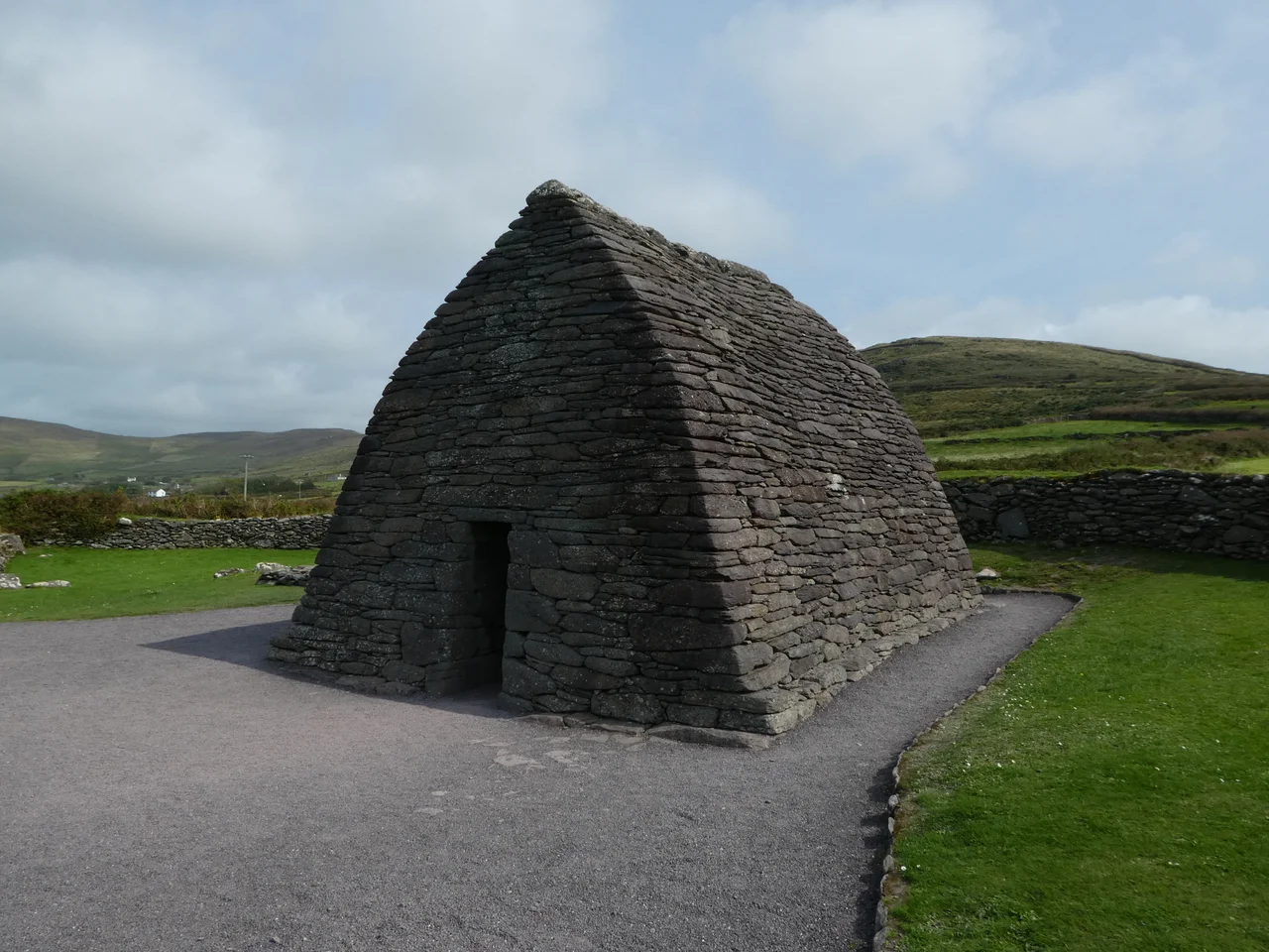
The cashel is the older structure — a circular drystone wall enclosing a small courtyard, the standard fortified farmstead of Iron Age and early medieval Ireland. Inside the wall, five clocháns once stood. A clochán is a beehive hut: walls of unmortared stone laid in concentric rings, each layer cantilevered slightly inward until the stones meet at the top, producing a corbelled dome that needs no wood, no nails, no roof beams. It is one of the oldest building techniques on earth and the Dingle Peninsula contains hundreds of examples. The huts at Caherdorgan have largely collapsed, but the bases are still there, and a souterrain — an underground passage used for storage or refuge — was once accessible from within the cashel.
Smerwick Below
The cashel lies 6.6 kilometres northwest of Dingle town, on a slope that opens out onto Smerwick Harbour. The view is wide and historically loaded. In 1580, the harbour was the site of the Siege of Smerwick, where an Anglo-Irish force under Lord Grey de Wilton massacred a garrison of Italian and Spanish papal troops along with their Irish allies after they surrendered. The bay is calm now, with white sand at Dún an Óir and gulls working the tideline. From the cashel, you can take in both the harbour and the slow climb toward Mount Brandon, and on a clear day you understand exactly why someone chose this spot to build a fortified home: water to the north, mountain to the east, fields between.
The Chancellor's House
Three hundred metres north of the cashel stands a building from a different world. The Chancellor's House — Fothrach an tSainsiléara in Irish — is the ruin of a rectangular stone medieval building, 17.6 metres long, with a bread oven and a fireplace still identifiable in the masonry. It was probably the residence of the cancellarius, the chancellor of the Diocese of Ardfert and Aghadoe — the senior cleric responsible for the diocese's archives, seals, and correspondence. To find such an office out here, on a slope above a harbour better known for siege than scholarship, is a reminder of how thoroughly medieval ecclesiastical structure penetrated the western edge of Europe. There was probably parchment in this house, and ink, and a fire in winter, and somewhere a key to a strongbox.
The Saint's Road
Caherdorgan sits along Cosán na Naomh — the Saint's Road — a pilgrimage route that runs from Ventry on the south coast of the peninsula northward to the slopes of Mount Brandon. For more than a thousand years, pilgrims have walked this path, climbing Brandon in honour of Saint Brendan the Navigator, the seafaring monk credited in medieval legend with sailing west to the Americas. The cashel and the Chancellor's House would have been familiar landmarks to walkers passing through. They still are. Walkers today on the Cosán na Naomh follow the same desire-line through stone-walled fields, past collapsed clocháns and roofless oratories, toward a mountain that once promised the edge of the world and now promises only weather.
From the Air
Located at 52.18°N, 10.34°W on the slope overlooking Smerwick Harbour, 6.6 km northwest of Dingle town. The cashel is small but the circular footprint shows clearly from low altitude. Nearest airport is Kerry (EIKY), about 55 km east. Recommended viewing altitude 1,500–3,000 feet for both the cashel circle and the nearby Chancellor's House. Best in low morning or evening light to bring out the wall outlines.
Nearby Stories
- Ballyheigue Castle 1 km away
- Killemlagh Church 2.8 km away
- Pouldergaderry Sinkhole 6.8 km away
- Derreen Garden 11 km away
- Kilkee 59 km away
- The Laki Eruption: The Volcano That Changed World History 1366 km away
- The Northern Lights: The Sky Show That Vikings Thought Was Bridge to the Gods 1469 km away
- Sao Miguel 1935 km away