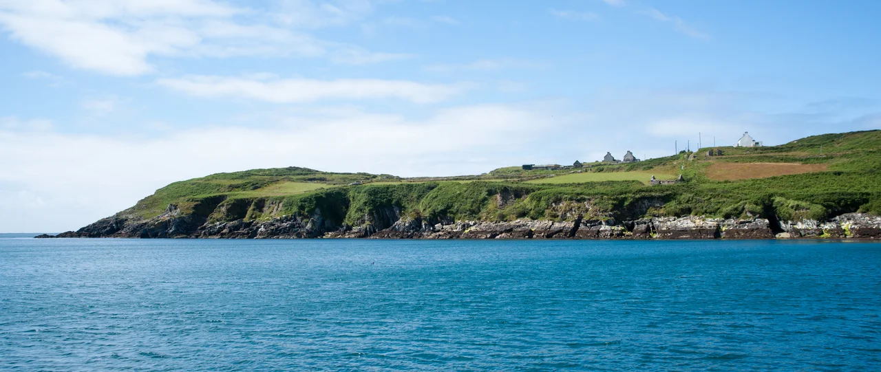

Cape Clear Island
On the first weekend of September each year, storytellers gather on a windswept island eight kilometres off the coast of County Cork to do what islanders here have done for centuries - sit close together and talk. The Cape Clear Island International Storytelling Festival has run every year since 1994, drawing tellers from across Ireland and beyond to a place where Irish is still the everyday language of a third of the residents. Cape Clear is small enough to walk across in an afternoon and remote enough that until 1995 it ran on diesel generators. It is also, by a few hundred metres of geography, the southernmost inhabited part of Ireland.
An Island Cut in Half
The Irish call it Cleire, or Oilean Chleire. In English it is Clear Island or, more commonly, Cape Clear. A narrow waist of land called - inevitably - the Waist divides the island into east and west halves, with North Harbour on the landward side and South Harbour facing open Atlantic. Ferries run from North Harbour to Schull and Baltimore on the mainland, twenty minutes across the sound. South Harbour, sheltered from the prevailing weather by the bulk of the island itself, becomes a parking lot for visiting yachts in summer. The nearest neighbour is Sherkin Island, two kilometres east; beyond that lies the mainland and the long peninsula of Mizen Head. The 2022 census counted 110 residents on Cape Clear, less than an eighth of the population the island carried before the Great Famine of the 1840s emptied it.
Layers in the Stone
People have been on Cape Clear a very long time. The archaeological record on the island includes a prehistoric cup-marked stone, now kept in the small island museum; a fulacht fiadh at Gort na Lobhar (Bronze Age cooking sites, ash-pits where stones were heated and dropped into water); a Neolithic passage tomb at Cill Leire Forabhain; standing stones; a promontory fort at Dun an Oir; and a Napoleonic-era signal tower from the years when Britain feared a French invasion of these shores. Tradition makes Cape Clear the birthplace of Saint Ciaran of Saigir, one of the earliest Christian missionaries to Ireland - older, by the legend, than even Patrick. Near the main pier in the North Harbour stand the ruins of a 12th-century church, designated a national monument, which suggests the island was already organised, taxed, and prayed-over before the Normans arrived in force.
A Place Where Irish Is Spoken
Cape Clear is one of the Gaeltacht areas, the regions where the Irish state recognises Irish as the daily community language. The 2016 census found 62 percent of islanders over the age of three claiming the ability to speak Irish, and 27 percent saying they actually used it daily outside school. The summer brings reinforcement. Students travel to the island's Irish colleges - Colaiste Phobal Chleire and Colaiste Chiarain - to live with local families and speak Irish for weeks at a time, a tradition that quietly props up both the language and the local economy. The primary school dates from 1897 and still functions, although the small population means small classes. In 1998 the President of Ireland, Mary McAleese, came across the water to visit it - a presidential acknowledgment that small places matter.
Birds, Sharks, Storytellers
If you arrive in autumn carrying binoculars, you have probably come for the birds. Cape Clear's mild oceanic climate and exposed position make it one of Europe's premier migration watch-points; the lighthouse and bird observatory together turn the island into a station where rare vagrants from North America occasionally arrive on the wrong wind. Black guillemots, common guillemots, cormorants, and storm petrels nest along the cliffs, while sea pinks and honeysuckle flower in the rough grass behind. In the surrounding water, seals haul out on rocks, basking sharks cruise the surface in summer with their mouths open to plankton, and dolphins pass through. The September storytelling festival completes the picture - a small population, a strong language, a deep sense of where on the planet this rock sits. When Mary McAleese came in 1998, she came to a place that had been holding itself together by remembering itself.
From the Air
Located at 51.43 degrees N, 9.50 degrees W in the Celtic Sea off the southwest tip of County Cork. From the air Cape Clear reads as a long east-west island with the Waist constriction in the middle and the Fastnet Rock lighthouse visible a few kilometres to the southwest. Cork Airport (EICK) lies about 80 kilometres east-northeast. The island and surrounding sound are best appreciated at lower altitudes in clear weather. In summer the haze can blur the coastline; in winter, gales make it a wild approach.
Nearby Stories
- Adrigole 4 km away
- Dunmanway Castle 4.7 km away
- Ballinskelligs Abbey 16 km away
- Glandore 17 km away
- Dursey Island 21 km away
- Wolfpack Prien 55 km away
- SM U-27 168 km away
- Sao Miguel 1912 km away