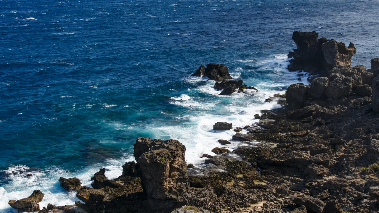

Cape Maobitou
Cat Nose Head. That is what the name means in Mandarin, and once you know it, the headland makes a different kind of sense. Maobitou — the cape that forms the western boundary of South Bay on the southern tip of Taiwan — is not dramatic in the way of towering sea cliffs. It is pointed. It protrudes. It has the quality of something pushed forward, curious and alert, which is exactly what cats and headlands have in common.
The Name Through Several Tongues
Languages accumulate at a cape like this one. The Mandarin name, Māobítou, literally means Cat Nose Head, though bítou is a dialectical reinforcement of bí — both words signifying a headland or promontory, the way a nose juts from a face. Hokkien speakers had their own version: Niauphi, which maps to the same image through a different phonological path. The Japanese, who administered Taiwan from 1895 to 1945, used their own rendering. Each successive naming layer tells you something about who was navigating these waters and what they needed to call the land they were watching. Cape Maobitou lies opposite Cape Eluanbi to the southeast; together they bracket the southern coast of the Hengchun Peninsula like two promontories marking an entrance.
South Bay's Western Wall
The cape forms the western boundary of South Bay, one of the principal bays on Taiwan's southern coast and a centre for water sports within Kenting National Park. South Bay's relative calm, compared with the more exposed Pacific-facing shores to the east, has made it a popular beach destination. Cape Maobitou itself is part of the national park, the protected landscape that covers most of the Hengchun Peninsula. From the cape, the coastline swings north toward the township of Hengchun, which gave the peninsula its name — Hengchun meaning Eternal Spring, a reference to the mild winters that set this latitude apart from the rest of Taiwan. Provincial Highway 26 runs along the coast near the cape, making it accessible by road.
A Southernmost Neighbourhood
The southern tip of Taiwan is unusually dense with geographic significance. Cape Eluanbi, a few kilometres to the southeast, is the definitive southernmost point of the main island. Cape Maobitou is among the southernmost points as well — a distinction the Wikipedia article carefully phrases as 'one of the southernmost points' rather than the southernmost, because Eluanbi holds that distinction. Still, Maobitou sits at 21.920°N, a latitude that places it in the company of very few other pieces of Taiwan. Between these two capes, the Hengchun Peninsula pinches to its narrowest, the Pacific on one side and the Taiwan Strait on the other. On clear days, looking south from either cape, the horizon is empty ocean all the way to the Philippines.
Kenting National Park
Kenting National Park, established in 1982, was Taiwan's first national park. It covers the entire southern end of the Hengchun Peninsula and encompasses the waters offshore, protecting coral reefs, coastal forests, and the geological formations that give the cape its shape. Cape Maobitou sits within this protected zone, which means the headland itself is preserved from development. The park attracts visitors year-round, but especially in summer, when the beaches of South Bay draw crowds from across Taiwan and the road through Hengchun slows to a crawl. In winter, the northeast monsoon makes the cape windier and the sea choppier, but the peninsula's characteristic mildness persists — the name Hengchun does not lie.
From the Air
Cape Maobitou sits at 21.920°N, 120.739°E at the western edge of South Bay on the southern tip of Taiwan's Hengchun Peninsula. From 3,000–5,000 feet, the cape's protruding shape is clearly visible as it divides the western coast from South Bay's calmer waters. Cape Eluanbi is visible to the southeast, and the twin capes frame the peninsula's tip. The nearest major airport is RCKH (Kaohsiung International Airport), approximately 90 km to the north. Provincial Highway 26, which encircles the southern tip of Taiwan, is visible from the air as it follows the coastline. The open Luzon Strait extends to the south.
Nearby Stories
- Mudan Incident 2 km away
- Lanyu Flying Fish Cultural Museum 30 km away
- Zhaori Hot Spring 59 km away
- Ten Drum Rende Creative Park 88 km away
- Mavulis Island 89 km away
- Barclay Memorial Park 121 km away
- 1991 Eruption of Mount Pinatubo 722 km away
- Scarborough Shoal 762 km away