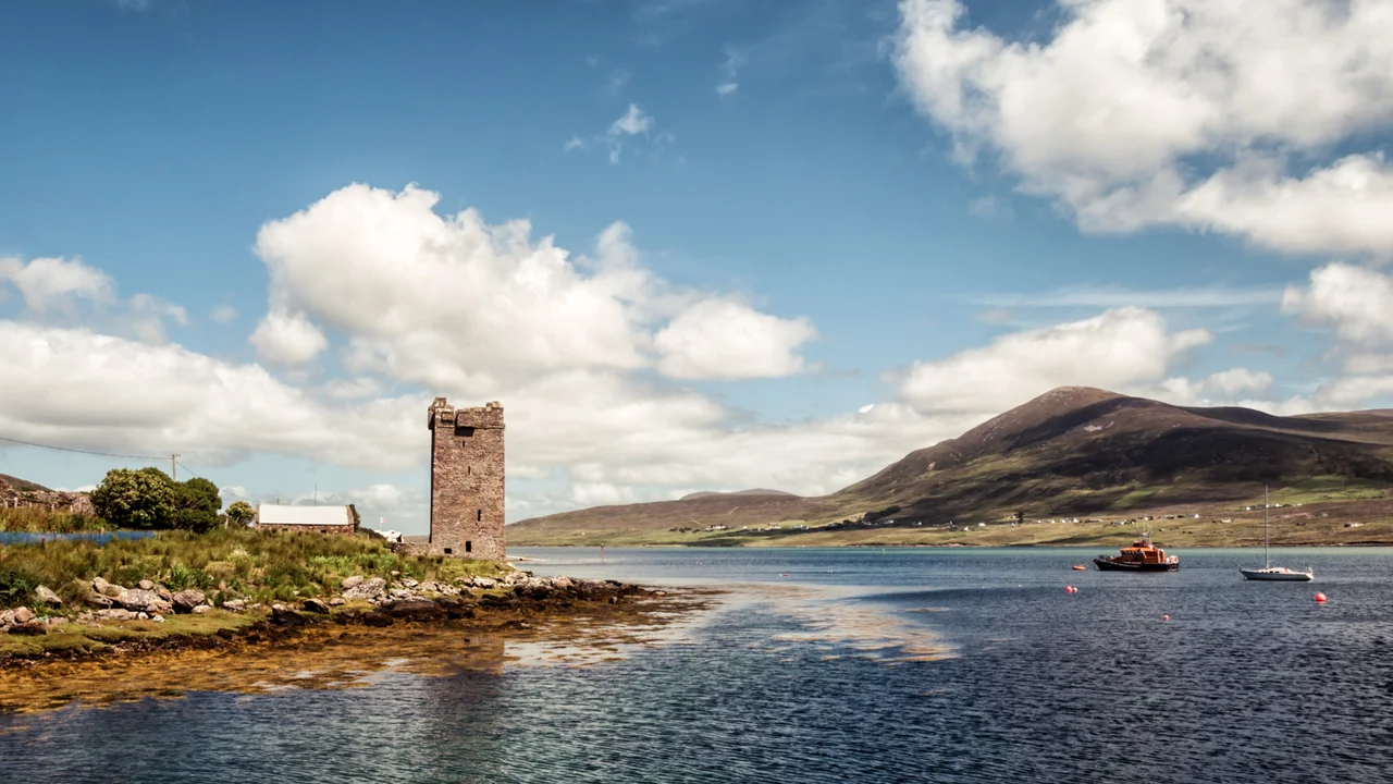

Carrickkildavnet Castle
It stands four storeys high on a low promontory at the south end of Achill Island, looking out across the narrow water of Achill Sound toward the Corraun Peninsula. Carrickkildavnet was built around 1429 by the O'Malley clan - the O Maille, Kings of Umaill - to control one of the most strategic stretches of water on the entire west coast of Ireland. Whoever held this tower controlled the only sheltered passage connecting Clew Bay to the south and Blacksod Bay to the north. A hundred years later, the tower passed into the hands of the most famous member the O'Malley clan ever produced: Grainne Ni Mhaille, born around 1530, known in English as Grace O'Malley, and on her own coast as Granuaile, the pirate queen.
The Strategic Chokepoint
Look at Achill Sound on a map and the reason for a tower at this exact spot becomes immediately obvious. The sound is a narrow channel running north-south between Achill Island and the Corraun Peninsula. A vessel coming up from Clew Bay and heading for the open Atlantic by the northern route had to thread this passage or take the much longer outside swing around Achill Head. With a tower at Kildavnet, the O'Malleys could see, signal, and intercept anything passing through. The strategic logic is the same one that produced castles at the mouth of every important Irish harbour. The difference at Kildavnet is that the seaborne power held it for long enough, and ran enough vessels of their own, to make it a base rather than just a checkpoint.
Granuaile's Tower
Grace O'Malley inherited the O'Malley maritime tradition and made it formidable. Her fleet ranged the entire west coast of Ireland; she negotiated with Queen Elizabeth I in London in 1593 in a meeting that became one of the iconic stories of sixteenth-century Anglo-Irish encounters; she outlived two husbands and most of her enemies. Carrickkildavnet was one of three strongholds she used, the others being Rockfleet Castle on Clew Bay and Granuaile's Castle on Clare Island. She is thought to have died around 1603 - the same year as Elizabeth - and was buried, by tradition, at Clare Island Abbey. The Kildavnet tower outlived her by four hundred years and is now a National Monument.
The Building Itself
Carrickkildavnet is a classic Irish tower house, four storeys built compactly for defence. The first floor is vaulted in stone, and the only access to the upper levels is through a single hole in one corner of that vault - a defensive feature that forced any attacker to come up one at a time, into whatever waited above. Inside the thick walls are murder-holes, defensive arrow loops, and a small mural chamber. The top of the tower carries machicolations and buttress fortifications. A ruined bawn wall - the outer enclosure that once protected the tower yard - traces a faint outline around the base. The basic geometry is recognisable from a thousand similar towers across Ireland, but the setting, on a low promontory with Achill Sound running past, is unusually dramatic.
What the Tower Watches Now
From the top of Carrickkildavnet today, on a clear day, you can see the Corraun Peninsula rising across the sound, the Michael Davitt Bridge linking Achill to the mainland a few miles north, and the white shape of the Achill Island Lifeboat Station boathouse less than a hundred metres away. The O'Malleys watched for raiders; the modern crew at the boathouse watches for distress calls. The water is the same. The castle is a free site, accessible by the road that runs south through Kildavnet village, and the small graveyard beside it adds a particular quality of quiet to the place.
From the Air
Carrickkildavnet Castle stands at 53.881°N, 9.946°W on a low promontory at the south end of Achill Island, overlooking Achill Sound. The four-storey stone tower is a clear visual landmark from 1,000-3,000 feet AGL. The Achill Island Lifeboat Station is immediately adjacent. Ireland West Airport Knock (EIKN) is about 45 nm to the east. Best photographed from the southeast in afternoon light, when the tower casts a long shadow toward the sound.
Nearby Stories
- Tully Cross 4.6 km away
- Binghamstown 6.7 km away
- Lough Mask Murders 6.8 km away
- Aughagower 13 km away
- Ballycastle, County Mayo 18 km away
- Action of 7 May 1794 36 km away
- RMS Carinthia (1925) 45 km away
- Inishtooskert 194 km away