Central Papua
The fight over where to put the capital nearly derailed the province before it was born. Timika, home to the Freeport copper-and-gold mine and the biggest economy in the region, wanted the honor. Six other regencies - Nabire, Dogiyai, Deiyai, Paniai, Intan Jaya, Puncak Jaya - wanted it in Nabire instead. Timika's supporters argued that the mine's revenues justified the claim. Nabire's supporters argued that being free of Freeport's influence was itself an advantage. When the national parliament settled the question in Nabire's favor on 30 June 2022, Timika residents took to the streets, threatening to shut down the Freeport mine by force. The province of Central Papua came into being anyway, on 25 July 2022, carrying the tension of its birth with it.
The Newest Province
Central Papua was carved from the western regencies of the former Papua province as part of a 2022 reorganization that also created three other new provinces: Highland Papua, South Papua, and Southwest Papua. It covers about 61,000 square kilometers and holds roughly 1.5 million people. The administrative capital sits in Wanggar District in Nabire Regency, where a new airport - Douw Aturure Nabire - opened in February 2024 after years of stop-and-start construction. The province's eight regencies stretch from the Cenderawasih Bay coast in the north, through the central highlands, down to the southern lowlands where Timika and the Freeport mine sit. It borders four other Papuan provinces and, along its southeastern edge, the Arafura Sea.
Puncak Jaya and the Equatorial Ice
The central part of the province rises into the Sudirman Range, part of the spine of New Guinea. Several peaks climb above 4,000 meters. The tallest is Puncak Jaya at more than 4,800 meters - the highest point in Indonesia and Oceania, and one of the Seven Summits on some lists. It is wrapped in the Carstensz Glacier, a shrinking patch of ice just four degrees south of the equator. The glacier has been melting steadily since measurements began, and climate models suggest it will disappear within decades. For now, it remains - a tropical alpine anomaly, accessible only by difficult trekking or helicopter. Climbers need permits to attempt the summit and must coordinate with local guides from the Moni and Dani communities whose territories surround the approach routes.
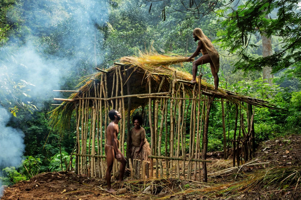
The Lakes of the Mee
In 1938, a Dutch pilot named Frits Wissel flew over the central highlands and discovered three large lakes at altitude. The Dutch named them Wisselmeeren, after him. The Mee people who had been living on their shores for generations already knew them as Paniai, Tigi, and Tage. After the Dutch period ended, the Mee names prevailed. Today the capitals of Paniai and Deiyai regencies sit on these shores. The Mee grow sweet potatoes in the fertile valleys, alongside small experiments with cold-climate crops like the Moanemani variety of coffee in the Kamuu Valley of Dogiyai. The highlands are not hospitable to every crop. Occasional frosts can wipe out a harvest, and remote villages in Puncak Regency - Agandugume, Lambewi - have suffered famine when roads were cut and resupply delayed. The lack of infrastructure is complicated by the Free Papua Movement's continued presence, which has made some areas effectively inaccessible to government and aid workers alike.
The Grasberg Mine and Its Downstream Cost
In the northern hills of Mimika Regency, within the Jayawijaya Mountains, Freeport Indonesia operates the Grasberg mine - one of the largest gold and copper deposits ever found. It has its own company town called Tembagapura. The scale of the operation is hard to overstate: Grasberg has produced more gold than any other mine in history. The cost has also been large. Tailings from the mine are discharged into the Ajkwa and Otomona rivers, carrying suspended rock and metals downstream through Mimika's lowlands, where the Kamoro and Sempan peoples have lived for generations. The rivers have thickened with grey mud. Some local families now pan the tailings for residual gold using simple tools, a subsistence activity that exists because the water that used to feed their traditional economies no longer does. The dispute over the mine's environmental impact has run for decades and does not appear close to resolution.
Three Coasts, Three Worlds
Central Papua's geography is really three worlds stacked vertically. The northern coast along Cenderawasih Bay is part of a national marine park famous for whale sharks that gather near floating fishing platforms called bagans. The fish eat the same plankton the sharks feed on, and over generations the sharks have learned to approach. Tourists now pay to swim alongside them. The highlands in the middle are the domain of the Mee, Moni, Dani, and other indigenous peoples - valleys at 1,500 to 2,500 meters where traditional sweet potato agriculture still anchors daily life. The southern lowlands, reaching to the Arafura Sea, are hot and flat, dominated by Southern New Guinea lowland rainforest and mangroves. Timika sits here, drawing migrants from the highlands and from other Indonesian islands alike. Three ecosystems, three economies, one young province trying to govern all of them at once.
From the Air
Central Papua spans roughly 2.5 to 5.5 degrees south latitude and 135 to 138 degrees east longitude, in the central region of Indonesian New Guinea. The new provincial capital at Nabire is served by Douw Aturure Nabire Airport. Mozes Kilangin (WABP) at Timika is the largest airport, handling Freeport mine operations. Puncak Jaya (4,884 m) dominates the central terrain and remains covered by the shrinking Carstensz Glacier. Expect tropical weather with heavy afternoon convective buildup, severe mountain weather above 3,000 meters, and limited navigation infrastructure outside the main hubs. Security restrictions apply in highland regions.
Nearby Stories
- Republic of West Papua 31 km away
- The Throat of the Bird 52 km away
- 2026 Smart Air Cessna 208 Crash 64 km away
- Tembagapura 79 km away
- Cenderawasih Bay 133 km away
- Lorentz National Park 169 km away
- Mamberamo River 298 km away
- The Abyss That Isn't a Trench 499 km away