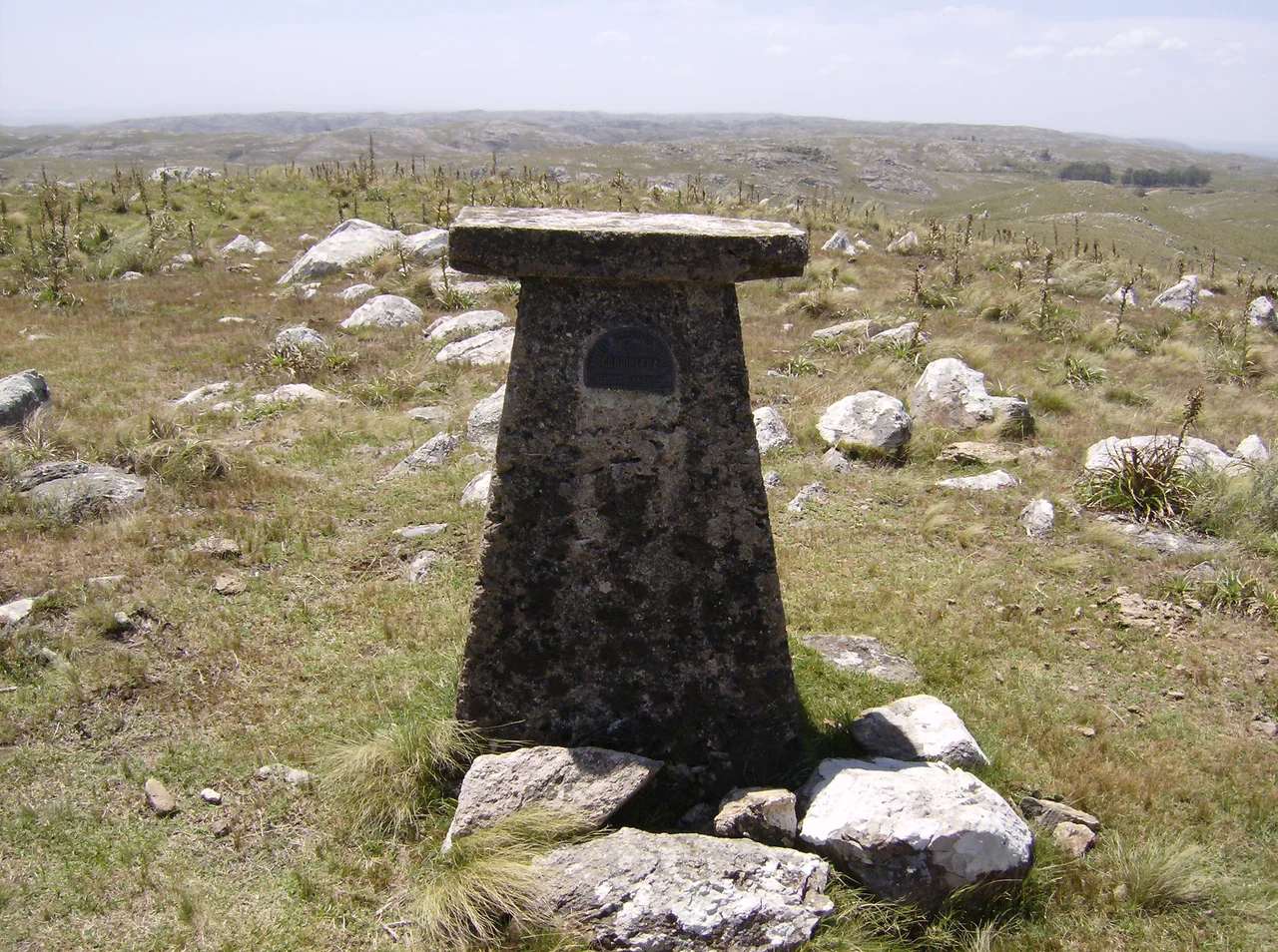

Cerro Catedral (Uruguay)
Uruguay's tallest summit would not crack the height of many office towers. Cerro Catedral rises to 513.66 meters, a figure that makes it the highest point in the entire country and yet would be a footnote in almost any range of real mountains. This is a nation of rolling cuchillas, the long low ridges that ripple across the interior, and its apex is a granite hill you can climb in an afternoon. The name promises grandeur. The reality offers something gentler and, in its way, more honest: a high place in a country that never went in for altitude.
A Cathedral Made of Rock
The name comes from the stone itself. Near the summit, the granite weathers into curious shapes, blocky outcrops and rounded forms that early observers thought resembled the spires and masses of a cathedral. These formations are common across southern Uruguay, where ancient bedrock breaks the surface in sculptural clusters, but here they crown the country's highest ground and gave the hill its title. Cerro Catedral is also known as Cerro Cordillera, a nod to the modest range it belongs to. There is no soaring nave, no flying buttress, only rock shaped by millions of years of wind and rain into something the eye wants to read as architecture.
The Day Uruguay Got Taller
For much of the twentieth century, Uruguayans believed their highest point was somewhere else entirely. Cerro de las Ánimas, once called Mirador Nacional, held the title at 501 meters. Then, in 1973, surveyors from the Servicio Geográfico Militar, the country's military mapping service, re-measured Cerro Catedral and found it higher. With that recalculation, the crown changed hands. It is a quietly remarkable thing to think about: a country whose tallest mountain was settled not by exploration or conquest but by a survey correction, a few extra meters discovered with better instruments. The summit is marked today by a triangulation station, the surveyor's bronze witness to the measurement that made this hill the roof of Uruguay.
Deep Time in the Granite
The hill belongs to the Sierra Carapé, a range formed in the Precambrian, among the oldest chapters of Earth's history. The rock here is granite and gneiss, hard crystalline stone that has endured while softer ground eroded away around it. The range crosses Maldonado Department from west to east and marks part of the border with Lavalleja, and from its slopes two streams are born: the José Ignacio, which runs south, and the Coronilla, which drains northwest toward the town of Aiguá. To stand on this summit is to stand on some of the most ancient exposed bedrock in the country, worn down over unimaginable spans into the gentle profile it wears now.
Tough Grass and a Rare Snow
Little grows on the highest rocks. Vegetation thins toward the top, where a hardy shrub called murta clings between the stones and, above roughly 400 meters, tough grasses and drought-adapted plants take over. The climate is oceanic and temperate, with mild summers and cool, frost-prone winters, swept frequently by strong winds. Snow is rare enough to be an event when it comes. The most recent snowfall recorded here fell on June 23, 2025, a genuine novelty in a country where white winters are the stuff of headlines. On a clear day the summit gives long views across the rolling interior, a reminder that in Uruguay, you do not need height to feel like you can see the whole country breathing below you. The murta, worth a second thought, is the same shrub known as Chilean guava, native to Chile and southern Argentina; here it survives as a low, hardy scrub among the granite, a small green proof of how much life can hold on at the top of a country that barely rises at all. Cerro Catedral asks nothing of climbers but a willing afternoon, and gives back the quiet satisfaction of standing, for a moment, higher than anyone else in Uruguay.
From the Air
Cerro Catedral sits at roughly 34.38 degrees south, 54.67 degrees west, in northern Maldonado Department near the municipality of Aiguá, in the Sierra Carapé. At 513.66 meters it is the highest point in Uruguay but represents only modest terrain relief; pilots should not expect a dramatic peak but rather a rounded granite high point amid rolling ridgelines. The exposed rock outcrops near the summit and the surrounding sparse vegetation distinguish it from the greener valleys. Strong winds are common in the area. Best viewed at low altitude in clear conditions. The nearest international airport is Laguna del Sauce (SULS) near Punta del Este, roughly 80 km to the south; Montevideo's Carrasco International (SUMU) lies about 170 km southwest.
Nearby Stories
- Minas 4.2 km away
- Laguna Garzón Bridge 21 km away
- Argentino Hotel 27 km away
- Cabo Polonio 33 km away
- Santa Teresa National Park 56 km away
- Treinta y Tres 100 km away
- Battle of Sarandí 118 km away
- South Georgia Island 2577 km away