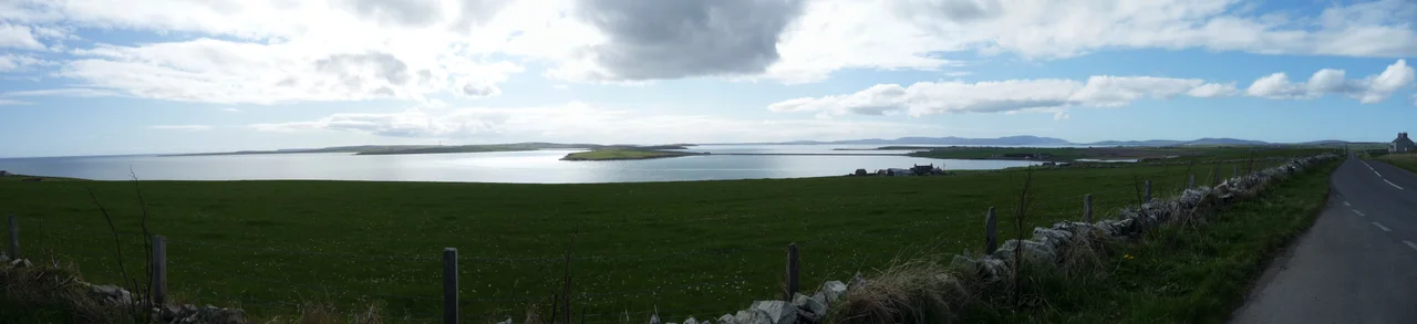

Churchill Barriers
At one minute past one in the morning on 14 October 1939, U-47 surfaced inside Scapa Flow. Within twenty minutes, the battleship HMS Royal Oak rolled over and sank at her moorings, taking 833 sailors with her. Many were boys; the youngest crew members aboard British capital ships at the start of the war were barely fifteen. The four squat concrete causeways that now stitch the southern Orkney islands together exist because of that night. They are a monument to the dead disguised as a road.
The Night Scapa Flow Failed
The Royal Navy had treated Scapa Flow as a fortress. The eastern entrances through Holm Sound were threaded with sunken blockships, booms, and anti-submarine nets, the leftover ironmongery of the First World War supplemented hurriedly as a second one began. It was meant to be impenetrable. But Kapitanleutnant Gunther Prien had studied charts and tide tables, and on a moonless October night he brought U-47 in on the surface at high water, sliding between the rusting hulls of the blockships. The first torpedo salvo caused only a small explosion; many of the Royal Oak's crew assumed an internal mishap and went back to sleep. The second salvo, fired some minutes later, did the killing. The ship capsized in thirteen minutes. Most of those who died never made it out of their hammocks.
Churchill's Order
Winston Churchill, then First Lord of the Admiralty, was apoplectic. The loss of a battleship inside Britain's main northern anchorage was a humiliation, and the eastern approaches had to be closed permanently. Sunken ships and nets were not enough. He ordered solid barriers. The contract went to Balfour Beatty, and preparatory work began in May 1940. Engineers from the University of Manchester tested model designs at Whitworth Laboratories. The plan was monumental: drop 250,000 tonnes of broken Orkney rock into gabion baskets in water up to eighteen metres deep, then cap the whole spine with 66,000 concrete blocks weighing five and ten tonnes apiece. The five-tonners formed the core. The ten-tonners were tumbled along the flanks in deliberately random patterns to break the wave action that would otherwise have flung them aside.
The Italians at Camp 60
By 1943 the labour force had peaked at over two thousand, and more than 1,300 of them were Italian prisoners of war, captured in North Africa and shipped north to a place colder and farther from home than any of them could have imagined. They were technically forbidden to do war-related work under the Geneva Convention, so the British called the causeways civilian roads. The Italians, housed at Camp 60 on the small uninhabited island of Lamb Holm, did the lifting. They also did something extraordinary. From two Nissen huts, scavenged scrap metal, and pieces of concrete, they built the Italian Chapel, a small church with a frescoed interior that would not look out of place on the Italian Riviera. Domenico Chiocchetti, an artist among the prisoners, painted the Madonna and Child above the altar. When the war ended the men went home, but Chiocchetti returned in 1960 to restore his frescoes. The chapel still stands, sea wind salting its walls.
Opened Four Days Late
The barriers were officially opened on 12 May 1945, four days after Victory in Europe Day. The war for which they were built was already over. But they had become useful in another way, linking Mainland Orkney to Burray and South Ronaldsay by road for the first time in history. Today the causeways are Category A listed structures, the two southernmost officially protected. Sand has buried the eastern flank of Barrier Number 4 so completely that the wreck of the steamship Carron, sunk as a blockship in 1940, lies entombed beneath a dune system colonised by marram grass and oyster leaf. The rusting hulks of the other blockships still break the surface beside Barrier Number 1, exactly where U-47 threaded its way through.
Driving Across the Dead
There are visitors who drive the A961 across the barriers without realising what is beneath them. The sea on the eastern side is grey and choppy, the sea on the western side darker and stiller, sheltered now as the Royal Navy had once meant Scapa Flow to be. Replacing even one of the causeways is fiercely unpopular among Orcadians, who understand that these are not really roads. Climate change is now the threat: stronger storms are eroding the structures faster than they were designed to withstand, and Barrier Number 2 between Lamb Holm and Glimps Holm is rated at high risk by the Scottish Environment Protection Agency. The Orkney Islands Council took over from the Ministry of Defence in 2011 and is looking for ways to keep all four intact. Eighty-five years on, the dead are still being defended.
From the Air
Located at 58.893 degrees north, 2.897 degrees west, the Churchill Barriers run roughly four miles south from Mainland Orkney across the eastern approaches to Scapa Flow. Best viewed at 2,000 to 4,000 feet AGL, where all four causeways appear as a chain of pale concrete spines linking Mainland to Lamb Holm, Glimps Holm, Burray, and South Ronaldsay. The rusting blockships beside Barrier Number 1 are visible from the air on clear days. Nearest airport is Kirkwall (EGPA), four miles north. Wick (EGPC) and Sumburgh (EGPB) provide alternate fields. Orkney weather is famously changeable; wind shear and low cloud are routine.
Nearby Stories
- Pentland Skerries 5.4 km away
- Thurso 13 km away
- HMS Daring (H16) 42 km away
- Wolfburn Distillery 42 km away
- Orcadian Basin 55 km away
- Fair Isle 57 km away
- Jarlshof 119 km away
- The Laki Eruption: The Volcano That Changed World History 941 km away