Ciudad Mitad del Mundo
The yellow line painted down the middle of the plaza at Ciudad Mitad del Mundo is in the wrong place. Not by much - 240 meters, a little more than two football fields - but in the wrong place all the same. Tourists line up every day to straddle it for photos, one foot in each hemisphere. The equator they are actually straddling is a line painted on stone by Ecuadorian geographers who trusted the wrong measurements. The real equator, the one satellites have confirmed, runs just north of the monument, through what was probably a site of pre-Columbian astronomical observation. The story of how we got here is a story of French scientists, Andean mountaintops, and measurements that changed the world - nearly.
The French Expedition
In 1735, the French Academy of Sciences dispatched one of history's most ambitious scientific expeditions. Led by Louis Godin, Pierre Bouguer, and Charles Marie de La Condamine, the mission's assignment was to settle one of the great scientific questions of the age: was the Earth an oblate spheroid - flattened at the poles, as Isaac Newton had predicted - or was it elongated like an egg, as some French astronomers still believed? Only precise measurement of a degree of latitude near the equator, compared with similar measurement near the pole, could answer the question. A second team went to Lapland. The Godin expedition came to the Spanish colonial territory that is now Ecuador, the one place near the equator where a Catholic empire would permit a Protestant-tolerating French scientific mission to work. They arrived in 1736. They were good. Their methods were painstaking. Their instruments were state of the art.
What They Got Right
The expedition's core finding proved definitive: the Earth is oblate, flattened at the poles, just as Newton had predicted. Their measurements of arc length near the equator, compared against similar measurements in Lapland, confirmed a rotational bulge at the middle of the planet. This was not a small result. It validated the Newtonian model of the universe over competing Cartesian models, gave mapmakers a foundation for calculating distances across curved surfaces, and established the geodetic principles still used today. The expedition took approximately ten years, longer than planned, plagued by political friction with Spanish authorities, internal disagreements among the three leaders, tropical diseases, and the logistical difficulty of hauling pendulums and brass instruments up Andean mountains above 4,000 meters. They eventually returned to France separately. They were right about the shape of the Earth.
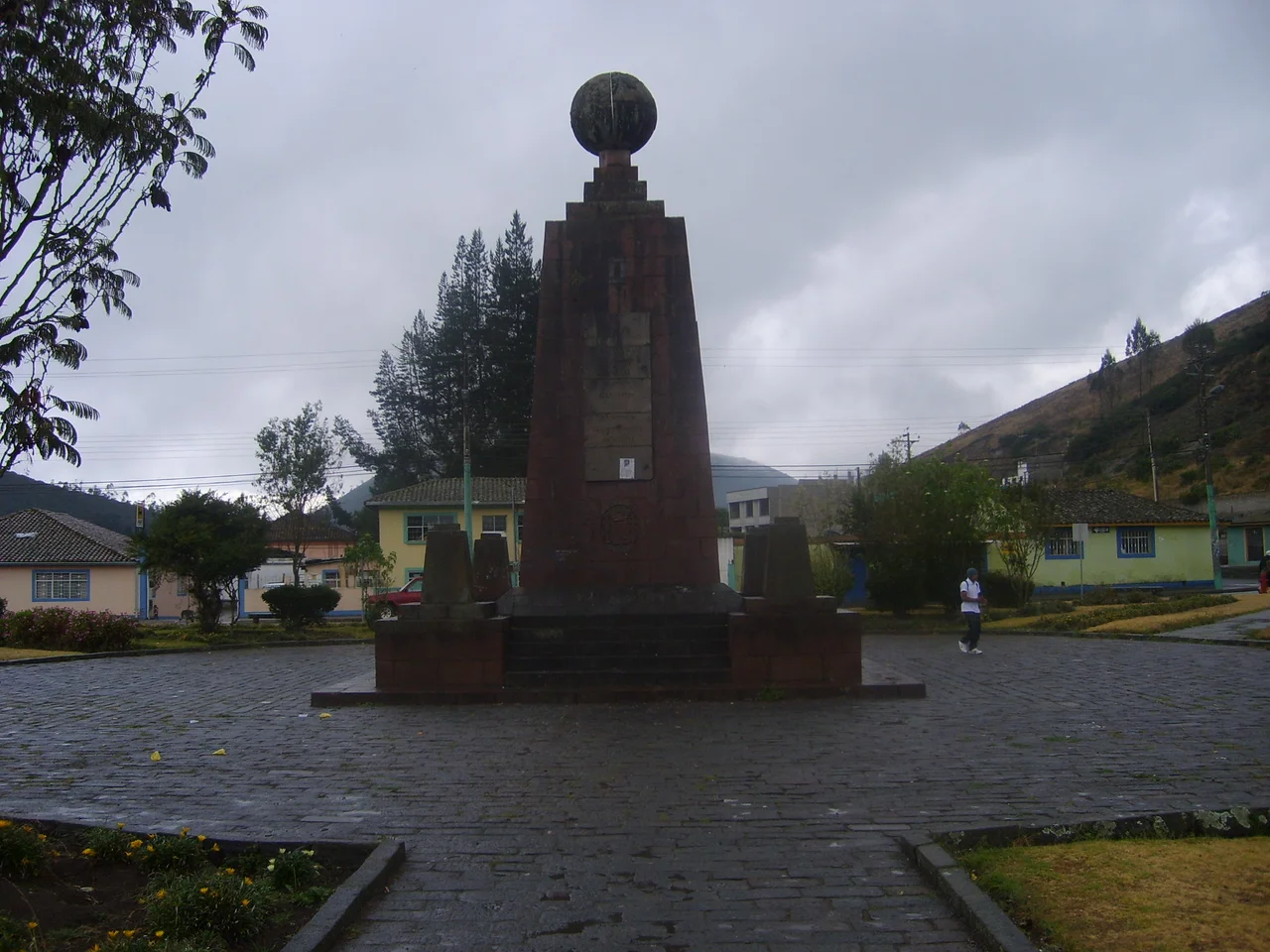
What They Got Wrong
They were also, it turns out, about 240 meters off on the exact location of the equator. Given the instruments of 1736, this was not a bad result. Given what modern GPS can measure, it is an embarrassment that has outlasted the expedition by nearly three centuries. In 1936, the Ecuadorian government built a ten-meter monument marking the equator according to the French expedition's coordinates, under the direction of the geographer Luis Tufino. In 1979, that monument was replaced by the current 30-meter pyramid, constructed between 1979 and 1982 by architect Alfredo Fabian Paez with Carlos Mancheno. The old, smaller monument was moved seven kilometers to a nearby town called Calacali, where it still stands. The new monument is made of iron and concrete, sheathed in cut and polished andesite stone, topped with a globe 4.5 meters in diameter that weighs five tons.
Catequilla and the Older Line
Here the story takes a turn. While the French were measuring the equator between 1735 and 1745, they passed by ruins that they did not recognize as significant. Those ruins, the archaeological site called Catequilla, were built by the Quitu-Cara culture that inhabited the region centuries before the Inca arrived. The ruins sit almost exactly on latitude zero. Not the French one. The real one. Modern GPS confirms that Catequilla is located essentially on the true equator - suggesting that the Quitu-Cara had measured, to remarkable precision, the same line the French would later mis-locate. How they did it without European instruments remains a subject of debate. Solar observation, likely - perhaps using shadows cast at solstice and equinox from surrounding peaks. The irony is thick: European scientists were dispatched to measure something the locals had arguably measured better, centuries earlier, using methods the Europeans did not recognize as methods.
Straddling the Line
Today the site contains more than the monument. There is a planetarium, a miniature model of Quito, handicraft stores, cafes, and a small ethnographic museum inside the pyramid displaying indigenous clothing and cultural artifacts. Two hundred meters northeast is the privately operated Intinan Solar Museum, which also claims to mark the equator (it does not) and offers tourist demonstrations based on the supposed equatorial magic of the Coriolis effect. Water, visitors are told, drains different directions on different sides of the line. Eggs balance easier on the equator. None of this is true - the Coriolis force is far too small at such short distances to affect drain direction, and eggs balance equally well anywhere. But the demonstrations continue. The former UNASUR headquarters, a modern building once intended as the seat of a South American Union, sits nearby in disuse since Ecuador's 2019 withdrawal. The monuments, the museums, the merchants, the photos - the whole apparatus accumulates around a line that is almost, but not quite, where it should be.
From the Air
Coordinates 0.00 N/S, 78.46 W at monument (true equator runs approximately 240 meters north of marked line). Located in San Antonio parish, Pichincha Province, 26 km north of central Quito at approximately 2,400 meters elevation. Best viewed from 10,000-14,000 feet. Nearest major airport: Mariscal Sucre International (SEQM), approximately 15 km southeast.
Nearby Stories
- History of Ecuador (1830-1860) 7.8 km away
- Baeza 22 km away
- Illiniza 38 km away
- Quinindé Canton 45 km away
- Guandera Biological Station 60 km away
- Sumaco Napo-Galeras National Park 64 km away
- La Mana 67 km away
- Jatun Sacha Foundation 85 km away