.jpg)
Baeza
The pronunciation lesson comes fast: "La Y" is not "La Why." It's "La Yeh," in Ecuadorian Spanish, and it refers to the fork in the road two kilometers downhill from town - one branch bending north to Lago Agrio and the Amazon oil fields, the other curling south toward Tena. This is where travelers make a choice, and for centuries, so have armies, missionaries, and traders. Baeza has always been a place of decisions, perched between worlds.
Where the Andes Break Open
Baeza sits in Napo Province at roughly 1,900 meters, on the eastern flank of Ecuador's cordillera where the mountains finally lose their grip and begin their tumbling descent into the Amazon basin. The Quijos River, which gave its name to both the canton and the indigenous Quijos-Quichua people who still live here, races past town in white-veined torrents. Travelers arriving from the high, lung-thinning plazas of Quito feel it immediately: more air, warmer air, the kind with weight and humidity. Everything grows thicker at this elevation. Moss hangs from the telephone wires. The hills wear bromeliads like jewelry.
Two Baezas
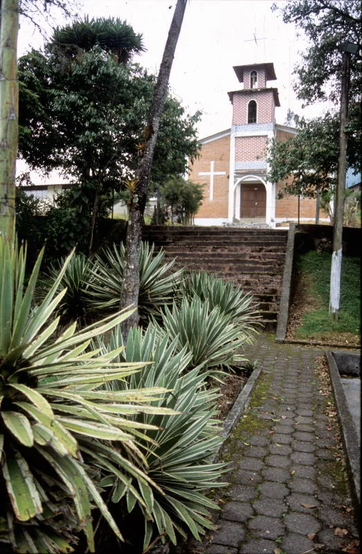
There are, in fact, two towns separated by a five-minute walk. Colonial Baeza - Baeza Antiguo - perches on a quaint hill, its blackened antique cobblestones leading down to a small waterfall and the ghosts of a Spanish outpost founded in 1559. The name came with the conquistadors, borrowed from the Spanish town of Baeza in Andalusia. Nueva Baeza, the newer settlement, sprawls flatter and more practical below, its streets lined with small grocery markets and produce stands but no supermarket. This is Ecuadorian small-town life without pretense. The town has no bus terminal. Travelers wait at La Y and flag down whatever passes.
Kayakers' Season
From November through March, something unusual happens in this quiet town. Several dozen expert whitewater kayakers arrive from around the world, drawn by rivers that run consistently when others run dry. The water here ranges from Class III to difficult Class V - steep, continuous, technical. Baeza has become, improbably, one of South America's most reliable hubs for serious paddlers. The climate suits them: cooler and drier than the lower-elevation rivers around Tena or Santo Domingo, where heat turns the jungle into a sauna. In high season, the hotels fill. In low season, from April to October, the town returns to its quieter rhythm, and visitors have to make their own company.
The Road to the Oriente
For centuries, Baeza has served as a threshold between highland Ecuador and the Oriente - the Amazon territory east of the Andes. Colonial administrators, missionaries, rubber tappers, oil prospectors, and now tourists have all passed through. The town makes a natural stopover for travelers headed deeper into the jungle, a place to adjust from the thin air of Quito before the humid heat of the lowlands. Hikes within town include a grueling climb to the radio antennas visible from anywhere below, and a waterfall loop beginning near the zoo. Papallacta, forty kilometers northwest, offers hot springs on the route back to the capital. El Chaco lies five minutes northeast by bus. Cosanga, nineteen kilometers south, marks the beginning of cloud forest country.
Quiet Corner of the Quijos
What Baeza lacks in tourist infrastructure, it makes up for in something harder to package. The evenings are cool enough for blankets. The Quijos rushes through its canyon with a sound that carries through open windows. Clouds roll down from the high passes and settle in the valleys overnight. Tourist infrastructure is limited but improving, and the town is rapidly coming into its own as a mountain destination for travelers challenged by Ecuador's higher elevations. Those who make it here find a place still shaped by its geography - the place where the continent tips eastward, where the rivers begin their thousand-mile journey toward the Atlantic, where "La Y" marks the choice between mountains and jungle.
From the Air
Coordinates 0.46 S, 77.89 W. Elevation approximately 1,900 meters. Baeza sits in the Quijos River valley on the eastern slopes of the Ecuadorian Andes, where cloud cover is frequent. Best viewing altitudes 9,000-14,000 feet in clear weather. Nearby airports include Mariscal Sucre International (SEQM) in Quito to the west and Francisco de Orellana (SECO) in Coca to the east.
Nearby Stories
- Assassination of Fernando Villavicencio 9.5 km away
- Cotopaxi 27 km away
- Tena 32 km away
- Hacienda Guachala 37 km away
- Ecuadorian Amazon 51 km away
- Quilotoa Loop 58 km away
- Oriente (Ecuador) 64 km away
- Cuyabeno Wildlife Reserve 168 km away