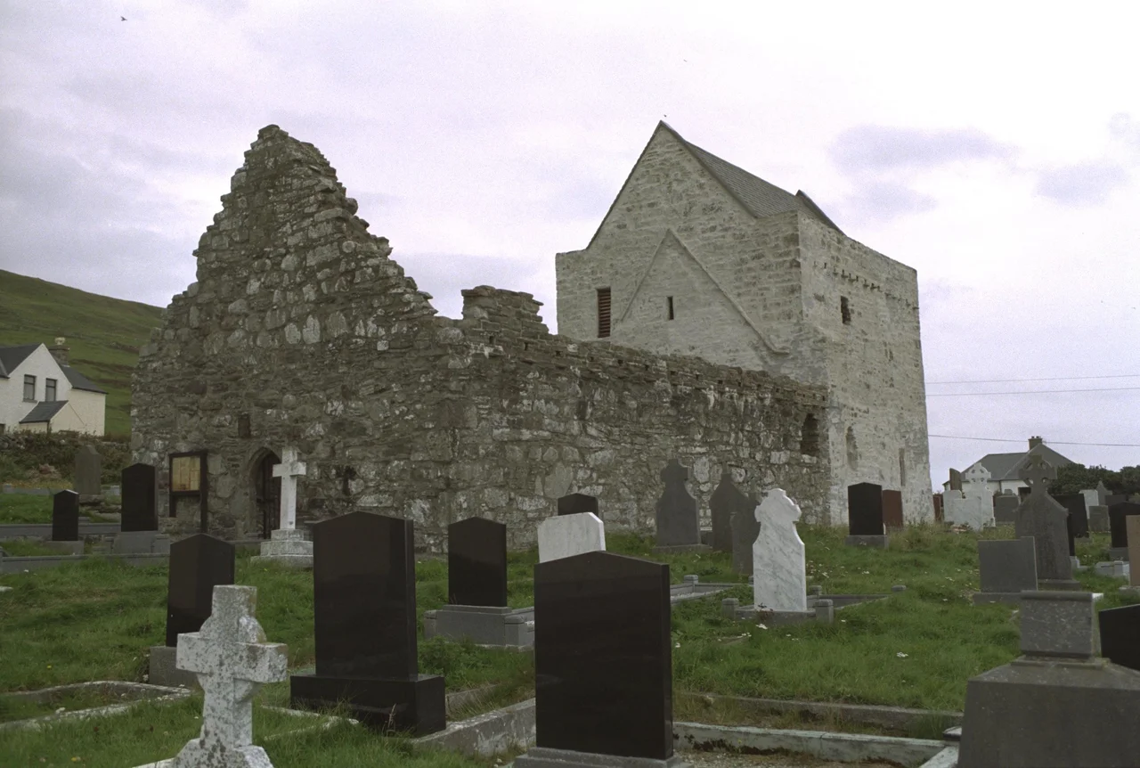

Clare Island Abbey
On the ceiling of a small thirteenth-century church on Clare Island, dragons curl through painted vines. There are stags, a cockerel, a harper bent over his strings, mounted horsemen, birds, trees - a medieval bestiary in colours muted by seven centuries of damp Atlantic air. The paintings should not be here. Cistercian houses, by the order's reformist principles, deliberately avoided this kind of ornamental display. But Clare Island Abbey - officially Saint Brigid's Abbey, founded sometime in the twelfth or thirteenth century - has its dragons anyway, surviving on a remote Mayo island when more accessible Cistercian foundations had theirs whitewashed long ago.
A Cell of Knockmoy
Saint Brigid's was founded as a small Cistercian house in the twelfth or thirteenth century, and in 1224 became a cell of Knockmoy Abbey, the larger Cistercian foundation near Tuam in County Galway. The architecture is modest - a small nave, a chancel, the usual liturgical fittings of piscina and sedilia, lancet windows in ogee and cusped heads. There are carved heads of unknown subjects worked into the stonework. The abbey sits near the south coast of the island, a short walk from the modern post office, in ground that has been continuously sacred for at least eight hundred years.
The Painted Ceiling
What sets Clare Island Abbey apart from any number of similar small abbeys around Ireland is the survival of its medieval wall and ceiling paintings - one of the most important collections of late medieval secular and mythological imagery in the country. The figures include dragons, a cockerel, stags, men on foot and mounted, a harper, birds and trees. Cistercian houses were not supposed to allow this kind of imagery; the order had spent its early centuries deliberately stripping religious art down to plaster-white austerity. Whoever painted these images here, on a remote western island, was either operating outside the normal supervision of the order or working under a patron who simply did not care what Citeaux thought. The paintings have been the subject of careful conservation work in recent decades.
The O'Malley Tomb
The abbey contains numerous tombs of the local ruling family, the O Maille - O'Malley. The most prominent is a canopied tomb on the north wall, and tradition holds that this is the burial place of Grainne Ni Mhaille, Grace O'Malley, the famous pirate queen who died around 1603. The same tradition has her baptized, married, and finally interred here, the centre of her life on the island where she kept one of her three strongholds (Granuaile's Castle stands a few miles north on the east coast). Whether the tomb actually contains her remains has not been definitively proven, but the canopy, the inscription O S O'Mhaille (the O'Malley motto, 'Powerful by Land and Sea'), and the consistency of the local tradition give the claim weight.
Dissolution and Refuge
The abbey was probably dissolved in the late sixteenth century, swept up in the long process by which the English crown took apart Irish monastic institutions. But Clare Island was remote and difficult to reach, and the buildings did not become a quarry the way some mainland abbeys did. Carmelite friars, dispossessed from their own foundations, took refuge here at various points - an unofficial continuation of religious life on a site the dissolution paperwork had nominally ended. The dragons on the ceiling kept their colours through all of this, and through the next four hundred years of weather and wear.
From the Air
Clare Island Abbey sits at 53.793°N, 9.989°W, near the south coast of Clare Island. The abbey is a small stone structure best identified from the air by its position near the harbour and post office, with Achillbeg visible to the north and the Mayo coast to the east. Best viewed at low altitude (1,000-2,000 feet AGL). Ireland West Airport Knock (EIKN) is about 50 nm to the east. Connemara Regional (EICA) is about 40 nm to the south-southeast.
Nearby Stories
- Tully Cross 4.6 km away
- Binghamstown 6.7 km away
- Lough Mask Murders 6.8 km away
- Aughagower 13 km away
- Ballycastle, County Mayo 18 km away
- Action of 7 May 1794 36 km away
- RMS Carinthia (1925) 45 km away
- Inishtooskert 194 km away