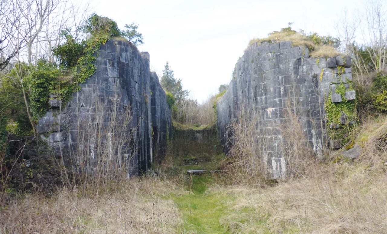
Cong Canal
The Cong Canal is a six-kilometre cut between Lough Mask and Lough Corrib, built to carry boats from Galway Bay into the inland lakes of Mayo. It was excavated through solid limestone over a decade from 1844, finished, fitted with locks and bridges, and then never used. The water it was meant to carry preferred to flow underground through the porous rock, leaving the channel high and dry for most of the year. The Board of Works that built it issued statements blaming costs, labour shortages, and the new railways. Local people knew the real story and have remembered it ever since: the engineers failed to take account of the cavernous nature of the limestone in the district. Today the canal is popularly known as the Dry Canal, and you can walk its bed in summer.
The Famine Project
The Cong Canal began as part of a much larger scheme, the Corrib, Mask and Carra Drainage and Navigation project, intended to drain flooded land around three Connacht lakes and open a navigation from the sea at Galway all the way to Lough Mask. Survey work started in June 1844. The design was published in March 1846. The timing was disastrous: the Great Famine had begun, the potato crop had failed across Ireland, and the project was suddenly accelerated as a Famine relief scheme to put starving labourers to work. Three other navigations received Treasury funding during the Famine years: Lough Neagh and the River Bann in Antrim, the Ballinamore-Ballyconnell Canal in Leitrim, and the Lough Oughter-Lough Gowna scheme in Cavan. Of the four, only Cong was abandoned mid-construction. The Galway-to-Lough Corrib section was completed and worked. The northern extension to Lough Mask was not.
The Limestone Drinks the Water
The land between Lough Corrib and Lough Mask is karst, riddled with underground channels through which water naturally moves. Local people knew this. Generations had watched streams disappear into rock and emerge somewhere else entirely. The engineers of the Board of Works apparently did not. They cut six kilometres of channel through limestone, fitted it with completed locks at Cong, and waited for the water to flow. In conditions of low flow, all the water drained through the underground passages, leaving the canal empty. Rather than admit the error, the Board installed great sluices at Killimor to block the channel they had just spent six years excavating. The rusting sluices are still there, six kilometres north of Cong, though they are difficult to access. The local folk memory had been right all along.
Wilde Names It
The canal might have been quietly forgotten if not for William Wilde, the prominent Anglo-Irish surgeon, historian, and antiquarian, who built a summer house on the shores of Lough Corrib and took an interest in the local landscape. In 1872 he brought the abandoned canal to wide public attention and coined the name it has carried ever since: the Dry Canal. Wilde's writings drew attention to the ironies of a navigation built but unused, of locks completed but stranded, of public money spent and then walled off. The canal had also caused legal trouble in its construction. The Board, in attempting to manage flood waters, had directed runoff into the tailraces of the mills of Cong, damaging the millers' business. The millers sued. They won.
Walking the Channel
Today the Cong Canal is something between an industrial archaeology site and a curious local amenity. The fully completed lock in the village of Cong still stands, an elegant piece of cut-stone engineering opening onto nothing. The excavated channel runs north through the karst, dry in summer and capable of flooding in winter when high flows overwhelm the underground drainage. The lower one-and-a-half kilometres at Cong village remain dry at all times. Walkers can hike the bed in summer, an unusual experience: walking down what was supposed to be a waterway, between walls cut through rock by hand. It is a monument less to engineering triumph than to engineering failure, but as such it is one of the more honest pieces of Victorian infrastructure left in Ireland.
From the Air
Coordinates: 53.5442 N, 9.2858 W. The Cong Canal runs roughly six kilometres north-south between Cong village (south end) and the Lough Mask shore (north end). From the air the canal reads as a straight line through the patchwork karst landscape, distinguishable from natural watercourses by its precise geometry. Lough Mask lies to the north, Lough Corrib to the south. Nearest airports: Ireland West Knock (EIKN) about 45 km northeast, Galway (EICM, GA only) about 35 km south. Recommended viewing altitude 2,000 to 3,500 ft.
Nearby Stories
- Kylemore Abbey 5 km away
- Granuaile's Castle 7.2 km away
- Castlebar 8.1 km away
- Knockmoy Abbey 9.9 km away
- Kilmovee 13 km away
- Salthill 16 km away
- Loughrea 17 km away
- RMS Carinthia (1925) 55 km away