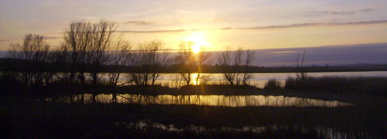

Coonagh, Limerick City
When the Shannon broke its banks in October 1961 and submerged most of Coonagh in five metres of water, the children of the village had to be taken out to school in gandelow boats - the same flat-bottomed wooden craft their fathers and grandfathers used for drift-netting salmon. That was a working answer to a working problem. For most of its long history Coonagh has done what places along the great Irish river do: fish, cut reed for thatch, dig the river clay for brick, and wait for the next flood. The 2008 boundary change folded Coonagh into Limerick city; the M7 motorway and the Limerick Tunnel cut through the salt marshes south of the village; the brick holes are gone. But Thady's Lamp still warns ships of the shallows in the channel, and the badger setts are still visible just below it.
A Village in Two Counties
Coonagh sits in the awkward geographical seam where County Limerick presses against County Clare along the north bank of the Shannon. The village has two halves - Coonagh West, sometimes called Faha or 'the village', and Coonagh East. Until 2008 it was administratively part of County Limerick proper; then a boundary alteration order quietly absorbed it into Limerick city. But its religious geography stays older: Coonagh belongs to the Catholic parish of Parteen-Meelick-Coonagh in the Diocese of Limerick, an arrangement set down at the Synod of Ráth Breasail in 1111 AD, when the bishops of Ireland sat down and drew lines on a map that have, in places, lasted nine centuries. For generations Coonagh's children walked across the county line to attend Meelick National School - Scoil Mhuire Miliuc - on the Clare side.
The Gandelow Trade
The traditional working life of Coonagh ran by the river. Men fished for salmon with drift nets from gandelows - long, narrow, flat-bottomed wooden boats unique to the Shannon Estuary, light enough to be poled through shallow channels and stable enough to handle a heavy net of fish. They harvested the tall reeds along the riverbank for sale to thatchers across Munster. They cut clay from the 'brick holes' in Coonagh West and fired it in kilns to make building bricks; excavations during the recent motorway construction uncovered the remains of several post-medieval brick kilns, exactly where the local memory said they would be. They farmed the reclaimed salt marshes south of Coonagh Point - although those marshes, archaeology revealed, were only reclaimed from the Shannon as recently as the 1820s. Everything Coonagh did, the river either provided or threatened.
Holding Back the Shannon
The embankments that keep the river out of Coonagh are an unending project. The Down Survey of the 1650s described the land here simply as 'pasture overflowen every tide.' In 1808 the surveyor Hely Dutton called the existing embankments along the Shannon and Fergus the worst possible work - lamenting the indolence of the proprietors and the lack of any qualified person to maintain them. Then between 1824 and 1828, Eugene O'Curry - later one of Ireland's most distinguished Irish-language scholars - was employed as overseer during the construction of a new and better embankment at Coonagh. It was still not enough. In 1843 travellers reported that the river flats were still often overflowed by the Shannon, and along the road, stone pillars marked the flood levels. After the 1961 flood, much higher banks were built using clay from the village's brick holes; the modern N18 dual-carriageway now runs along the top of those embankments. The flood, fertile, left silt behind. For years afterwards Coonagh was famous in Limerick for wild mushrooms.
The Riot of 1848
In June 1848, with the Great Famine ravaging Ireland, a tense local episode unfolded on the Shannon at Coonagh. The village then hosted a Royal Navy Coast Guard station whose Inspecting Commander, Captain Montagu Pasco, wrote a detailed report of an incident on 22 June. Three to four hundred local cot fishermen - working men whose families were starving and whose traditional fishing rights were being pressed by the privately owned salmon weirs - proceeded down the river in their boats. They destroyed every weir they could reach between the Coast Guard station and Grass Island near the mouth of the Maigue. Pasco, with his small Coast Guard detachment, managed to save only two or three. He noted that the Royal Navy presence at Green's Island prevented the riot from spreading further. The men were not criminals in any modern sense - they were people fishing where the law said they could not, in a year when fishing meant the difference between eating and not eating. The weirs were rebuilt. The famine continued. The names of the cot fishermen who took the river back for a day were never written down.
Thady's Lamp
A handful of small landmarks define Coonagh's older landscape, the kind of detail that doesn't make tourist brochures. Thady's Lamp is an unmanned metal lamp tower on the river that warns ships of shallow water; until recently it was lit by oil lanterns, now by solar-powered electric bulbs. A second tower nearby is called the Rock Lamp. There is a Cealtrach - an old infant burial ground for unbaptised children, also known as Craggen, on a quiet plot in Clonconane in Coonagh East. There was once a fifteenth-century O'Brien castle called Coreen Castle; nothing of it remains, but the rugby pitches of Shannon RFC now occupy its site. Coonagh House, an eighteenth-century gentleman's residence built by the Sexton family around 1700, burned in 1831. The local soccer club, Coonagh United AFC, founded in 1971, still plays on grounds the villagers fundraised and built themselves. The motorway thunders past. The river goes on.
From the Air
Coonagh sits at 52.67 degrees north, 8.62 degrees west, on the north bank of the River Shannon about 5 km west of Limerick city centre. Shannon Airport (EINN) is 20 km west. From altitude, the M7 Limerick Southern Ring Road and the Limerick Tunnel are clearly visible - they pass directly through Coonagh's reclaimed salt-marsh territory. Carrigogunnell Castle is across the river to the south.
Nearby Stories
- Cloughjordan 4.8 km away
- Charleville 5.6 km away
- Kilfenora Cathedral 10 km away
- Shanbally Castle 10 km away
- Abbeyfeale 11 km away
- Holy Cross Abbey 15 km away
- 2003 Derrybrien Landslide 20 km away
- Kilrush 23 km away