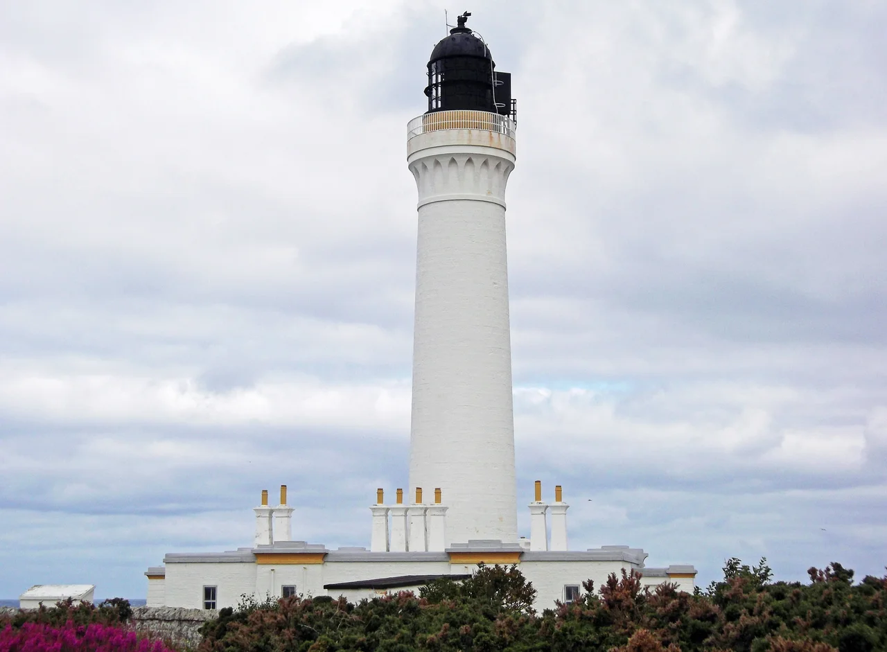

Covesea Skerries Lighthouse
In November 1826, a single storm in the Moray Firth sank sixteen vessels. The Northern Lighthouse Board considered building a light at Covesea and decided against it. The fishing communities along the Moray coast did not accept the answer. They wrote letters. They sent petitions. They kept writing until the board finally relented. Twenty years and one design by Alan Stevenson later, a white tower rose above the skerries west of Lossiemouth - a light that would burn for 166 years before someone finally turned it off.
The Stevenson Lineage
Covesea Skerries was designed by Alan Stevenson, one of a Scottish family that produced more famous lighthouses than any other dynasty in history. His uncle Robert Stevenson built the impossible tower at Bell Rock. Alan himself built Skerryvore, often called the most beautiful lighthouse in the world. His brother Thomas and his nephew David built dozens more around Scotland's serrated coastline. Tucked among them, sometimes overlooked, is Alan's quieter middle son in the family business - the lighthouse novelist Robert Louis Stevenson, who abandoned the family trade for fiction and gave the world Treasure Island and Dr Jekyll. Covesea is Alan's work, completed in 1846 at a cost of £11,514 - a substantial sum for a lighthouse whose existence the board itself had once opposed.
Clockwork and Storms
The original lens turned by clockwork. A descending stack of weights, like a colossal grandfather clock, drove the rotation of the lamp for hour after hour through the long northern night. A keeper had to wind it back up periodically. The walls around the lighthouse yard had been built tall for shelter, but the storms that howled in off the Moray Firth turned them into vortex generators - the wind boiled over the parapets and made the yard impossible to work in. In 1907 the walls were lowered. The lens kept turning, weights kept dropping, the keepers kept winding, and the light continued to sweep the cliffs of Lossiemouth and the dark water beyond.
The Light Goes Out
Automation came in 1984. The keepers left, the clockwork was replaced, and the lighthouse was run remotely from the Northern Lighthouse Board's offices in Edinburgh. Twenty-eight years later, on 2 March 2012, the board switched it off altogether. Modern navigation no longer needed it. A North Cardinal buoy fitted with X-band radar, anchored offshore the previous month, was now doing the work that for almost two centuries had belonged to the white tower on the headland. The original lens travelled the short distance into Lossiemouth and went on display in the town's Fisheries and Community Museum, where you can still see it today - a small mountain of cut glass that once threw light fifteen miles out to sea.
Community Ownership
What happened next was unusual. The Northern Lighthouse Board no longer needed the site, so a group of business owners in Lossiemouth formed the Covesea Lighthouse Community Company and registered an interest in the property under Scotland's 2003 Land Reform Act. The legislation gives communities the right to buy land in their area. With a major grant from the Scottish Land Fund secured, the company bought the entire complex on 4 April 2013. The lighthouse passed from a national board in Edinburgh into the hands of the people who actually live beside it. The plan now is to make Covesea a heritage centre - lighthouse history, the wildlife of the Moray Firth, and the story of RAF Lossiemouth, whose Typhoons climb out daily from the airfield just inland.
From the Air
Covesea Skerries Lighthouse is at 57.72 N, 3.34 W, on a low headland between Burghead and Lossiemouth on the southern shore of the Moray Firth. From the air it's a slender white tower standing alone on green coastline. RAF Lossiemouth (EGQS) is two nautical miles east - the lighthouse sits directly under the approach path for runway 23. Inverness Airport (EGPE) lies 28 nautical miles west. The skerries themselves - low rocks just offshore - become visible at low tide. Best photographed in late afternoon light, when the white tower glows against the dark water of the firth.
Nearby Stories
- Cardhu Distillery 1.5 km away
- Clynelish Distillery 1.8 km away
- Hilton of Cadboll Chapel 3.1 km away
- Huntly Castle 3.4 km away
- Findlater Castle 6.3 km away
- Culloden Viaduct 12 km away
- Helmsdale 23 km away
- HMS Exmouth (H02) 39 km away