Coyote Mountains
Six million years ago, where the Coyote Mountains now stand, there was an inland sea. The Gulf of California extended much further north than it does today, and the ancestral Colorado River delivered sediment into warm, shallow water where marine creatures lived and died and accumulated into the thick deposits now called the Imperial Formation. The Elsinore Fault eventually pushed those marine sediments skyward, creating a narrow, 12-mile-long desert range where the fossils of a vanished sea erode out of the badlands with every rain.
A Range Made by Faults
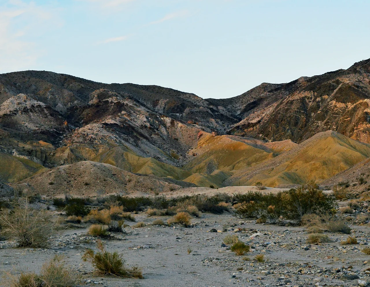
The Coyote Mountains owe their existence to tectonic uplift along the Elsinore Fault Zone, which runs through the western edge of the Imperial Valley. The fault's movement raised the Imperial Formation deposits — those marine sediments deposited between 6.3 and 4.3 million years ago — above the surrounding desert floor, creating a range that rises to 2,408 feet at Carrizo Mountain. The mountains are geologically recent in the sense that matters for understanding why they look the way they do: the uplift that exposed the ancient seabed to erosion is still active, still tilting the landscape, still creating the fault scarps and eroded badlands that characterize the range.
Fossils From an Inland Sea
The Imperial Formation preserves a remarkable record of the Pliocene marine environment that once occupied the Salton Trough. Marine fossils — shells, fish remains, invertebrate traces — erode from the Coyote Mountains' badland terrain, falling out of the sedimentary matrix that has held them for millions of years. The Imperial Formation represents a period when the Pacific Ocean connected to the Salton basin through a broad seaway, before the Colorado River's delta eventually isolated the northern portion and the trapped water evaporated to create the depression that is now the Salton Sea. The fossils in the Coyote Mountains are remnants of that connected marine world.
Painted Gorge
The Coyote Mountains contain Painted Gorge — a canyon where volcanic intrusions have produced rocks in colors that seem excessive for a desert landscape: reds, ochres, purples, greens, and the buff tones of the surrounding sediments mixing into a palette that rewards the visitor who makes the effort to reach it. The gorge's colors derive from the iron-bearing minerals in the volcanic rock and the chemical transformations that heat and pressure produced in the surrounding sediments. The contrast between the painted volcanic formations and the tan badlands that surround them makes Painted Gorge one of the more visually distinctive geological features in Imperial County.
The Imperial County Wilderness
The Coyote Mountains are designated wilderness within the Anza-Borrego Desert State Park's eastern extension into Imperial County. The wilderness designation protects the geological and paleontological resources from the kind of vehicular access that would accelerate erosion and fossil collection. The range is genuinely remote — the roads that approach it test vehicle capability, and the terrain itself discourages casual visitation. This remoteness has preserved the badlands and fossil beds from the intensive disturbance that more accessible geological sites typically experience.
Desert Topography in Miniature
At 12 miles long and 2 miles wide, the Coyote Mountains are a compact range, but they contain the full vocabulary of desert geology at manageable scale: fault scarps, badlands, volcanic features, marine sediments, and the alluvial fans that spread from the mountain flanks onto the desert floor. Carrizo Mountain, at 2,408 feet, offers views across the Imperial Valley to the east and the badland terrain of the Carrizo Gorge area to the west. The range sits between two significant geographic features — the Salton Sea basin to the north and the US-Mexico border to the south — making it a quiet landmark in a region better known for agricultural scale than for geological drama.
From the Air
The Coyote Mountains lie at approximately 32.81°N, 116.07°W in western Imperial County, a narrow east-west ridge about 12 miles long rising to Carrizo Mountain at 2,408 feet. From the air, the mountains are identifiable as a low but distinct range between the flat Imperial Valley to the east and the Anza-Borrego Desert terrain to the west. El Centro Regional Airport (KELN) is the nearest facility. The badland terrain of the Imperial Formation is visible from lower altitudes as eroded tan and ochre slopes along the mountain flanks.
Nearby Stories
- El Vallecito 5.3 km away
- Mesa Grande Band of Diegueno Mission Indians 5.6 km away
- Sycuan Band of the Kumeyaay Nation 11 km away
- The Slot at Anza-Borrego 12 km away
- Mount Signal Solar 12 km away
- Imperial Valley Geothermal Project 14 km away
- Laguna Salada 18 km away
- Tijuana: The Border City That Became Its Own Third Country 30 km away