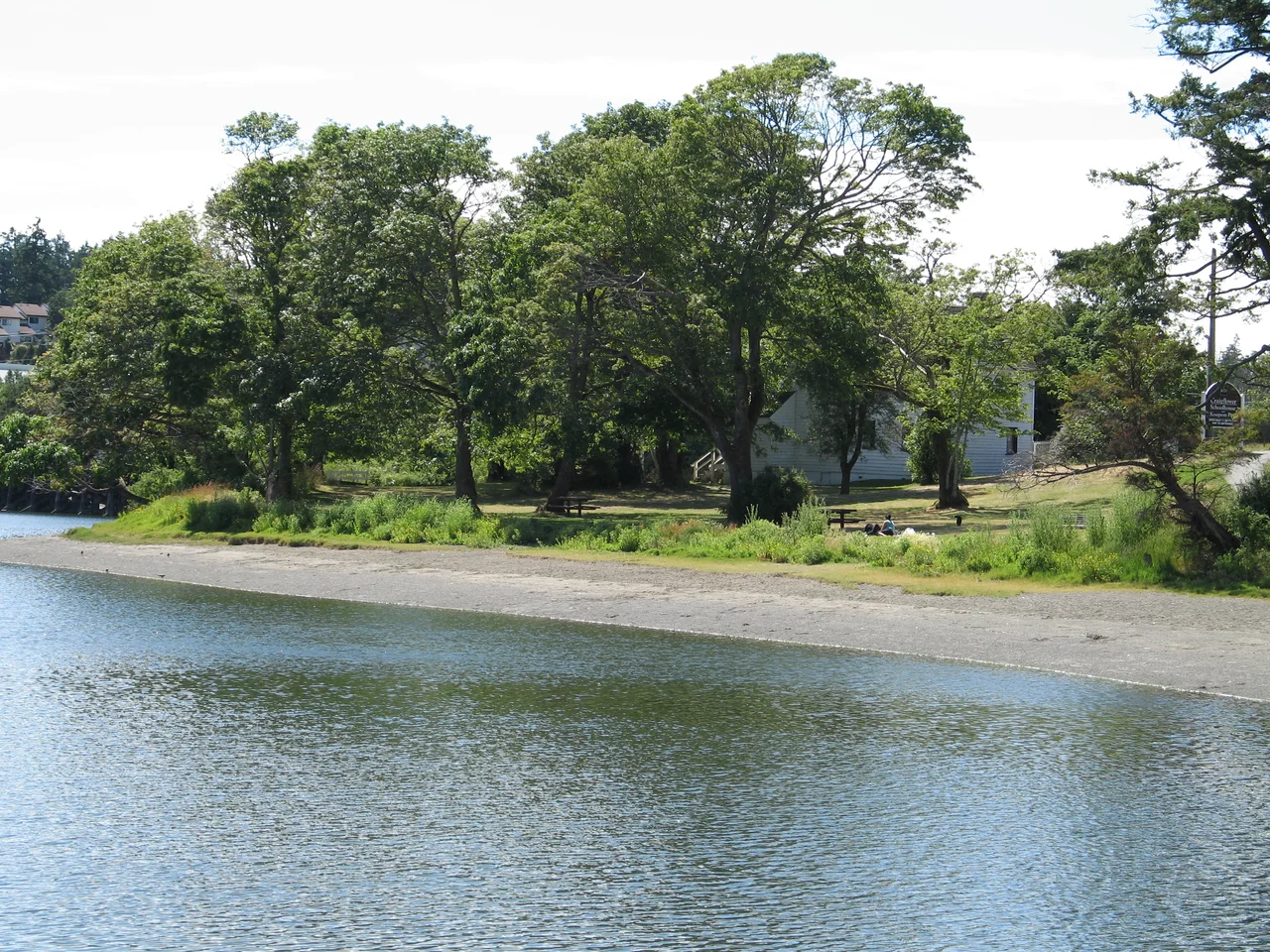

Craigflower Manor and Schoolhouse
On March 8, 1855, workers hung a ship's bell at the end of a new schoolhouse on the Gorge Waterway near Victoria. The bell had come off the steamer Major Tompkins, which had run aground off Macaulay Point and been picked apart by salvagers; the school bought it for ten pounds. Three days earlier, eight boys and six girls had walked in for the first day of classes. That bell called children to lessons in a building that still stands, and Craigflower Schoolhouse is now the oldest surviving schoolhouse in Western Canada.
Kosapsom
The ground here is much older than anything the Hudson's Bay Company built on it. Around 13,000 years ago, retreating glaciers gouged this landscape into a chain of lakes and streams that the sea eventually reclaimed, producing the saltwater inlet now called the Gorge Waterway. The Indigenous name for it is Kosapsom. Archaeologists working across the Gulf of Georgia have sorted the region's human past into distinct culture types, and the Craigflower site holds three of them - Locarno Beach, Gulf of Georgia, and Historic. The first two are legible mostly through a large shell midden, thousands of years of accumulated meals testifying to how much shellfish and game this shoreline offered. The oldest layer, Locarno Beach, left behind microblades, adzes, and other worked stone. In 1850 the Hudson's Bay Company obtained this land through a treaty with the Esquimalt people, recorded on the document as the Kosapsom, who relocated nearby - one of a series of agreements whose meaning the Crown and the signing nations would understand very differently for generations afterward.
A Scottish Name on a Colonial Farm
Craigflower Farm was an act of provisioning. The colony of Vancouver Island needed food, and the Hudson's Bay Company needed its employees fed, housed, and settled enough to stay. The farm took its name from the Craigflower Estate in Scotland, owned by Andrew Colville, who served as Governor of the Hudson's Bay Company from 1852 to 1856 - a transplanted label for a transplanted enterprise. Kenneth McKenzie arrived at Craigflower in early 1853 as the first farm director and bailiff, running the operation until his contract lapsed in 1861, with his wife Agnes and their large family. What grew up around him was a working agricultural community with all the ordinary needs of one, including somewhere to put the children.
"Growing Up in Ignorance"
McKenzie commissioned the schoolhouse, originally called Maple Point School, to educate the children of farm employees. It was the third school built in the colony, answering Governor James Douglas's call "to give a proper moral and religious training to the children of the settlers who are growing up in ignorance and the utter neglect of all their duties to God and society." The need was reckoned most urgent among Protestant families; Roman Catholic children had until 1851 received what the record calls "very able and zealous" instruction from a priest of the Oblates. Fees ran between thirty shillings and a pound. The two-storey Georgian Revival building held a single schoolroom downstairs and six rooms above for the teacher, the teacher's family, and boarding students sent in from elsewhere on Vancouver Island. A large brick fireplace and a stove fought the damp. Until the first Craigflower bridge was finished in 1856, the only way to reach the school from the rest of the farm was by boat.
The House Agnes Asked For
The manor went up shortly after the school, on the opposite bank, to serve as both residence and office for the farm's management. Agnes McKenzie asked that it be built as a Scottish manor house in the Georgian Revival manner, and it was: two storeys, dining room, sitting room, office, music room, kitchen, and four bedrooms, warmed by several fireplaces feeding two heavy brick chimneys. In the young colony it was said to be second only to the first Government House for elegance. It stayed in use as lodging until 1922, when the Hudson's Bay Company turned it into a community centre. Later it passed to Jean and Jerry Thompson, who restored the building and ran it first as a bed and breakfast and then as a museum, selling it to the government in 1965 - a rescue without which one of the earliest surviving buildings of its kind in Western Canada would likely be gone.
Two Hundred Metres Apart
The manor stands in View Royal and the schoolhouse in Saanich, separated by 200 metres of water and joined by the Craigflower Bridge. Both are National Historic Sites of Canada. They have stayed useful in a way that historic buildings often do not: the schoolhouse is cared for by the Capital Regional District's oldest heritage preservation organization and opens for presentations in summer, while the manor has been leased to a Highland Games society. Standing on the bridge between them, you can see the whole arrangement at once - the schoolhouse on one shore, the manor on the other, the tidal water moving between them the way it did when the only crossing was a rowboat.
From the Air
Craigflower Manor and Schoolhouse sit at 48.4526°N, 123.4220°W, just northwest of downtown Victoria on Vancouver Island. Navigate by water: the Gorge Waterway is the narrow tidal inlet running inland from Victoria's Inner Harbour, and the two sites face each other across it where the Craigflower Bridge crosses, with Portage Inlet widening immediately upstream. Esquimalt Harbour and the naval base lie a short distance west, and the Victoria waterfront with its Parliament buildings and Empress Hotel marks the southeast. Recommended viewing altitude is 2,000-3,500 ft MSL for the waterway and bridge detail, or 6,000 ft to frame Greater Victoria against the Strait of Juan de Fuca and the Olympic Mountains beyond. Victoria International (CYYJ) is roughly 12 nm north; Victoria Inner Harbour Water Aerodrome (CYWH) is about 3 nm southeast. Expect morning marine fog in the strait during late summer and autumn; otherwise this is among the driest and clearest corners of coastal British Columbia.
Nearby Stories
- Arbutus Ridge, Cowichan Valley 2.5 km away
- San Juan Island National Historical Park 4.5 km away
- Eastsound 11 km away
- Juan de Fuca Marine Trail 11 km away
- Mesachie Lake 13 km away
- Sappho, Washington 17 km away
- Spruce Railroad Trail 19 km away
- Port Townsend 22 km away
Sources
- Craigflower Manor and Schoolhouse - Wikipedia
- Craigflower Manor and Schoolhouse - Wikipedia (fact cross-check)
- Craigflower Schoolhouse History to 1958 - Hallmark Heritage Society
- Craigflower Farm - Times Colonist Islander, September 5 1993 (Hallmark Heritage Society archive)
- Colonial Schoolmasters at Craigflower - Hallmark Heritage Society