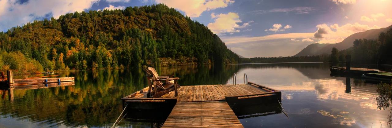

Mesachie Lake
Somebody named this place evil and it stuck. Mesachie comes from Chinook Jargon, the Pacific coast trade language, and it is not a mild word - where cultus meant merely bad, mesachie meant vile, rotten, wicked. Nobody today can say for certain what earned the lake the label. What is certain is that in 1942, a lumber company chose the shore of a lake called Evil to build a town for its workers and their families, and that the town is still here, eighty-odd years later, long after the mill fell silent.
Houses That Came by Rail
The Hillcrest Lumber Company had spent a quarter century at Sahtlam, near Duncan, and by 1942 the timber around it was gone. So the company moved - not just the machinery, but the town. Workers' houses at Sahtlam were cut into sections, loaded onto rail cars, hauled west to the south shore of Cowichan Lake, and bolted back together on new ground. Walk Mesachie Lake today and most of what you see still contains some part of those original buildings. The mill's machinery made the same journey and cut its first lumber here in August 1943. Company towns usually get built from scratch; this one was carried in, piece by piece, and reassembled like a model kit.
The Mill That Powered the Neighbours
What went up at Mesachie Lake was not a relocated relic but something new. The mill was redesigned from the ground up, with more efficient modern equipment, and it came with a powerhouse of its own. Those generators produced more electricity than the mill and the townsite needed, and the surplus had somewhere useful to go: when the village of Lake Cowichan's plant overloaded or broke down, Mesachie Lake carried its neighbour. The operation belonged to the Stone family, and Carlton Stone ran it until his death on October 10, 1950 - one day short of his seventy-third birthday. His sons took over the pieces: Hector as president and general manager, Gordon running the mill, Peter as assistant manager, Paul over mechanical affairs.
The Gurdwara by the Sawmill
Mesachie Lake is one of several Cowichan Valley towns with more than a century of South Asian Canadian history, most of it Sikh, most of it written in sawdust. Punjabi men came to Vancouver Island's mills in the early 1900s, at a time when Canadian law and public sentiment worked hard to keep them out and harder to keep them from bringing their families. They stayed anyway, and they became central to the industry - a presence that lasted into the 1980s. The Stone family built a gurdwara for their Sikh workers in the mid-1930s, and it served the community as long as the company did. When Hillcrest ceased operations in 1968, the gurdwara closed too. The faith did not leave the valley; the workplace that had gathered it simply ended.
After the Whistle
Hillcrest shut down in 1968 for the same reason it had left Sahtlam - it could no longer secure enough timber. The mill site was sold. Camp Imadene bought the old Hillcrest ground in 1982 and moved its camp onto it about a decade later. Most company towns do not outlive their company, but Mesachie Lake did, converting itself quietly into an ordinary place. The old Hillcrest office is somebody's house now, as are all the workers' homes. The school and the church went to Lake Cowichan. What stayed is a post office, a public boat launch, a community hall that keeps a calendar, and the Mesachie Skydome, which fills with ball tournaments. The company also planted fruit and shade trees here, species that were never native to this coast; those trees now hold heritage status, an orchard's worth of evidence that someone once intended this to be a home rather than a camp.
From the Air
Mesachie Lake lies at 48.8084°N, 124.1240°W, on the south shore of Cowichan Lake in the interior of southern Vancouver Island. Cowichan Lake is the navigational anchor - a long, narrow, roughly east-west body of water about 30 km end to end, unmistakable against the surrounding logged and regrowing hills. The community sits near its southeastern end, just west of the village of Lake Cowichan, with the Cowichan River draining east toward Duncan and the Strait of Georgia. Recommended viewing altitude is 3,000-4,500 ft MSL to read the townsite, the lake shore, and the checkerboard of cutblocks that explain the town's existence; 8,000 ft frames the lake against the Saanich Peninsula and the Olympic Mountains beyond. Nanaimo (CYCD) is roughly 18 nm northeast, Victoria International (CYYJ) about 29 nm southeast, and the small Duncan Airport (CAM3) sits about 15 nm east. Expect valley fog on autumn mornings and low cloud pinned against the hills through the winter rains; summer afternoons are typically clear with good visibility down the length of the lake.
Nearby Stories
- Sombrio Beach 2.5 km away
- Cowichan Tribes 3 km away
- Leechtown, British Columbia 4.3 km away
- Alberni Inlet 4.6 km away
- Ruxton Island 5.1 km away
- West Coast Trail 13 km away
- Mount Arrowsmith Biosphere Region 16 km away
- SS Pacific (1850) 21 km away