
Cresta del Gallo
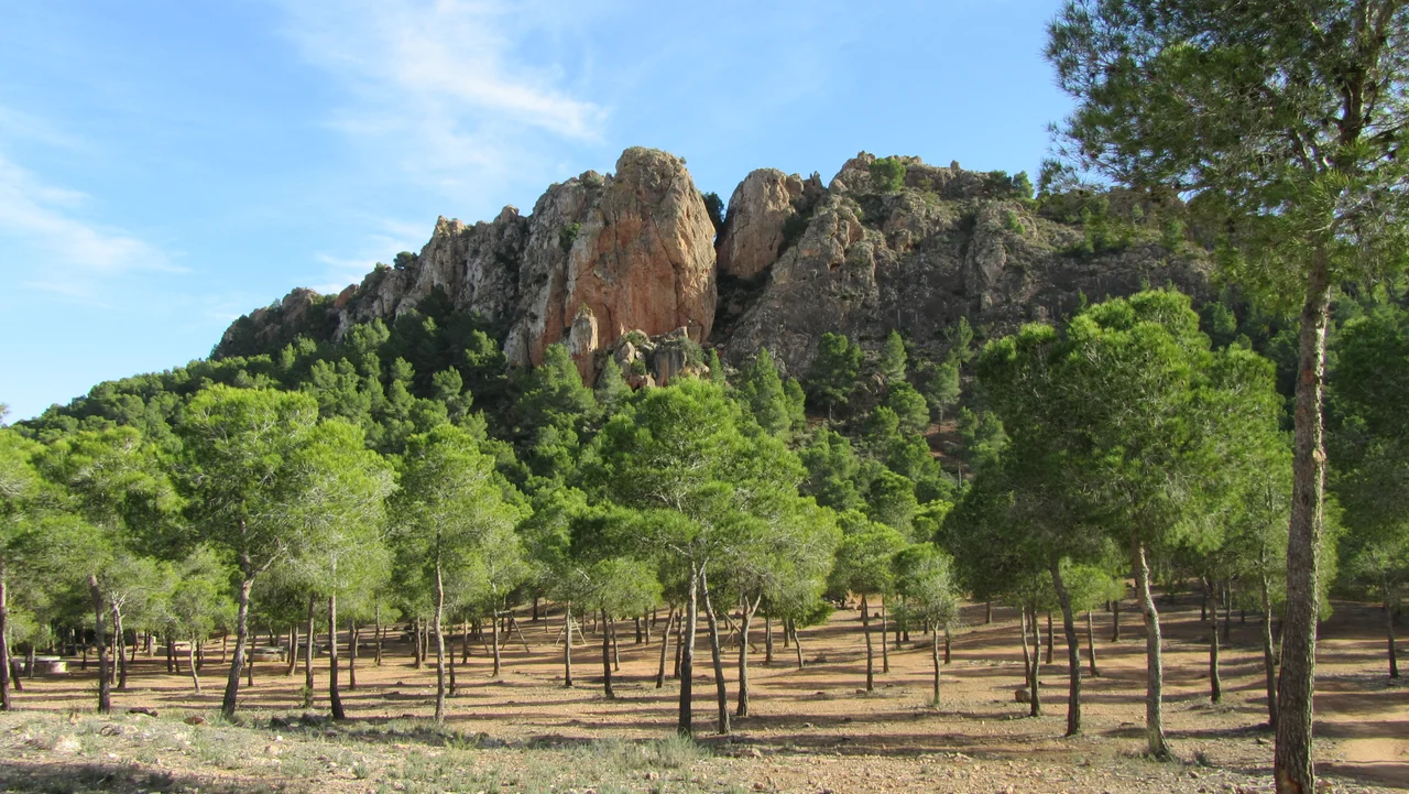
Look south from the streets of Murcia as the sun drops toward the horizon, and a long spine of rock along the skyline catches fire, glowing the color of embers. Generations of locals settled on what it resembled - the jagged red comb of a rooster thrown back mid-crow. This is the Cresta del Gallo, the Rooster's Crest, a 523-meter ridge of reddish stone that walls off the southern edge of the city and marks where the fertile Huerta de Murcia gives way to the drier country of the Campo de Cartagena.
The Comb and the Corn Cob
The name lives at the summit, where clusters of large reddish rocks jut up like the serrated crest of a rooster. One of them stands apart from the rest. Locals call it La Panocha - the corn cob - because its swollen, ribbed profile reminded them of an ear of maize. It is a true monolith, its sheer northern face dropping fifty-five meters, climbable only by rope and fingertip. At dusk the stone flushes a deep red that carries clear across the huerta and into the windows of Murcia itself. La Panocha is not even the range's high point; that distinction belongs to El Relojero, at 605 meters. Yet no other rock here is so instantly known. Ask anyone in the valley to point out the Cresta del Gallo, and their finger finds the corn cob first.
A Classroom of Vertical Rock
Few places in the region have taught more people to climb. An outdoor climbing school works among these crags, and on weekends the red walls fill with ropes, chalk dust, and the scrape of rubber soles hunting for holds. Walkers have an easier time of it. Trails fan out from a recreational area stocked with picnic tables and parking, leading up to the Relojero viewpoint and across a pale, cratered expanse that locals nicknamed the Lunar Landscape. Road cyclists come seeking a different reward. The paved climb over the ridge runs about six kilometers of tightening switchbacks, and it has featured as a category-two ascent in the Vuelta a Murcia, where professionals grind past hikers and picnicking families on the same red slope.
A View to the Small Sea
Reach the top on a clear day, and the reward reaches far past the rooftops. To the south and east, beyond the dry folds of the Campo de Cartagena, the Mar Menor glints into view - Europe's largest coastal lagoon, some forty kilometers off, a pale sheet of shallow water held between the mainland and the open sea. The Cresta del Gallo is really the northern flourish of the Sierra de Carrascoy, and the two ranges together anchor the Regional Park of Carrascoy and El Valle, a green band of pine and scrub that screens the city from the arid land beyond.
A Ridge Held in Trust
Spain recognized this landscape early. On the seventh of April 1931, by Royal Order 59/1931, the Cresta del Gallo was declared a natural site of national interest, a protection older than most of the country's parks. Three time-worn routes still climb toward the crest. One sets off from Beniajan, threading past the former estates of La Tana; a second leaves Algezares along the old pilgrim road up to the Sanctuary of Our Lady of Fuensanta; a third climbs from La Alberca through the wooded hollow of El Valle. Every one of them ends beneath the same fiery skyline that has watched over Murcia for as long as the city has thought to look up.
From the Air
The Cresta del Gallo rises at roughly 37.96 N, 1.07 W, a red rock crest immediately south of the city of Murcia. From 3,000 to 4,000 feet AGL the ridge and its standout monolith, La Panocha, read clearly against the paler farmland of the huerta, especially near sunset when the stone glows red. The Sierra de Carrascoy extends to the southwest, and the Mar Menor lagoon lies about 40 km southeast as a navigation reference. Nearest airport is Region de Murcia International (Corvera, LEMI), roughly 20 km southwest; Murcia-San Javier (LELC) sits on the coast to the southeast, and Alicante-Elche (LEAL) is about 60 km northeast. Skies here are clear on most days, though afternoon thermals and mountain turbulence can build over the ridge in summer.
Nearby Stories
- Phoenician shipwrecks of Mazarrón 7.2 km away
- Kingdom of Murcia 9.9 km away
- Torrevieja 11 km away
- Elche Palm Sunday Procession 14 km away
- Battle of Cape Palos (1758) 79 km away
- Cabo de Gata-Nijar Natural Park 98 km away
- Alcazaba of Almería 132 km away
- Battle of Las Navas de Tolosa 158 km away