.jpg)
Torrevieja
The name is a confession of how little was once here. Torrevieja means "old tower," and that is literally all this stretch of the Costa Blanca amounted to for centuries: a lone watchtower on an empty shore, one link in the chain of lookouts strung along the Valencian coast to warn of raiders coming off the sea. Only in the early eighteenth century did a fishing village gather around it. Three hundred years later that village has swollen into a city of nearly one hundred thousand people and one of the fastest-growing towns in all of Spain, its streets crowded each summer with holidaymakers from across Europe. The tower gave the place its name; salt and sun gave it everything else.
From a Lonely Watchtower
Torrevieja is young by Spanish standards. While inland towns like Villena and Elche count their history in millennia, this stretch of coast held little more than a defensive tower and open scrub until the 1700s. The first real settlement was a modest fishing village, its people drawn by two things the sea offered: fish and salt. That late start shows in the town's character. There is no medieval old quarter of tangled lanes here, no cathedral rising over a Roman street grid. Torrevieja is a working coastal town that became a resort, and it wears its newness openly, all seafront promenades, marina masts, and apartment blocks stacked toward the water.
The Lakes That Turn Pink
The real wealth was never in the harbor but behind it. Torrevieja sits between two great salt lagoons, now protected as a natural park, that have been worked for their salt for generations and rank among the most productive salt operations in Europe. One of them, the Laguna de Torrevieja, is famous for turning a startling shade of pink, its water dyed rose by salt-loving microorganisms until it looks less like a lake than a spill of strawberry milk against the blue Mediterranean. This salt did more than season food. In earlier centuries it filled the holds of ships bound for Cuba, and the sailors who made that crossing carried home the habanera, the Caribbean song that Torrevieja adopted so completely it now hosts the world's leading contest in the genre.
Twenty Kilometers of Coast
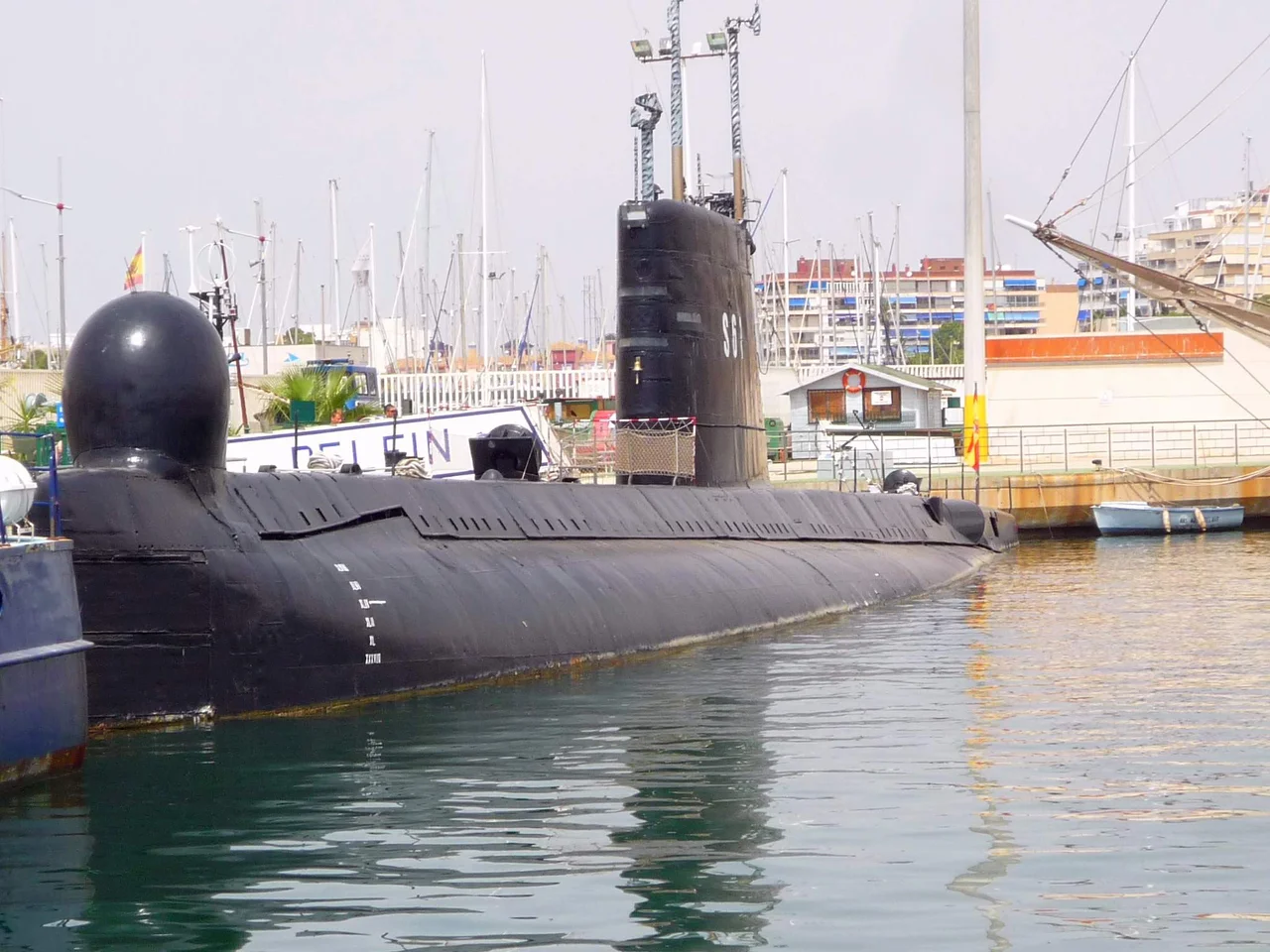
For most visitors, though, the draw is simpler: the shoreline. Torrevieja commands roughly twenty kilometers of coast, with six broad beaches, La Mata, Cabo Cervera, Los Locos, El Cura, Los Náufragos, and Ferris, strung between some twenty smaller coves where low cliffs give way to clear water. Small sightseeing boats slip out of the marina to run the coastline, and a few make for Tabarca, the little island off the coast toward Alicante. The town keeps a floating museum in its harbor as well, where visitors can climb down into the retired Spanish submarine Delfín, a rare chance to stand inside a real warship at rest on the water.
A Town of Many Passports
Tourism remade Torrevieja, and the change is visible in its streets and in its languages. So many Spaniards and other Europeans have bought holiday homes here that the town supports its own English-language newspapers, radio, and television, and the satellite districts of La Zenia and Playa Flamenca hum with bars and restaurants that hire English-speaking staff for the summer rush. That success has its shadows, from clever pickpockets working the busy Friday market to the scramble for a parking space in high season. But the essential trade-off suits the place. A town that began as a single tower watching an empty sea now watches over a crowd from half the countries of Europe, all of them come for the same salt-scented light.
From the Air
Torrevieja lies at 37.978°N, 0.683°W on the southern Costa Blanca, in the Vega Baja district of Alicante province. Its defining aerial feature is the pair of salt lagoons directly inland: the often rose-pink Laguna de Torrevieja and, to its north, the greener Laguna de La Mata, both fringed by rectangular salt-evaporation basins. The town's marina, seafront, and the long line of its beaches trace the coast between Guardamar to the north and Cabo Roig to the south, with the island of Tabarca visible offshore toward Alicante. Recommended viewing altitude 3,000-6,000 ft AGL to frame the pink lagoon beside the town and sea. Nearest airports are Alicante-Elche (LEAL), about 40 km north, and Región de Murcia International (LEMI), about 25 km south. The lagoon's pink hue reads most vividly under strong midday sun; coastal haze can build on humid afternoons.
Nearby Stories
- Murder of Miquel Grau 4.2 km away
- Fonda Milagros Nightclub Fire 8.8 km away
- Bajo de la Campana Phoenician Shipwreck 16 km away
- Battle of Helike 21 km away
- Mazarrón 31 km away
- Penyal d'Ifac Natural Park 36 km away
- La Muralla Roja 65 km away
- Battle of Mazagran 211 km away