
Mazarrón
Some of the oldest boats in the Mediterranean were lifted from the shallows off a Mazarrón beach - not warships or treasure galleons, but the working craft of Phoenician traders who plied this coast nearly three thousand years ago. Near the Playa de la Isla, divers found two hulls that sand and seawater had quietly preserved. One, named Mazarrón I, survives only as a keel and a scatter of timbers. The other, Mazarrón II, came up almost whole, its wooden ribs still holding the curve its builders gave them. To stand where they were raised is to feel how shallow the water really is between the ancient world and this one.
The Boats in the Shallows
Those two hulls, held to be the most ancient Phoenician vessels ever found in the Mediterranean, turned Mazarrón into one of the most important addresses in underwater archaeology - and they are only the opening line of the story the seabed tells here. The ancients knew this shore as Ficaria. The Romans who came after the Phoenicians prized it for a very specific reason: fish. In factories along the coast they brewed garum, the pungent fermented-fish sauce that seasoned tables across the empire, made from the entrails of mackerel and left to ripen in the sun. One of their salting works survives, its stone tanks now the heart of a museum. Long before anyone came for the beaches, this was a coast that shipped flavor to Rome.
A Sierra Full of Ore
People have clustered on these hills far longer than that - the Cabezo del Plomo, a fortified cluster of round stone huts, dates to the late Neolithic. Behind the bay rise the last foothills of the Sierra de la Almenara, and their mines were being worked as far back as the Carthaginians. Lead, silver, alum: the mountains gave up their minerals age after age, but the great fever came in the nineteenth century. Mining peaked in the 1840s and remade the town almost overnight. Money and migrants poured in, the streets got electric lamps, the region got railways, and the miners got a hospital of their own. The new wealth built landmarks in the ornate style known as Murcian Modernism, among them the town hall and the old Cultural Athenaeum. It was hard and often dangerous work underground, and its rewards were never evenly shared, but it dragged Mazarrón into the modern age.
Towers Against the Corsairs
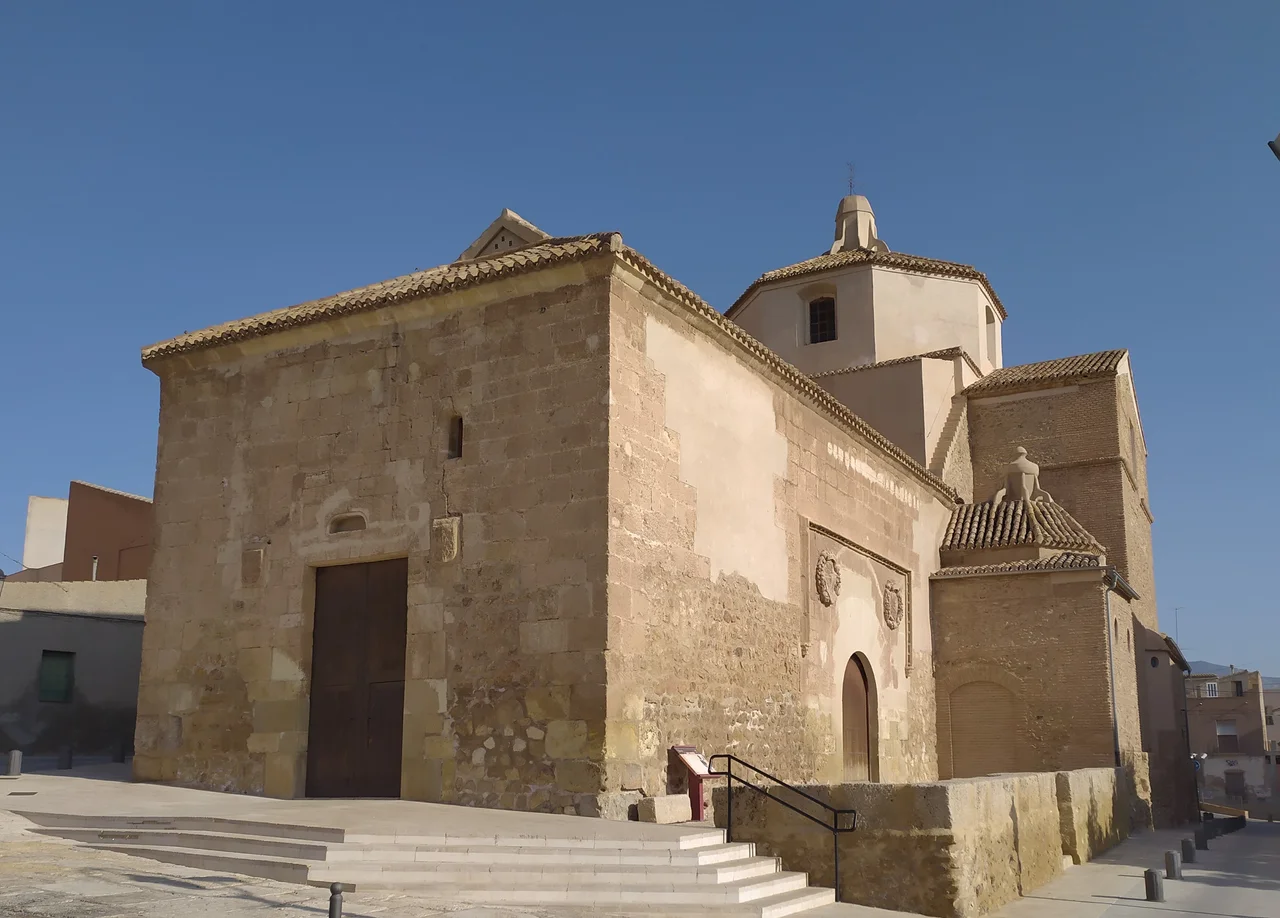
For centuries the sea brought danger as readily as trade. Berber corsairs raided this coast, and Mazarrón answered them in stone. Watchtowers still stand along the shore - the Torre de los Caballos, raised against pirates and manned from the mid-sixteenth to the early eighteenth century, and the Santa Isabel Tower guarding Puerto de Mazarrón. In the town itself, the round Molinete Tower has watched the rooftops since 1490, near the hilltop Vélez Castle. When King Philip II granted Mazarrón the status of villa in 1572, he confirmed what the towers already implied: this was a place worth defending. The church of San Andrés, built between 1523 and 1549, still carries Mudéjar woodwork beneath its later Baroque skin.
The Night the Village Brays
Mazarrón keeps a calendar crowded with saints and celebrations. Its patron festival honors the Immaculate Conception each December, filling the days from the 4th to the 8th with parades, floats, and neighborhood clubs that plan the whole thing a year in advance. But the strangest and most beloved tradition belongs to the hamlet of Las Balsicas, on the 28th of December. There, villagers become rebuznadores - 'brayers' - dressing the part and filling the streets with the unmistakable sound of donkeys. It is affectionate and self-mocking, the kind of ritual that endures because a small community simply decided it was theirs. Down the coast at Bolnuevo, the coarse-grit beaches draw the summer crowds, while inland the greenhouses ship tomatoes and cucumbers to markets far beyond Murcia.
From the Air
Mazarrón sits at 37.598 N, 1.314 W on the Murcian coast, where the Sierra de la Almenara meets the Mediterranean. From 3,000-5,000 ft the sheltered Bay of Mazarrón, the coarse-sand beaches toward Bolnuevo, and the hilltop Vélez Castle make clear visual references, the town tucked between low coastal ranges and the sea. Nearest airport is Región de Murcia International (Corvera, ICAO LEMI) inland to the northwest; the military field at San Javier (LELC) lies northeast along the coast, with Alicante-Elche (LEAL) farther up the shore. Clear, dry summer air gives long slant-range visibility over the water.
Nearby Stories
- Battle of Cape Palos (1815) 11 km away
- Sanctuary of Our Lady of Fuensanta 19 km away
- Torrevieja 21 km away
- German submarine U-573 36 km away
- Battle of Cape Palos (1758) 42 km away
- Cabo de Gata-Nijar Natural Park 62 km away
- Almería Cathedral 99 km away
- Battle of Las Navas de Tolosa 168 km away