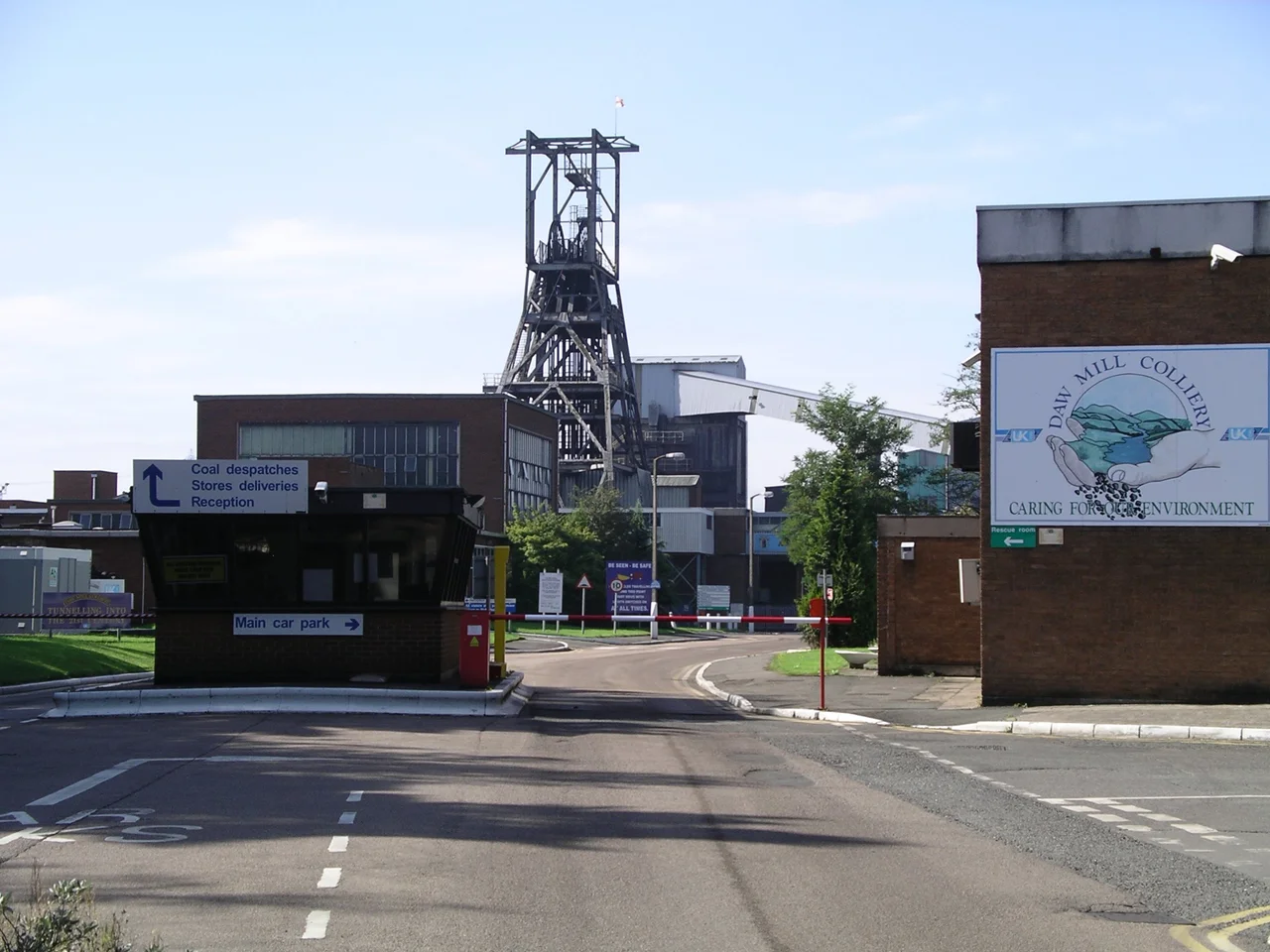

Daw Mill
At 12:34 on the afternoon of 22 February 2013, smoke began rising from a section of Daw Mill's underground roadway 500 metres below the Warwickshire fields. Within hours the colliery's emergency procedures had brought 92 workers safely back to the surface. None were lost. The fire below, however, could not be put out. It became the worst underground blaze in Britain for thirty years, and what it killed was not the workforce but the mine itself: the last coal mine in a county that had once worked twenty of them, and in 2008 the most productive single coal producer Britain had ever seen.
The Warwickshire Thick
Daw Mill worked a single seam, five metres of bituminous coal known to geologists as the Warwickshire Thick. The thickness mattered. A face that high meant that mechanised longwall mining could shear out enormous tonnages every week, and the mine's two shafts, sunk between 1956 and 1959 and again between 1969 and 1971, fed a colliery designed for industrial-scale extraction from the start. The pit was a natural successor to the older Kingsbury and Dexter collieries nearby; their workings reached toward the same coal Daw Mill would eventually take. The breakthrough came in 1983 with the completion of an inclined drift tunnel from the surface to the underground workings. Coal could now ride a conveyor straight out of the ground instead of waiting for a cage. The economics shifted, and the production curve steepened.
Record-Breaking
In 2008, employing 680 people, Daw Mill produced 3.25 million tonnes of coal in a single year. The figure broke a thirteen-year-old British record set at Selby in North Yorkshire, and made Daw Mill the country's biggest coal producer. The achievement was small consolation for a company and a country whose coal industry had collapsed almost entirely over the previous two decades. UK Coal, which owned and operated the mine, was carrying losses on its non-mining property portfolio and looking for any way to keep its remaining pits viable. Daw Mill's output was held up as proof that British deep mining could still compete. The Coal Authority warned in 2012 that High Speed 2 might force the mine to close because of the impact of the rail line on local groundworks. As it turned out, HS2 was not the threat that ended Daw Mill.
The Fire Below
When fire broke out on 22 February 2013, the 92 men working underground evacuated by the planned routes. The blaze, however, was burning in a coal seam itself, and a coal-seam fire is essentially uncontrollable once it has the run of a working face. Smoke filled the workings. Sealing one panel only pushed heat into the next. Two weeks of trying ended on 7 March, when UK Coal announced that Daw Mill would close. Almost 650 jobs went. UK Coal slid into insolvency four months later. The mine that had produced more coal in a year than any other in British history had taken less than a fortnight to lose. Twenty workers had died at Daw Mill over its working life in earlier accidents; the 2013 fire killed none of them, but it killed the colliery that had employed them.
Restored to Green Field
After the insolvency, the site passed to property developer Harworth Estates, who proposed converting it to a business park with an HGV depot. North Warwickshire residents and councillors objected to the traffic the scheme would generate, and the application was withdrawn in October 2014. A second application followed, smaller, with a low-level rail hub built into it. The Highways Department of Warwickshire County Council swung from opposition to support; local MP Craig Tracey wrote demanding they reverse their position; in November 2015 the borough council's planning committee unanimously rejected the plans for substantial harm to the local green belt. Harworth appealed, and in 2018 the Court of Appeal ruled that there could be no further appeals, and that the land must be returned to green field within the green belt. The deep coal is still there, the seam still ablaze in places, smouldering in voids that will never be reopened. Above it, the fields are coming back.
From the Air
Located at 52.5064°N, 1.6178°W near the village of Arley, north of Coventry and west of Nuneaton. Best viewed from 1,500 to 3,000 feet above ground level. The site reads today as fields and woodland with the geometric traces of former colliery roads, the rail siding, and the levelled spoil heap still visible against the surrounding farmland. Birmingham Airport (EGBB) lies 10 miles to the south-west; Coventry Airport (EGBE) is 9 miles to the south-east. The Coventry-Nuneaton railway runs north-south just east of the site; the M42 sits 3 miles to the west.
Nearby Stories
- Round Oak Steelworks 1.7 km away
- RAF Gaydon 6.6 km away
- Ashby-de-la-Zouch 7.3 km away
- Battle of Naseby 7.3 km away
- Stafford Castle 7.5 km away
- Siege of Worcester (1646) 7.8 km away
- Asfordby Colliery 9.7 km away
- Silverstone Circuit 15 km away