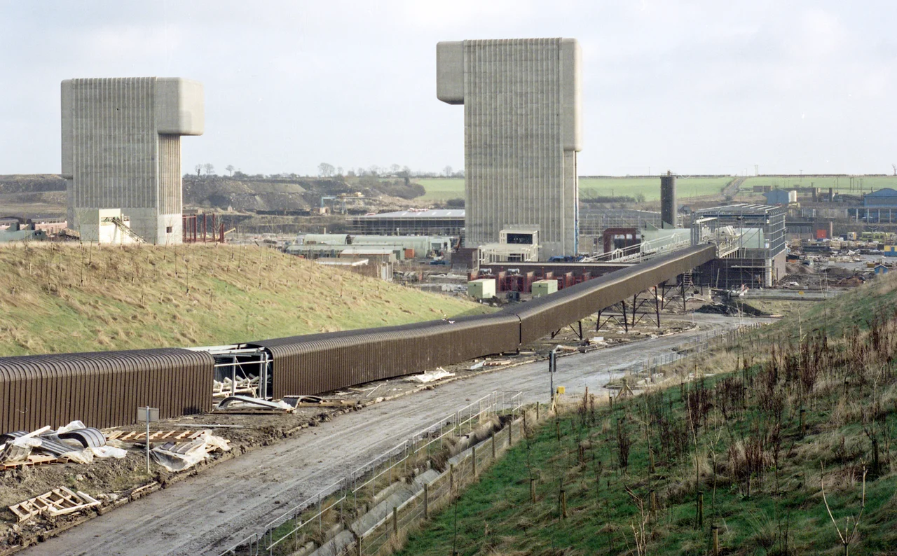

Asfordby Colliery
Half a billion tonnes of mineable coal still sits beneath the Leicestershire countryside near Melton Mowbray. It will never be brought to the surface. The story of why ends in a flooded shaft, a £6 million pile of ruined equipment, and a small village that learned the strange grief of losing a mine that had never quite started working. Asfordby Colliery was meant to be the future of British coal. Instead, it became its last expensive footnote.
The Last Super-Pit
In the 1980s, Michael Heseltine - then Secretary of State for the Environment under Margaret Thatcher's government - proposed three new 'super-pits' designed to keep British deep mining viable for another generation. Two were blocked, mostly by objections to building heavy industry in unspoiled countryside. Only Asfordby went ahead, and only because the site at the edge of the Vale of Belvoir was already industrial, with a rail connection a short walk away. Physical construction began in 1987. Two shafts were sunk over 1,500 feet down into the coal measures. First coal left the mine by train in 1991. British Coal invested more than £300 million in the project. At peak it employed 490 people, most of them brought in from pit villages elsewhere whose own mines had already closed - the displaced workforce of an industry already shrinking, given one last place to go.
The Geology That Killed It
Above the coal seams, the geologists found something the surveys had underestimated: thick volcanic sills, layers of igneous rock intruded into the sedimentary strata millions of years ago. These rocks were heavier than expected, and they pressed down on the seams below in ways the mine's structural engineers could not safely contain. As the workings extended, the strata above shifted under their own weight. The end came suddenly. In August 1997, just before British Coal's successor RJB Mining was due to make a final decision, a massive flood and rockfall tore through the workings and destroyed £6 million worth of mining equipment. Production had effectively ceased anyway. Closure was announced within days. Around 500 million tonnes of mineable coal were left in the seams, unreachable.
A Pit Without a Pit Village
Asfordby was a strange place to lose. The traditional rhythm of British colliery closure - a whole village losing its livelihood, generations of mining families cut adrift in a single week - did not quite apply here. Most of the men who worked at Asfordby were not from the village. They had come from earlier closures elsewhere, commuting in from the older coalfields of Nottinghamshire and Yorkshire, taking what they understood would be the last deep-mine jobs of their careers. When the closure notice came, locals lamented the loss, but the miners and the wider community both said the same thing aloud: this would not be like Easington, or Markham, or any of the pit villages whose communities had been built around a single shaft for a century. The grief was real, and so was the dislocation - but it was distributed across many places at once, and that made it harder to see.
What Remains
The two winding towers were demolished in 1998. The site reopened as a business park. In 2007, part of the complex became a rail test centre, taking advantage of a 14-mile test track that had been built nearby; a spur from the test track was already connected to the old mine, an inheritance of the colliery's freight infrastructure. Other proposals have come and gone over the years - a wind farm, an anaerobic digestion plant. The mining historians Martin Weiss and Tom Leafe, writing in Coal Mines Remembered, called Asfordby 'one of the country's biggest-ever state-led misjudgements', a £400 million folly representing 'a final fling for the 20th century coal industry'. The volcanic sills are still there. So is the coal beneath them. And the locals who watched the towers come down still remember the brief years when their village was supposed to be the future.
From the Air
Asfordby Colliery's former site is at 52.774 N, 0.926 W, on the edge of the village of Asfordby about 2 nm west of Melton Mowbray in Leicestershire. From the air the site reads as a flat industrial estate surrounded by farmland, with the parallel lines of the adjacent rail test track visible to the east - the test track is the most distinctive nearby landmark. Recommended viewing altitude is 1,500-3,000 ft AGL. East Midlands Airport (EGNX) lies about 18 nm west-north-west, and Cottesmore (former RAF, EGXJ) about 13 nm east-south-east. The market town of Melton Mowbray itself, famous for pork pies and Stilton cheese, lies 2 nm to the east and provides easy navigational reference.
Nearby Stories
- Calke Abbey 4.2 km away
- Nuneaton Rail Crash 5.3 km away
- National Tramway Museum 5.4 km away
- Rockingham, Northamptonshire 12 km away
- Nottinghamshire 12 km away
- RAF Coningsby 12 km away
- Spalding War Memorial 14 km away
- Connington South Rail Crash 15 km away