.jpg)
Derwentwater
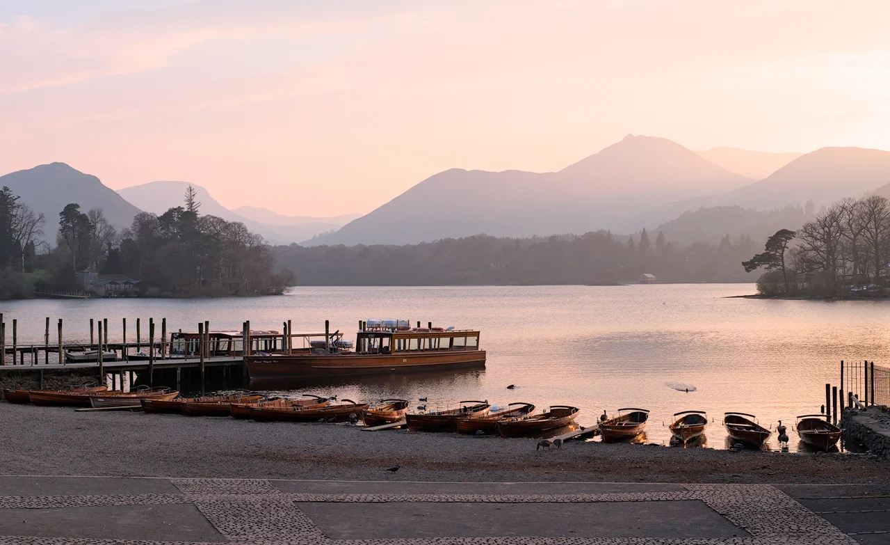
Look at any postcard of Derwentwater - taken from Catbells perhaps, or from Friar's Crag on the Keswick shore - and you are looking at one of the most photographed views in England. The Brythonic Celts who named the river that fills it called it the river with oak trees. Five thousand years later, in our age of glossy tourism, location scouts have decided it can be almost any lake, anywhere. The video game Silent Hill 2 used Derwentwater as the eerie panorama at its opening menu. Forza Horizon 4 borrowed it for a racing track. And in 2015, J. J. Abrams chose its wooded shoreline to stand in for the planet Takodana in Star Wars: The Force Awakens. The real Derwentwater is more cheerful than any of those cameos suggest.
The Third Lake
Derwentwater is the third-largest of the Lake District's lakes by area, after Windermere and Ullswater - 4.6 kilometres long, 1.91 wide at its broadest, covering 5.4 square kilometres. It is fed and drained by the River Derwent, which arrives down the valley of Borrowdale from the highest peaks in England, runs through the lake from south to north, and then flows on into Bassenthwaite Lake before reaching the Irish Sea at Workington. The fells around the lake - Catbells on the west, Skiddaw to the north, Walla Crag and the wooded slopes of Lord's Seat - are mostly forested on their lower flanks, which is unusual for the Lake District. Most of the region's lakes sit in open valleys of grass and bracken. Derwentwater's wooded shores give it a softer, almost alpine character. The Friar's Crag viewpoint near Keswick is sometimes called the loveliest in the Lake District. Few people who have seen it argue.
Seven Islands and a Hermit
Seven named islands sit in the lake. Derwent Island, the largest, has the only inhabited house on any island in the Lake District - a curious Italianate villa, built in the late 18th century by a tin-mine speculator named Joseph Pocklington, who used to fire cannons across the water at staged mock-naval battles. Lord's Island once held a fortified house belonging to the Earls of Derwentwater. Rampsholme, Otterbield, Park Neb and Otter Island are smaller and wooded. The last - the most quietly remarkable - is St Herbert's Island, named after a seventh-century hermit. Herbert of Derwentwater was a friend of St Cuthbert of Lindisfarne. He chose this island as his cell because he wanted solitude, and prayed to die on the same day as Cuthbert, his beloved teacher. According to Bede, on 20 March 687 both men died on the same day, in the same hour. The island is empty now, except for trees and the occasional visiting kayak.
Vendace and Pigmyweed
Derwentwater used to be one of only four lakes in Britain home to the vendace, a small whitefish that has lived here since the last ice age. For a worried period between 2008 and 2014, conservationists believed it had gone extinct in its native range entirely - the Bassenthwaite population had crashed, the Scottish populations at Lochmaben had vanished, and Derwentwater was thought to be the last refuge. Then in September 2014 a breeding population was rediscovered at Bassenthwaite, having quietly survived the alarm. The fish is still in serious trouble - sensitive to warm water, low oxygen, and habitat damage - but it is not yet lost. The lake faces a different invader too: New Zealand Pigmyweed, a stubborn aquatic plant that smothers native vegetation and chokes shallow margins. It is everywhere now, in lakes across Britain, and nobody has worked out how to remove it without doing more damage than the weed itself.
A Working Lake
A passenger launch runs around Derwentwater throughout the year, calling at seven landing stages - Keswick, Portinscale, Hawes End, Low Brandelhow, High Brandelhow, Lodore and Ashness Gate. The full loop takes about an hour. You can buy a single-direction ticket and walk back along the shore. The Keswick-to-Borrowdale road skirts the eastern shore; a quieter unclassified lane traces the west, threading the villages of Portinscale and Grange. Recreational walking is the lake's main economy - guidebooks, hiking boots, fish-and-chip suppers, B&Bs. The southern end is the touristic gateway to Borrowdale and to the high fells beyond. The northern end is Keswick, the market town that pencil-graphite built, and the practical hub for almost every walker who comes to this corner of the Lake District.
Names and Stories
The word Derwent comes from a Brythonic Celtic root meaning oak, the same root that gave England the rivers Derwent, Darwen, Darent and Dart. In the eighteenth and nineteenth centuries, before the modern name fully settled, the lake was often called Keswick Lake or Keswick Water. The poet Letitia Elizabeth Landon wrote a poetical illustration of Derwentwater for Fisher's Drawing Room Scrap Book in 1837. The Manchester-born singer-songwriter Richard Dawson has a song called Derwentwater Farewell. The album cover of Bonobo's 2010 record Black Sands shows a moody photograph of the lake. The Earls of Derwentwater took their title from these waters. The hermit took his name from them. The film scouts and game designers keep coming back to them. It is, in the end, a small lake of considerable scenic value - just as a flat Wikipedia sentence once said - and it has been quietly absorbing other people's stories for at least thirteen hundred years.
From the Air
Derwentwater sits at 54.58 degrees north, 3.15 degrees west, immediately south of Keswick in the central Lake District. From the air the lake reads as a roughly oval body of water about 4.6 km long oriented north-south, with several wooded islands visible. The town of Keswick lies at the northern end. The Borrowdale valley extends south from the lake's southern shore. Skiddaw (931 m) rises to the north; Helvellyn (950 m) lies about 7 nm east. Nearest airfields: Carlisle Lake District (EGNC) approximately 23 nm north, Newcastle (EGNT) about 60 nm east. Cruise altitudes of 4,000-5,500 feet give clear views of the lake, surrounding fells and the Borrowdale valley. Watch for low cloud on the surrounding peaks even when the lake itself is in clear weather.
Nearby Stories
- Parton railway station 4.4 km away
- Brough Castle 11 km away
- Cartmel Racecourse 13 km away
- Caerlaverock Castle 15 km away
- Vindolanda 18 km away
- Yorkshire Dales 25 km away
- Cashtal yn Ard 55 km away