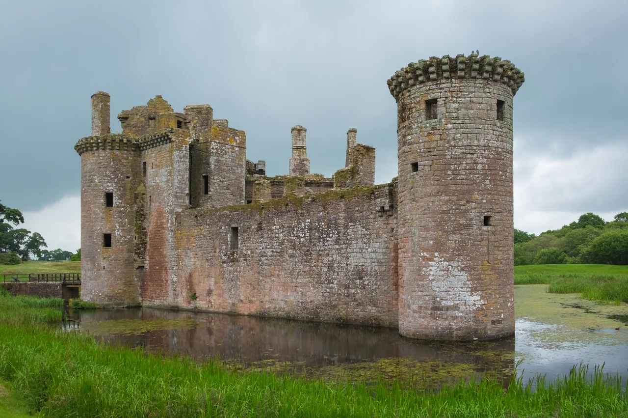

Caerlaverock Castle
In July 1300, the English heralds who marched north with Edward I composed a poem as they went. The Roll of Caerlaverock named eighty-seven barons, knights from Brittany and Lorraine, the future Edward II among them, and described each man's coat of arms in Old French verse. Then they had to do something with all this chivalry. Their target was a small triangular castle on the Solway marshes held by sixty Maxwell men. The siege took the king's army considerable time. The poem, in the end, outlasted everyone in it.
A Castle Shaped Like Nothing Else
Caerlaverock is the only triangular castle in Britain and one of a small number anywhere in Europe. Its gatehouse, with twin drum towers, sits at the apex pointing north; the two southern corners hold smaller drum towers. A moat encloses the whole, fed by the marshy floodplain of the River Nith. The red sandstone came from Bankend nearby. The name is older than the building - Brittonic in origin, from the element 'cajr,' meaning an enclosed defensible site, the same root that gives Welsh 'caer' for fort or city. Sir Aymer Maxwell began the present castle in the 1270s after an earlier attempt 200 metres south was abandoned. The gatehouse sits on natural rock; the rest stands on a clay platform engineered for the purpose. The Maxwell line traces back to Undwin and his son Maccus in the 11th century, the namesake of the barony of Maccuswell.
The Roll of Caerlaverock
Edward I arrived in July 1300 with an army that read like a directory of late-medieval English aristocracy: Henry de Lacy, Earl of Lincoln; Humphrey de Bohun, Earl of Hereford; Guy de Beauchamp, Earl of Warwick; Thomas Earl of Lancaster and his brother Henry; Richard Fitzalan, Earl of Arundel; Antony Bek, the warrior Bishop of Durham; and the king's son, the future Edward II. Sixty Maxwell men under Sir Eustace Maxwell mounted what one chronicle calls a vigorous defence, repelling the English several times before surrendering. Throughout the siege the king's heralds composed the Roll of Caerlaverock, a long poem in Old French rhymed couplets giving each noble's blazon and feats of arms. It is one of the great surviving documents of medieval heraldry, and a strange tribute - the chivalric memorialisation of a one-sided fight against a small Scottish garrison.
Sieges, Sides, and a Dismantling
The castle changed hands and loyalties repeatedly. Sir Eustace got it back, took an English pension of 20 pounds a year from Edward II in 1312, then switched to Robert Bruce, withstood a second English siege, and finally dismantled his own fortress so it could not be held against the Bruce cause. Bruce rewarded him handsomely. By 1337 the castle was inhabited again. Sir Eustace switched sides one more time, supporting Edward Balliol. Around 1355 Sir Roger Kirkpatrick of Closeburn took the castle for David II and partly dismantled it again. Sir Robert Maxwell rebuilt much of what stands today between 1373 and 1410, working in the same red Bankend sandstone.
The Renaissance Lodging and the Covenanter End
In the 1630s the Maxwells, by then Earls of Nithsdale, added the most surprising building on the site: the Nithsdale Lodging, a Renaissance range tucked into the northeast of the courtyard. Nine large windows topped by carved pediments depicting armorials and symbolic sculptures - it has been called among the most ambitious early classical domestic architecture in Scotland. Then came the wars. In 1640 a Protestant Covenanter army besieged the staunchly Catholic Maxwells for thirteen weeks. According to Sir Henry Vane, the Earl and Countess and their page were allowed to leave. Forty defenders surnamed Maxwell were put to the sword. The south wall and the southeast tower were demolished, and the castle was never repaired or reoccupied. Murdoch's Tower in the southwest is largely intact; the west range from around 1500 still stands roofless and complete; the south Banqueting Hall range is reduced to a few metres of wall, with one massive fireplace surviving to hint at its former scale.
The Estuary Around It
Caerlaverock sits within the Nith Estuary National Scenic Area, on the northern edge of the Caerlaverock National Nature Reserve - 55 square kilometres of saltmarsh, mudflats, and grazing land that is one of the most internationally important wintering grounds for waterfowl and wading birds in Britain. Barnacle geese pour in from Svalbard every autumn, sometimes more than thirty thousand birds at a time. The castle was used as a location in the 2011 film The Decoy Bride. Visitors today still cross the same drawbridge gap the Maxwell garrison defended in 1300, and the twin drum towers still rise about fifteen and a half metres above the moat to the line of late-15th-century machicolations - the projecting stone galleries with floor openings through which defenders could drop or pour things on anyone foolish enough to be at the gate.
From the Air
Caerlaverock Castle sits at 54.98 N, 3.52 W on the Solway floodplain, 11 km south of Dumfries. The nearest airport is Dumfries (former RAF Dumfries) about 8 nm north; Carlisle (EGNC) lies 25 nm southeast and Prestwick (EGPK) about 55 nm northwest. From 1,500 to 3,500 feet AGL the castle reads as a small dark triangle on bright marsh, with the River Nith winding south to the Solway Firth and the Caerlaverock reserve spreading east in flat green and silver. Watch for high concentrations of wintering waterfowl - tens of thousands of barnacle geese in autumn and winter - and for unpredictable visibility as Solway sea fog rolls in on southerly winds.
Nearby Stories
- Keswick 7.7 km away
- Workington Lifeboat Station 8.2 km away
- Morton Castle 9.5 km away
- Quintinshill Rail Disaster 9.8 km away
- Garlieston 19 km away
- Cumnock 29 km away
- Point of Ayre Lighthouse 30 km away
- Kielder Observatory 35 km away